Current Weather/Notams (Metars, TAFs, Notams, NWS Forecast, PIREPS, and nearby weather)
Customs Information Send updates to Support@FltPlan.com
Customs Not Available
Database effective 05/16/2024
Airport Diagram might not be current.
|
| Facility Name: | J LYNN HELMS SEVIER COUNTY |
| City Name: | DE QUEEN |
| County: | SEVIER |
| State abbrev: | AR |
| State Name: | ARKANSAS |
| | |
| Ownership: | PUBLICLY OWNED |
| Use: | OPEN TO THE PUBLIC |
| Owner's Name: | SEVIER COUNTY |
| Address: | 115 N. 3RD STREET |
| | DEQUEEN, AR 71832 |
| Owner's Phone: | 870-642-2425 |
| | |
| Manager's Name: | SCOTT SIMMONS |
| Address: | PO BOX 206 |
| | DEQUEEN, AR 71832 |
| Phone: | 870-582-2492; SECONDARY PHONE #: 870-582-5414 |
| | |
| FAA Region: | SOUTHWEST |
| FAA Field Office: | AOK |
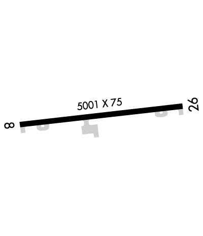
Runway Identifications
Runway Identification: 08/26Length: 5001 ft
Width: 75 ft
Surface: ASPHALT-GOOD CONDITION
Edge lights: Medium IntensityTreatment: NONE
| | Runway: 08 | | Runway: 26 |
| Mag heading: | 79° | Mag heading: | 259° |
| Rwy Slope: | .12% Up | Rwy Slope: | -.12% Down |
| Approach: | | Approach: | |
| Pattern: | Left Traffic | Pattern: | Left Traffic |
| Markings: | NONPRECISION INSTRUMENT | Markings: | NONPRECISION INSTRUMENT |
| Marking Condition: | GOOD | Marking Condition: | GOOD |
| Arresting Dev: | | Arresting Dev: | |
| Lat & Long: | N3402.8 W09424.5 | Lat. & Long.: | N3402.9 W09423.5 |
| Elev: | 348.8 ft. MSL | Elev: | 354.8 ft. MSL |
| TCH: | 44 ft. AGL | TCH: | 49 ft. AGL |
| Visual Glide Path: | 3.00 degrees | Visual Glide Path: | 3.00 degrees |
| Displaced Threshold: | No | Displaced Threshold: | No |
| Touchdown Zone: | YES | Touchdown Zone: | YES |
| Touchdown Elev.: | 349.5 feet | Touchdown Elev.: | 354.8 feet |
| Visual Glide Slope: | 2-Light PAPI on LEFT side of Runway | Visual Glide Slope: | 2-Light PAPI on LEFT side of Runway |
| RVR Equipment: | | RVR Equipment: | |
| RVV Equipment: | NO | RVV Equipment: | NO |
| Approach Lights: | | Approach Lights: | |
| REIL: | YES | REIL: | YES |
| Centerline Lights: | NO | Centerline Lights: | NO |
| Touchdown lights: | NO | Touchdown lights: | NO |
| Runway Category: | Runway with a Non-precision Approach having visibility minimums greater than 3/4 mile | Runway Category: | Runway with a Visual Approach |
| Declared Distances: | | Declared Distances: | |
| Obstructions: | TREE | Obstructions: | TREES |
| Marked: | NOT Marked/Lighted | Marked: | NOT Marked/Lighted |
| Clearance slope: | 35:1 | Clearance slope: | 28:1 |
| Obstruction height: | 25 feet AGL | Obstruction height: | 45 feet AGL |
| Dist. from runway: | 1075 feet | Dist. from runway: | 1500 feet |
| Centerline offset: | 10 right of centerline | Centerline offset: | 400 feet right of centerline |
| Comments: | | Comments: | +6 FT FENCE 198 FT FM RY END 100 FT L. |

