| |||||||||||||||||||||||||||||||||||||||||||||||||||||||||||||
| |||||||||||||||||||||||||||||||||||||||||||||||||||||||||||||
| |||||||||||||||||||||||||||||||||||||||||||||||||||||||||||||
| Rwy | Rwy | |||||||
| 4201x75 | 4201' | 4201x75 | 4201' | |||||
| Runway ID | Single Wheel | Double Wheel | Double Tandem Wheel | Dual Double Wheel |
| 15/33 | 30,000 | N/A | N/A | N/A |
| These numbers are Advisory and are not limits. The Airport Manager should have more accurate Weight Limits | ||||
 Airport Diagram might not be current. | |
| Facility Name: | SKYHAVEN |
| City Name: | ROCHESTER |
| County: | STRAFFORD |
| State abbrev: | NH |
| State Name: | NEW HAMPSHIRE |
| Ownership: | PUBLICLY OWNED |
| Use: | OPEN TO THE PUBLIC |
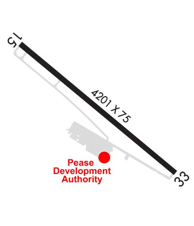
| Owner's Name: | PEASE DEVELOPMENT AUTHORITY |
| Address: | 55 INTERNATIONAL DR |
| PORTSMOUTH, NH 03801 | |
| Owner's Phone: | 603-433-6536 |
| Manager's Name: | ANDREW POMEROY |
| Address: | PDA, 36 AIRLINE AVE |
| PORTSMOUTH, NH 03801 | |
| Phone: | 603-433-6536; MGR PHONE 603-948-1142. |
| FAA Region: | NEW ENGLAND |
| FAA Field Office: | NONE |
| Date | Sunrise | Sunset |
|---|---|---|
| 04/25/24 Thursday | 5:45 | 19:39 |
| 04/26/24 Friday | 5:43 | 19:40 |
| 04/27/24 Saturday | 5:42 | 19:42 |
| 04/28/24 Sunday | 5:40 | 19:43 |
| 04/29/24 Monday | 5:39 | 19:44 |
| 04/30/24 Tuesday | 5:37 | 19:45 |
| 05/01/24 Wednesday | 5:36 | 19:46 |
| 05/02/24 Thursday | 5:35 | 19:47 |
| 05/03/24 Friday | 5:33 | 19:49 |
| 05/04/24 Saturday | 5:32 | 19:50 |
| 05/05/24 Sunday | 5:31 | 19:51 |
| 05/06/24 Monday | 5:29 | 19:52 |
| 05/07/24 Tuesday | 5:28 | 19:53 |
| 05/08/24 Wednesday | 5:27 | 19:54 |
| Airport Attendance Schedule | M-F 0730-1600; EXC HOLS. |
| Airport Status | OPERATIONAL (This Status can change at any time - please check NOTAMS) |
| Airport Lighting Schedule | ACTVT ODALS RWY 33; REIL RWY 15; PAPI RWY 33; MIRL RWY 15/33; WIND CONE LGT - CTAF. |
| Airport Storage Available | Tie Downs |
| Extra Services Available | NONE |
| Wind Indicator | YES - (lighted) |
| Control Tower | NO |
| CTAF Frequency | 122.700 |
| Unicom Frequency | 122.700 |
| Rotating Beacon Color | WG; BCN LCTD 3000 FT NW OF ARPT. |
| Segmented Circle | YES |
| Landing Fee | NO |
| Airport Inspected | STATE - performed by STATE AERONAUTICAL PERSONNEL |
| Inspection Date | 05/26/2023 |
| Type of Fuel Available | Grade 100LL; -10SELF SVC 100LL AVBL 24 HRS WITH CREDIT CARD. |
| Airframe Repair Service | MAJOR |
| Power Plant Repair Service | MAJOR |
| Latitude | N4317.1 |
| Longitude | W07055.8 (ESTIMATED) |
| Arpt Elevation | 322ft (SURVEYED) |
| Magnetic Variation | 16W |
| 3 miles SE | of ROCHESTER |
| Traffic Pattern Altitude | 800 |
| Sectional Chart | NEW YORK |
| Operations (Reported) | Yearly | Avg. Daily |
|---|---|---|
| General Aviation Transient | 2250 | 6 |
| General Aviation Local | 8000 | 22 |
| Air Taxi | 0 | 0 |
| Commerical | 0 | 0 |
| Commuter | 0 | 0 |
| Military | 0 | 0 |
| Aircraft based on Field | |
|---|---|
| General Aviation Singles | 61 |
| General Aviation Multi | 3 |
| Jet Aircraft | 0 |
| General Aviation Helicopters | 2 |
| Military Aircraft | 0 |
| Gliders | 0 |
| Ultralights | 0 |
| FSS on field | NO |
| FSS tie-in | BANGOR |
| FSS Phone | 1-800-WX-BRIEF |
| Who issues Notams | DAW |
| Notam D service at airport | YES |
| ARTCC Name | BOSTON |
| Airport Certification | |
| Aircraft Rescue & Firefighting Index | None |
| Airport of Entry | No |
| Custom Landing Rights | No |
| Joint Civil/Military | No |
| Military Landing rights | YES |
| NATIONAL PLAN OF INTEGRATED AIRPORT SYSTEMS (NPIAS) |
| GRANT AGREEMENTS UNDER FAAP/ADAP/AIP |
| ASSURANCES PURSUANT TO TITLE VI, CIVIL RIGHTS ACT OF 1964 |
| DEER ON & INVOF ARPT AFT SS. |
| RWY 33 DSGND CALM WIND RWY. |
| ULTRALIGHT; ANTIQUE & NORDO TFC IN GOOD WX. |
| FOR CD CTC BOSTON APCH AT 603-594-5552. |
Airport Communications & Frequencies:
| ||||||||||||||
| Runway: 15 | Runway: 33 | ||
| Mag heading: | 147° | Mag heading: | 327° |
| Rwy Slope: | .53% Up | Rwy Slope: | -.53% Down |
| Approach: | Approach: | ||
| Pattern: | Left Traffic | Pattern: | Right Traffic |
| Markings: | BASIC | Markings: | NONPRECISION INSTRUMENT |
| Marking Condition: | GOOD | Marking Condition: | GOOD |
| Arresting Dev: | Arresting Dev: | ||
| Lat & Long: | N4317.3 W07056.1 | Lat. & Long.: | N4316.8 W07055.4 |
| Elev: | 299.9 ft. MSL | Elev: | 322.1 ft. MSL |
| TCH: | TCH: | 43 ft. AGL | |
| Visual Glide Path: | Visual Glide Path: | 3.00 degrees | |
| Displaced Threshold: | No | Displaced Threshold: | No |
| Touchdown Zone: | YES | Touchdown Zone: | YES |
| Touchdown Elev.: | 318.3 feet | Touchdown Elev.: | 322.1 feet |
| Visual Glide Slope: | Visual Glide Slope: | 4-Light PAPI on LEFT side of Runway | |
| RVR Equipment: | RVR Equipment: | ||
| RVV Equipment: | NO | RVV Equipment: | NO |
| Approach Lights: | Approach Lights: | ODALS - omnidirectional approach lighting system | |
| REIL: | YES | REIL: | NO |
| Centerline Lights: | NO | Centerline Lights: | NO |
| Touchdown lights: | NO | Touchdown lights: | NO |
| Runway Category: | Runway with a Non-precision Approach | Runway Category: | Runway with a Non-precision Approach |
| Declared Distances: | Declared Distances: | ||
| Obstructions: | TREES | Obstructions: | |
| Marked: | NOT Marked/Lighted | Marked: | |
| Clearance slope: | 12:1 | Clearance slope: | 20:1 |
| Obstruction height: | 49 feet AGL | Obstruction height: | |
| Dist. from runway: | 780 feet | Dist. from runway: | |
| Centerline offset: | 300 right of centerline | Centerline offset: | |
| Comments: | Comments: |