
| ||||||||||||||||||||||||||||||||
| ||||||||||||||||||||||||||||||||
| ||||||||||||||||||||||||||||||||
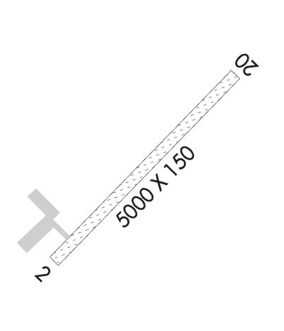
| Rwy | Rwy | |||||||
| 5000x150 | 5000' | 5000x150 | 5000' | |||||
| Runway ID | Single Wheel | Double Wheel | Double Tandem Wheel | Dual Double Wheel |
| 02/20 | N/A | N/A | N/A | N/A |
| These numbers are Advisory and are not limits. The Airport Manager should have more accurate Weight Limits | ||||
| FltPlan does not have IFR approach charts available for KCSR. |
 Airport Diagram might not be current. | |
| Facility Name: | CAMPBELL AIRSTRIP |
| City Name: | ANCHORAGE |
| County: | ANCHORAGE |
| State abbrev: | AK |
| State Name: | ALASKA |
| Ownership: | PUBLICLY OWNED |
| Use: | PRIVATE |
| Owner's Name: | U S GOVT BLM |
| Address: | 4700 B.L. M. RD |
| ANCHORAGE, AK 99507 | |
| Owner's Phone: | (907) 267-1357 |
| Manager's Name: | DAVE DOUCET |
| Address: | 4700 B.L. M. RD |
| ANCHORAGE, AK 99507 | |
| Phone: | (907) 267-1357; 907-267-1360 |
| FAA Region: | ALASKA |
| FAA Field Office: | NONE |
| Date | Sunrise | Sunset |
|---|---|---|
| 04/24/24 Wednesday | 6:08 | 21:47 |
| 04/25/24 Thursday | 6:05 | 21:50 |
| 04/26/24 Friday | 6:02 | 21:53 |
| 04/27/24 Saturday | 5:59 | 21:55 |
| 04/28/24 Sunday | 5:56 | 21:58 |
| 04/29/24 Monday | 5:53 | 22:01 |
| 04/30/24 Tuesday | 5:50 | 22:03 |
| 05/01/24 Wednesday | 5:48 | 22:06 |
| 05/02/24 Thursday | 5:45 | 22:09 |
| 05/03/24 Friday | 5:42 | 22:11 |
| 05/04/24 Saturday | 5:39 | 22:14 |
| 05/05/24 Sunday | 5:36 | 22:17 |
| 05/06/24 Monday | 5:33 | 22:19 |
| 05/07/24 Tuesday | 5:31 | 22:22 |
| Airport Attendance Schedule | |
| Airport Status | OPERATIONAL (This Status can change at any time - please check NOTAMS) |
| Airport Lighting Schedule | |
| Airport Storage Available | NONE |
| Extra Services Available | Cargo Handling |
| Wind Indicator | YES - (unlit) |
| Control Tower | NO |
| CTAF Frequency | 122.900 |
| Unicom Frequency | 127.45 |
| Rotating Beacon Color | |
| Segmented Circle | NO |
| Landing Fee | NO |
| Airport Inspected | 5010-2 PRIVATE USE MAILOUT PROGRAM - performed by the OWNER |
| Inspection Date | 05/29/1979 |
| Type of Fuel Available | None |
| Airframe Repair Service | NONE |
| Power Plant Repair Service | NONE |
| Latitude | N6109.5 |
| Longitude | W14946.8 (ESTIMATED) |
| Arpt Elevation | 286ft (SURVEYED) |
| Magnetic Variation | 25E |
| 4 miles SE | of ANCHORAGE |
| Traffic Pattern Altitude | |
| Sectional Chart | ANCHORAGE |
| Operations (Reported) | Yearly | Avg. Daily |
|---|---|---|
| General Aviation Transient | 0 | 0 |
| General Aviation Local | 500 | 1 |
| Air Taxi | 0 | 0 |
| Commerical | 0 | 0 |
| Commuter | 0 | 0 |
| Military | 100 | 0 |
| Aircraft based on Field | |
|---|---|
| General Aviation Singles | 0 |
| General Aviation Multi | 0 |
| Jet Aircraft | 0 |
| General Aviation Helicopters | 0 |
| Military Aircraft | 0 |
| Gliders | 0 |
| Ultralights | 0 |
| FSS on field | NO |
| FSS tie-in | KENAI |
| FSS Phone | 1-800-866-864-1737 |
| Who issues Notams | |
| Notam D service at airport | No |
| ARTCC Name | ANCHORAGE |
| Airport Certification | |
| Aircraft Rescue & Firefighting Index | None |
| Airport of Entry | No |
| Custom Landing Rights | No |
| Joint Civil/Military | No |
| Military Landing rights | No |
| USE PERMITTED ONLY WITH PRIOR PERMISSION OF BLM ANCHORAGE FIELD MANAGER 267-1246, ARPT MANAGER 907-267-1357. |
| ALL TFC PTRNS SE OF FIELD; AUTHORIZED ACFT CTC FREQ 127.45 PRIOR TO LNDG. |
| FOR WSO PHONE 271-3491. |
| NO WINTER MAINTENANCE. |
| WX CAMERA AVBL ON INTERNET AT HTTPS://WEATHERCAMS.FAA.GOV |
| RWY COND NOT MONITORED, RECOMMEND VISUAL INSPECTION PRIOR TO LDG. |
| DRONE USE TO 400 FT AGL. |
| RWY 02/2 0 TREATED |
| Runway: 02 | Runway: 20 | ||
| Mag heading: | N/A | Mag heading: | N/A |
| Rwy Slope: | .82% Up | Rwy Slope: | -.82% Down |
| Approach: | Approach: | ||
| Pattern: | Right Traffic | Pattern: | Left Traffic |
| Markings: | Markings: | ||
| Marking Condition: | Marking Condition: | ||
| Arresting Dev: | Arresting Dev: | ||
| Lat & Long: | Lat. & Long.: | ||
| Elev: | 245.0 ft. MSL | Elev: | 286.0 ft. MSL |
| TCH: | TCH: | ||
| Visual Glide Path: | Visual Glide Path: | ||
| Displaced Threshold: | No | Displaced Threshold: | No |
| Touchdown Zone: | NO | Touchdown Zone: | NO |
| Touchdown Elev.: | Touchdown Elev.: | ||
| Visual Glide Slope: | Visual Glide Slope: | ||
| RVR Equipment: | RVR Equipment: | ||
| RVV Equipment: | NO | RVV Equipment: | NO |
| Approach Lights: | Approach Lights: | ||
| REIL: | NO | REIL: | NO |
| Centerline Lights: | NO | Centerline Lights: | NO |
| Touchdown lights: | NO | Touchdown lights: | NO |
| Runway Category: | Runway with a Visual Approach | Runway Category: | Runway with a Visual Approach |
| Declared Distances: | Declared Distances: | ||
| Obstructions: | TREES | Obstructions: | TREES |
| Marked: | NOT Marked/Lighted | Marked: | NOT Marked/Lighted |
| Clearance slope: | 15:1 | Clearance slope: | 7:1 |
| Obstruction height: | Obstruction height: | ||
| Dist. from runway: | 800 feet | Dist. from runway: | 100 feet |
| Centerline offset: | Centerline offset: | ||
| Comments: | Comments: |
