Current Weather/Notams (Metars, TAFs, Notams, NWS Forecast, PIREPS, and nearby weather)
Customs Information Send updates to Support@FltPlan.com
Customs Not Available
Database effective 05/16/2024
Airport Diagram might not be current.
|
| Facility Name: | CHERAW MUNI/LYNCH BELLINGER FLD |
| City Name: | CHERAW |
| County: | CHESTERFIELD |
| State abbrev: | SC |
| State Name: | SOUTH CAROLINA |
| | |
| Ownership: | PUBLICLY OWNED |
| Use: | OPEN TO THE PUBLIC |
| Owner's Name: | TOWN OF CHERAW |
| Address: | P O BOX 111 |
| | CHERAW, SC 29520 |
| Owner's Phone: | 843-537-7283 |
| | |
| Manager's Name: | ROBERT WOLFE |
| Address: | PO BOX 219 |
| | CHERAW, SC 29520 |
| Phone: | 843-537-8400 |
| | |
| FAA Region: | SOUTHERN |
| FAA Field Office: | ATL |
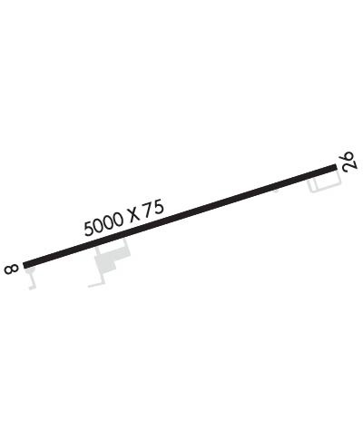
Runway Identifications
Runway Identification: 08/26Length: 5000 ft
Width: 75 ft
Surface: ASPHALT-FAIR CONDITION
Edge lights: Medium IntensityTreatment: POROUS FRICTION COURSE
| | Runway: 08 | | Runway: 26 |
| Mag heading: | 78° | Mag heading: | 258° |
| Rwy Slope: | -1.02% Down | Rwy Slope: | 1.02% Up |
| Approach: | | Approach: | |
| Pattern: | Left Traffic | Pattern: | Left Traffic |
| Markings: | NONPRECISION INSTRUMENT | Markings: | NONPRECISION INSTRUMENT |
| Marking Condition: | FAIR | Marking Condition: | FAIR |
| Arresting Dev: | | Arresting Dev: | |
| Lat & Long: | N3442.6 W07957.9 | Lat. & Long.: | N3442.9 W07957.0 |
| Elev: | 238.7 ft. MSL | Elev: | 187.9 ft. MSL |
| TCH: | | TCH: | |
| Visual Glide Path: | | Visual Glide Path: | |
| Displaced Threshold: | No | Displaced Threshold: | No |
| Touchdown Zone: | YES | Touchdown Zone: | YES |
| Touchdown Elev.: | 238.7 feet | Touchdown Elev.: | 208.7 feet |
| Visual Glide Slope: | | Visual Glide Slope: | |
| RVR Equipment: | | RVR Equipment: | |
| RVV Equipment: | NO | RVV Equipment: | NO |
| Approach Lights: | | Approach Lights: | |
| REIL: | YES | REIL: | YES |
| Centerline Lights: | NO | Centerline Lights: | NO |
| Touchdown lights: | NO | Touchdown lights: | NO |
| Runway Category: | Runway with a Non-precision Approach having visibility minimums greater than 3/4 mile | Runway Category: | Runway with a Non-precision Approach having visibility minimums greater than 3/4 mile |
| Declared Distances: | | Declared Distances: | |
| Obstructions: | TREE | Obstructions: | POLE; POWER POLE IS MKD AND LGTD. |
| Marked: | NOT Marked/Lighted | Marked: | NOT Marked/Lighted |
| Clearance slope: | 10:1 | Clearance slope: | 20:1 |
| Obstruction height: | 81 feet AGL | Obstruction height: | 47 feet AGL |
| Dist. from runway: | 1055 feet | Dist. from runway: | 1182 feet |
| Centerline offset: | 357 right of centerline | Centerline offset: | 299 feet right of centerline |
| Comments: | | Comments: | |

