Current Weather/Notams (Metars, TAFs, Notams, NWS Forecast, PIREPS, and nearby weather)
Customs Information Send updates to Support@FltPlan.com
Customs Not Available
Database effective 05/16/2024
Airport Diagram might not be current.
|
| Facility Name: | PENNRIDGE |
| City Name: | PERKASIE |
| County: | BUCKS |
| State abbrev: | PA |
| State Name: | PENNSYLVANIA |
| | |
| Ownership: | PRIVATELY OWNED |
| Use: | OPEN TO THE PUBLIC |
| Owner's Name: | PENNRIDGE DEVELOPMENT LLC |
| Address: | 1100 RIDGE ROAD |
| | PERKASIE, PA 18944 |
| Owner's Phone: | 215-257-0166 |
| | |
| Manager's Name: | JEAN CURRY |
| Address: | 1100 N RIDGE ROAD |
| | PERKASIE, PA 18944 |
| Phone: | 267-718-4254 |
| | |
| FAA Region: | EASTERN |
| FAA Field Office: | HAR |
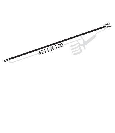
Runway Identifications
Runway Identification: 08/26Length: 4211 ft
Width: 100 ft
Surface: ASPHALT-GOOD CONDITION
Edge lights: Medium IntensityTreatment: POROUS FRICTION COURSE
| | Runway: 08 | | Runway: 26 |
| Mag heading: | 82° | Mag heading: | 262° |
| Rwy Slope: | 1.14% Up | Rwy Slope: | -1.14% Down |
| Approach: | | Approach: | |
| Pattern: | Left Traffic | Pattern: | Left Traffic |
| Markings: | NONPRECISION INSTRUMENT | Markings: | NONPRECISION INSTRUMENT |
| Marking Condition: | GOOD | Marking Condition: | GOOD |
| Arresting Dev: | | Arresting Dev: | |
| Lat & Long: | N4023.2 W07517.9 | Lat. & Long.: | N4023.5 W07517.0 |
| Elev: | 519.8 ft. MSL | Elev: | 567.6 ft. MSL |
| TCH: | 20 ft. AGL | TCH: | 28 ft. AGL |
| Visual Glide Path: | 3.78 degrees | Visual Glide Path: | 4.00 degrees |
| Displaced Threshold: | 266 feet | Displaced Threshold: | 351 feet |
| Touchdown Zone: | YES | Touchdown Zone: | YES |
| Touchdown Elev.: | 559.0 feet | Touchdown Elev.: | 565.1 feet |
| Visual Glide Slope: | 2-Light PAPI on LEFT side of Runway | Visual Glide Slope: | 2-Light PAPI on LEFT side of Runway |
| RVR Equipment: | | RVR Equipment: | |
| RVV Equipment: | NO | RVV Equipment: | NO |
| Approach Lights: | | Approach Lights: | |
| REIL: | NO | REIL: | NO |
| Centerline Lights: | NO | Centerline Lights: | NO |
| Touchdown lights: | NO | Touchdown lights: | NO |
| Runway Category: | Runway with a Non-precision Approach having visibility minimums greater than 3/4 mile | Runway Category: | Runway with a Non-precision Approach having visibility minimums greater than 3/4 mile |
| Declared Distances: | | Declared Distances: | |
| Obstructions: | TREES | Obstructions: | TREES |
| Marked: | NOT Marked/Lighted | Marked: | NOT Marked/Lighted |
| Clearance slope: | 2:1; APCH RATIO 27:1 TO DTHR. | Clearance slope: | 7:1; APCH RATIO 19:1 TO DTHR. |
| Obstruction height: | 19 feet AGL | Obstruction height: | 47 feet AGL |
| Dist. from runway: | 252 feet | Dist. from runway: | 549 feet |
| Centerline offset: | 4 right of centerline | Centerline offset: | 292 feet right of centerline |
| Comments: | | Comments: | 10 FT BLAST FENCE AT RWY END. 48 FT TREES, 257 FT FM RWY END, 239 FT RIGHT. |

