Current Weather/Notams (Metars, TAFs, Notams, NWS Forecast, PIREPS, and nearby weather)
Customs Information Send updates to Support@FltPlan.com
Customs Not Available
Database effective 05/16/2024
Airport Diagram might not be current.
|
| Facility Name: | WILLIAMSBURG RGNL |
| City Name: | KINGSTREE |
| County: | WILLIAMSBURG |
| State abbrev: | SC |
| State Name: | SOUTH CAROLINA |
| | |
| Ownership: | PUBLICLY OWNED |
| Use: | OPEN TO THE PUBLIC |
| Owner's Name: | WILLIAMSBURG COUNTY |
| Address: | PO BOX 1124 |
| | KINGSTREE, SC 29556 |
| Owner's Phone: | (843) 382-5800 |
| | |
| Manager's Name: | JOHN HUDSON |
| Address: | 85 AVIATION DRIVE |
| | KINGSTREE, SC 29556 |
| Phone: | (843) 372-2255 |
| | |
| FAA Region: | SOUTHERN |
| FAA Field Office: | ATL |
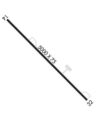
Runway Identifications
Runway Identification: 14/32Length: 5000 ft
Width: 75 ft
Surface: ASPHALT-GOOD CONDITION
Edge lights: Medium IntensityTreatment: NONE
| | Runway: 14 | | Runway: 32 |
| Mag heading: | 140° | Mag heading: | 320° |
| Rwy Slope: | -.01% Down | Rwy Slope: | .01% Up |
| Approach: | | Approach: | |
| Pattern: | Left Traffic | Pattern: | Left Traffic |
| Markings: | NONPRECISION INSTRUMENT | Markings: | NONPRECISION INSTRUMENT |
| Marking Condition: | FAIR | Marking Condition: | FAIR |
| Arresting Dev: | | Arresting Dev: | |
| Lat & Long: | N3343.3 W07951.8 | Lat. & Long.: | N3342.8 W07951.1 |
| Elev: | 65.5 ft. MSL | Elev: | 64.8 ft. MSL |
| TCH: | 43 ft. AGL | TCH: | 45 ft. AGL |
| Visual Glide Path: | 3.00 degrees | Visual Glide Path: | 3.00 degrees |
| Displaced Threshold: | No | Displaced Threshold: | No |
| Touchdown Zone: | YES | Touchdown Zone: | YES |
| Touchdown Elev.: | 66.1 feet | Touchdown Elev.: | 66.5 feet |
| Visual Glide Slope: | 2-Light PAPI on LEFT side of Runway | Visual Glide Slope: | 2-Light PAPI on LEFT side of Runway |
| RVR Equipment: | | RVR Equipment: | |
| RVV Equipment: | NO | RVV Equipment: | NO |
| Approach Lights: | | Approach Lights: | |
| REIL: | NO | REIL: | NO |
| Centerline Lights: | NO | Centerline Lights: | NO |
| Touchdown lights: | NO | Touchdown lights: | NO |
| Runway Category: | Runway with a Non-precision Approach having visibility minimums greater than 3/4 mile | Runway Category: | Runway with a Non-precision Approach having visibility minimums greater than 3/4 mile |
| Declared Distances: | | Declared Distances: | |
| Obstructions: | | Obstructions: | TREE |
| Marked: | | Marked: | NOT Marked/Lighted |
| Clearance slope: | 34:1 | Clearance slope: | 22:1 |
| Obstruction height: | | Obstruction height: | 20 feet AGL |
| Dist. from runway: | | Dist. from runway: | 649 feet |
| Centerline offset: | | Centerline offset: | 203 feet left of centerline |
| Comments: | 6 FT HI CORN 188 FT FROM RWY 14 THLD. | Comments: | |

