
| ||||||||||||||||||||||||||||||||||||||||||||
| ||||||||||||||||||||||||||||||||||||||||||||
| ||||||||||||||||||||||||||||||||||||||||||||
| Rwy | Rwy | |||||||
| 7800x150 | 7130' | 7800x150 | 7800' | 109.30 - 210° | ||||
| Runway ID | Single Wheel | Double Wheel | Double Tandem Wheel | Dual Double Wheel |
| 03/21 | 80,000 | 125,000 | 180,000 | 180,000 |
| H1 | N/A | N/A | N/A | N/A |
| These numbers are Advisory and are not limits. The Airport Manager should have more accurate Weight Limits | ||||
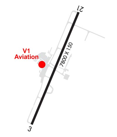 Airport Diagram might not be current. | |
| Facility Name: | NORTH CENTRAL WEST VIRGINIA |
| City Name: | CLARKSBURG |
| County: | HARRISON |
| State abbrev: | WV |
| State Name: | WEST VIRGINIA |
| Ownership: | PUBLICLY OWNED |
| Use: | OPEN TO THE PUBLIC |
| Owner's Name: | BENEDUM AIRPORT AUTHORITY |
| Address: | 2000 AVIATION WAY |
| BRIDGEPORT, WV 26330 | |
| Owner's Phone: | 304-842-3400 |
| Manager's Name: | RICK ROCK |
| Address: | 2000 AVIATION WAY |
| BRIDGEPORT, WV 26330 | |
| Phone: | 304-842-3400 |
| FAA Region: | EASTERN |
| FAA Field Office: | BKW |

| Date | Sunrise | Sunset |
|---|---|---|
| 04/17/24 Wednesday | 6:40 | 20:01 |
| 04/18/24 Thursday | 6:39 | 20:02 |
| 04/19/24 Friday | 6:37 | 20:03 |
| 04/20/24 Saturday | 6:36 | 20:04 |
| 04/21/24 Sunday | 6:34 | 20:05 |
| 04/22/24 Monday | 6:33 | 20:06 |
| 04/23/24 Tuesday | 6:32 | 20:07 |
| 04/24/24 Wednesday | 6:30 | 20:08 |
| 04/25/24 Thursday | 6:29 | 20:09 |
| 04/26/24 Friday | 6:28 | 20:10 |
| 04/27/24 Saturday | 6:26 | 20:11 |
| 04/28/24 Sunday | 6:25 | 20:12 |
| 04/29/24 Monday | 6:24 | 20:13 |
| 04/30/24 Tuesday | 6:23 | 20:14 |
| Airport Attendance Schedule | 7 Days A Week 0700-2300 |
| Airport Status | OPERATIONAL (This Status can change at any time - please check NOTAMS) |
| Airport Lighting Schedule | ACTVT MALSR RWY 21; REIL RWY 03; PAPI RWY 03 & 21; AND HIRL RWY 3/21 ON CTAF. |
| Airport Storage Available | Tie Downs, Hanger |
| Extra Services Available | Air Freight, Avionics, Charter, Flight Instruction |
| Wind Indicator | YES - (lighted) |
| Control Tower | YES |
| CTAF Frequency | 126.700 |
| Unicom Frequency | 123.000 |
| Rotating Beacon Color | WG |
| Segmented Circle | NO |
| Landing Fee | YES; LNDG FEE FOR ALL ACFT OVER 6500 LBS. |
| Airport Inspected | FEDERAL - performed by FAA AIRPORTS FIELD PERSONNEL |
| Inspection Date | 05/25/2021 |
| Type of Fuel Available | Grade 100LL, JET A (freeze point -40C); -10FUEL NOT AVBL DURG HRS 2300-0500. |
| Airframe Repair Service | MAJOR |
| Power Plant Repair Service | MAJOR |
| Latitude | N3917.9 |
| Longitude | W08013.7 (ESTIMATED) |
| Arpt Elevation | 1223ft (SURVEYED) |
| Magnetic Variation | 08W |
| 1 miles NE | of CLARKSBURG |
| Traffic Pattern Altitude | |
| Sectional Chart | CINCINNATI |
| Operations (Reported) | Yearly | Avg. Daily |
|---|---|---|
| General Aviation Transient | 11586 | 32 |
| General Aviation Local | 7294 | 20 |
| Air Taxi | 6889 | 19 |
| Commerical | 1404 | 4 |
| Commuter | 0 | 0 |
| Military | 6619 | 18 |
| Aircraft based on Field | |
|---|---|
| General Aviation Singles | 24 |
| General Aviation Multi | 14 |
| Jet Aircraft | 1 |
| General Aviation Helicopters | 0 |
| Military Aircraft | 7 |
| Gliders | 0 |
| Ultralights | 0 |
| FSS on field | NO |
| FSS tie-in | ELKINS |
| FSS Phone | 1-800-WX-BRIEF |
| Who issues Notams | CKB |
| Notam D service at airport | YES |
| ARTCC Name | CLEVELAND |
| Airport Certification | AIRPORT RECEIVING SCHEDULED AIR CARRIER SERVICE FROM CARRIERS CERTIFICATED BY THE CIVIL AERONAUTICS BOARD; PPR 24 HRS FOR UNSKED ACR OPNS WITH MORE THAN 30 PSGR SEATS CALL AMGR 304-842-3400 OR 304-848-6700. |
| Aircraft Rescue & Firefighting Index | AIRPORT HAS A CERTIFICATE UNDER CFR PART 139 |
| Airport of Entry | No |
| Custom Landing Rights | No |
| Joint Civil/Military | No |
| Military Landing rights | YES |
| NATIONAL PLAN OF INTEGRATED AIRPORT SYSTEMS (NPIAS) |
| GRANT AGREEMENTS UNDER FAAP/ADAP/AIP |
| ASSURANCES PURSUANT TO TITLE VI, CIVIL RIGHTS ACT OF 1964 |
| DEER & BIRDS ON & INVOF ARPT. |
| AFT HRS FOR EMERGS CALL 304-623-6559. |
| FOR CD CTC CLARKSBURG APCH AT 304-842-2011, WHEN APCH CLSD CTC CLEVELAND ARTCC AT 440-774-0226. |
| TWY A SOUTH OF TWY C, MAIN TRML APRON, AND HELIPAD NOT VSBL FROM TWR. |
| 24 PPR FOR PRK ON ARNG RAMP DSN 661-3800 C304-201-3800. |
| TWY H E OF TWY H1 CLSD TO TRAN ACFT. |
| CTLNG OBSTN SLOPE AT DSPLCD LOCATION RWY 03 IS 29:1. |
Airport Communications & Frequencies:
| |||||||||||||||||||||||||||||
| Runway: 03 | Runway: 21 | ||
| Mag heading: | 31° | Mag heading: | 211° |
| Rwy Slope: | .52% Up | Rwy Slope: | -.52% Down |
| Approach: | Approach: | ILS | |
| Pattern: | Left Traffic | Pattern: | Left Traffic |
| Markings: | PRECISION INSTRUMENT | Markings: | PRECISION INSTRUMENT |
| Marking Condition: | GOOD | Marking Condition: | GOOD |
| Arresting Dev: | Arresting Dev: | ||
| Lat & Long: | N3917.3 W08014.0 | Lat. & Long.: | N3918.5 W08013.3 |
| Elev: | 1183.1 ft. MSL | Elev: | 1223.5 ft. MSL |
| TCH: | 50 ft. AGL | TCH: | 60 ft. AGL |
| Visual Glide Path: | 3.44 degrees | Visual Glide Path: | 3.00 degrees |
| Displaced Threshold: | 670 feet | Displaced Threshold: | No |
| Touchdown Zone: | YES | Touchdown Zone: | YES |
| Touchdown Elev.: | 1187.6 feet | Touchdown Elev.: | 1223.5 feet |
| Visual Glide Slope: | 4-Light PAPI on LEFT side of Runway | Visual Glide Slope: | 4-Light PAPI on LEFT side of Runway |
| RVR Equipment: | ROLLOUT | RVR Equipment: | TOUCHDOWN |
| RVV Equipment: | NO | RVV Equipment: | NO |
| Approach Lights: | Approach Lights: | MALSR - 1,400 foot medium intensity approach lighting system with runway alignment indicator lights | |
| REIL: | YES | REIL: | NO |
| Centerline Lights: | NO | Centerline Lights: | NO |
| Touchdown lights: | NO | Touchdown lights: | NO |
| Runway Category: | Runway with a Non-precision Approach having visibility minimums greater than 3/4 mile | Runway Category: | Precision Instrument Runway |
| Declared Distances: | TORA:7800' TODA:7800' ASDA:7800' LDA:7130' | Declared Distances: | TORA:7800' TODA:7800' ASDA:7130' LDA:7130' |
| Obstructions: | TREES | Obstructions: | TREES |
| Marked: | NOT Marked/Lighted | Marked: | NOT Marked/Lighted |
| Clearance slope: | 9:1 | Clearance slope: | 33:1 |
| Obstruction height: | 43 feet AGL | Obstruction height: | 189 feet AGL |
| Dist. from runway: | 600 feet | Dist. from runway: | 6500 feet |
| Centerline offset: | 525 right of centerline | Centerline offset: | 300 feet right of centerline |
| Comments: | Comments: |