Current Weather/Notams (Metars, TAFs, Notams, NWS Forecast, PIREPS, and nearby weather)
Customs Information Send updates to Support@FltPlan.com
Customs Not Available
Database effective 05/16/2024
Airport Diagram might not be current.
|
| Facility Name: | CUYAHOGA COUNTY |
| City Name: | CLEVELAND |
| County: | CUYAHOGA |
| State abbrev: | OH |
| State Name: | OHIO |
| | |
| Ownership: | PUBLICLY OWNED |
| Use: | OPEN TO THE PUBLIC |
| Owner's Name: | CUYAHOGA COUNTY |
| Address: | 26300 CURTISS WRIGHT PKWY |
| | RICHMOND HEIGHTS, OH 44143-4408 |
| Owner's Phone: | 216-289-4111 |
| | |
| Manager's Name: | J MYERS; CCAIRPORT@CUYAHOGACOUNTY.US. |
| Address: | 26300 CURTISS WRIGHT PKWY |
| | RICHMOND HEIGHTS, OH 44143-4408 |
| Phone: | 216-289-4111 |
| | |
| FAA Region: | GREAT LAKES |
| FAA Field Office: | DET |
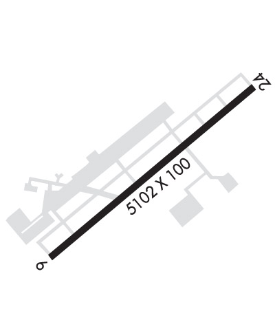
Runway Identifications
Runway Identification: 06/24Length: 5502 ft
Width: 100 ft
Surface: ASPHALT-GOOD CONDITION
Edge lights: High IntensityTreatment: GROOVED
Weight: PCN 35 /F/C/X/U
| | Runway: 06 | | Runway: 24 |
| Mag heading: | 57° | Mag heading: | 237° |
| Rwy Slope: | -.04% Down | Rwy Slope: | .04% Up |
| Approach: | | Approach: | ILS/DME |
| Pattern: | Left Traffic | Pattern: | Left Traffic |
| Markings: | NONPRECISION INSTRUMENT | Markings: | PRECISION INSTRUMENT |
| Marking Condition: | GOOD | Marking Condition: | GOOD |
| Arresting Dev: | EMAS | Arresting Dev: | EMAS |
| Lat & Long: | N4133.6 W08129.7 | Lat. & Long.: | N4134.2 W08128.8 |
| Elev: | 876.1 ft. MSL | Elev: | 874.0 ft. MSL |
| TCH: | 45 ft. AGL | TCH: | 45 ft. AGL |
| Visual Glide Path: | 3.00 degrees | Visual Glide Path: | 3.00 degrees |
| Displaced Threshold: | 318 feet | Displaced Threshold: | 500 feet |
| Touchdown Zone: | YES | Touchdown Zone: | YES |
| Touchdown Elev.: | 874.2 feet | Touchdown Elev.: | 873.2 feet |
| Visual Glide Slope: | 4-Light PAPI on LEFT side of Runway | Visual Glide Slope: | 4-Light PAPI on LEFT side of Runway |
| RVR Equipment: | | RVR Equipment: | |
| RVV Equipment: | NO | RVV Equipment: | NO |
| Approach Lights: | | Approach Lights: | MALSR - 1,400 foot medium intensity approach lighting system with runway alignment indicator lights |
| REIL: | YES | REIL: | NO |
| Centerline Lights: | NO | Centerline Lights: | NO |
| Touchdown lights: | NO | Touchdown lights: | NO |
| Runway Category: | Runway with a Non-precision Approach having visibility minimums greater than 3/4 mile | Runway Category: | Precision Instrument Runway |
| Declared Distances: | TORA:5502' TODA:5502' ASDA:5502' LDA:5184' | Declared Distances: | TORA:5502' TODA:5502' ASDA:5502' LDA:5000' |
| Obstructions: | TREE; 7 FT ROAD, 703 FT DIST, 325 FT L. | Obstructions: | ROAD |
| Marked: | NOT Marked/Lighted | Marked: | NOT Marked/Lighted |
| Clearance slope: | 12:1; APCH SLP 10:1 TO DTHR OVR 84 FT TREES, 920 FT DIST, 620 FT R. | Clearance slope: | APCH SLP 6:1 TO DTHR OVR 20 FT TREES, 130 FT DIST, 500 FT R. |
| Obstruction height: | 100 feet AGL | Obstruction height: | 7 feet AGL |
| Dist. from runway: | 1418 feet | Dist. from runway: | 201 feet |
| Centerline offset: | 500 right of centerline | Centerline offset: | 325 feet left of centerline |
| Comments: | | Comments: | 7 FT ROAD, 0 FT DIST, 525 FT L; 2 FT FENCE, 0 FT DIST, 500 FT L. |

