
| ||||||||||||||||||||||||||||||||||||||||||||
| ||||||||||||||||||||||||||||||||||||||||||||
| ||||||||||||||||||||||||||||||||||||||||||||
| ||||||||||||||||||||||||||||||||||||||||||||
| Rwy | Rwy | |||||||
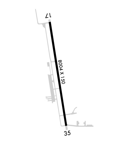
| 8006x150 | 8006' | 111.90 - 174° | 8006x150 | 8006' | ||||
| Runway ID | Single Wheel | Double Wheel | Double Tandem Wheel | Dual Double Wheel |
| 17/35 | 60,000 | 120,000 | 170,000 | N/A |
| These numbers are Advisory and are not limits. The Airport Manager should have more accurate Weight Limits | ||||
 Airport Diagram might not be current. | |
| Facility Name: | BOB SIKES |
| City Name: | CRESTVIEW |
| County: | OKALOOSA |
| State abbrev: | FL |
| State Name: | FLORIDA |
| Ownership: | PUBLICLY OWNED |
| Use: | OPEN TO THE PUBLIC |
| Owner's Name: | OKALOOSA COUNTY |
| Address: | BOARD OF COUNTY COMMISSIONERS, 302 NORTH WILSON ST. |
| CRESTVIEW, FL 32536 | |
| Owner's Phone: | 850-689-5000 |
| Manager's Name: | TRACY STAGE |
| Address: | 1701 STATE ROAD 85 NORTH |
| EGLIN AFB, FL 32542-1413 | |
| Phone: | 850-651-7160; EXT 4. |
| FAA Region: | SOUTHERN |
| FAA Field Office: | ORL |
| Date | Sunrise | Sunset |
|---|---|---|
| 04/24/24 Wednesday | 6:08 | 19:21 |
| 04/25/24 Thursday | 6:07 | 19:21 |
| 04/26/24 Friday | 6:06 | 19:22 |
| 04/27/24 Saturday | 6:05 | 19:23 |
| 04/28/24 Sunday | 6:04 | 19:23 |
| 04/29/24 Monday | 6:03 | 19:24 |
| 04/30/24 Tuesday | 6:02 | 19:25 |
| 05/01/24 Wednesday | 6:01 | 19:25 |
| 05/02/24 Thursday | 6:00 | 19:26 |
| 05/03/24 Friday | 6:00 | 19:27 |
| 05/04/24 Saturday | 5:59 | 19:27 |
| 05/05/24 Sunday | 5:58 | 19:28 |
| 05/06/24 Monday | 5:57 | 19:29 |
| 05/07/24 Tuesday | 5:56 | 19:29 |
| Airport Attendance Schedule | 7 Days A Week 0600-2000 |
| Airport Status | OPERATIONAL (This Status can change at any time - please check NOTAMS) |
| Airport Lighting Schedule | ACTVT HIRL RWY 17/35 - CTAF. PAPI RWYS 17 & 35 OPER CONSLY. |
| Airport Storage Available | Tie Downs |
| Extra Services Available | Flight Instruction, Aircraft Rental |
| Wind Indicator | YES - (lighted) |
| Control Tower | NO |
| CTAF Frequency | 122.950 |
| Unicom Frequency | 122.950 |
| Rotating Beacon Color | WG |
| Segmented Circle | Y-L |
| Landing Fee | NO |
| Airport Inspected | STATE - performed by STATE AERONAUTICAL PERSONNEL |
| Inspection Date | 03/06/2024 |
| Type of Fuel Available | Grade 100LL, JET A (freeze point -40C), JET A-1 (icing inhibitor, freeze point -50C); -10FOR FUEL AFT 1900 CALL 850-393-0751. |
| Airframe Repair Service | MAJOR |
| Power Plant Repair Service | MAJOR |
| Latitude | N3046.7 |
| Longitude | W08631.3 (ESTIMATED) |
| Arpt Elevation | 213ft (SURVEYED) |
| Magnetic Variation | 04W |
| 3 miles NE | of CRESTVIEW |
| Traffic Pattern Altitude | |
| Sectional Chart | NEW ORLEANS |
| Operations (Reported) | Yearly | Avg. Daily |
|---|---|---|
| General Aviation Transient | 29000 | 79 |
| General Aviation Local | 15400 | 42 |
| Air Taxi | 200 | 1 |
| Commerical | 0 | 0 |
| Commuter | 0 | 0 |
| Military | 4000 | 11 |
| Aircraft based on Field | |
|---|---|
| General Aviation Singles | 46 |
| General Aviation Multi | 5 |
| Jet Aircraft | 14 |
| General Aviation Helicopters | 4 |
| Military Aircraft | 0 |
| Gliders | 0 |
| Ultralights | 0 |
| FSS on field | NO |
| FSS tie-in | GAINESVILLE |
| FSS Phone | 1-800-WX-BRIEF |
| Who issues Notams | CEW |
| Notam D service at airport | YES |
| ARTCC Name | JACKSONVILLE |
| Airport Certification | |
| Aircraft Rescue & Firefighting Index | None |
| Airport of Entry | No |
| Custom Landing Rights | No |
| Joint Civil/Military | No |
| Military Landing rights | YES |
| NATIONAL PLAN OF INTEGRATED AIRPORT SYSTEMS (NPIAS) |
| GRANT AGREEMENTS UNDER FAAP/ADAP/AIP |
| ASSURANCES PURSUANT TO TITLE VI, CIVIL RIGHTS ACT OF 1964 |
| MIL & TRNG TFC ALL QUADRANTS; MEN & EQUIP ON & INVOF SAFETY AREA. |
| VFR ARR MNT 122.95. |
| NOISE ABATEMENT PROC IN EFCT; DEP MNTN RWY HDG TO 700 FT MSL BFR TURNING. |
| WILDLIFE ON & INVOF ARPT; SPCLY AT NIGHT. |
| FOR CD IF UNA TO CTC ON FSS FREQ, CTC EGLIN APCH 850-882-9152 OR 850-882-9151. |
| RWY 17 UNLGT OBST IN APCH; 55 FT TREES 1755 FT BFR AER. |
Airport Communications & Frequencies:
| ||||||||||||||
| Runway: 17 | Runway: 35 | ||
| Mag heading: | 175° | Mag heading: | 355° |
| Rwy Slope: | -.75% Down | Rwy Slope: | .75% Up |
| Approach: | ILS | Approach: | |
| Pattern: | Left Traffic | Pattern: | Left Traffic |
| Markings: | PRECISION INSTRUMENT | Markings: | NONPRECISION INSTRUMENT |
| Marking Condition: | GOOD | Marking Condition: | GOOD |
| Arresting Dev: | Arresting Dev: | ||
| Lat & Long: | N3047.4 W08631.4 | Lat. & Long.: | N3046.1 W08631.2 |
| Elev: | 213.5 ft. MSL | Elev: | 153.6 ft. MSL |
| TCH: | 50 ft. AGL | TCH: | 61 ft. AGL |
| Visual Glide Path: | 3.00 degrees | Visual Glide Path: | 3.00 degrees |
| Displaced Threshold: | No | Displaced Threshold: | No |
| Touchdown Zone: | YES | Touchdown Zone: | YES |
| Touchdown Elev.: | 213.5 feet | Touchdown Elev.: | 162.6 feet |
| Visual Glide Slope: | 4-Light PAPI on RIGHT side of Runway | Visual Glide Slope: | 4-Light PAPI on RIGHT side of Runway |
| RVR Equipment: | RVR Equipment: | ||
| RVV Equipment: | NO | RVV Equipment: | NO |
| Approach Lights: | Approach Lights: | ||
| REIL: | NO | REIL: | NO |
| Centerline Lights: | NO | Centerline Lights: | NO |
| Touchdown lights: | NO | Touchdown lights: | NO |
| Runway Category: | Precision Instrument Runway | Runway Category: | Runway with a Non-precision Approach having visibility minimums greater than 3/4 mile |
| Declared Distances: | Declared Distances: | ||
| Obstructions: | TREES | Obstructions: | TREES |
| Marked: | NOT Marked/Lighted | Marked: | NOT Marked/Lighted |
| Clearance slope: | 40:1 | Clearance slope: | 34:1 |
| Obstruction height: | 41 feet AGL | Obstruction height: | 58 feet AGL |
| Dist. from runway: | 1845 feet | Dist. from runway: | 2195 feet |
| Centerline offset: | 95 left of centerline | Centerline offset: | 120 feet left of centerline |
| Comments: | Comments: |
