Click here for more info on on SMS!

KC97

LOWELL
LOWELL
IN
Time Zone: Central
Lat: N 4113.8
Long: W 08730.5
Elev: 672
Var: +01
Longest Runway: 3041
CTAF: 122.9

FBO & Flight Services info for KC97

FBOs: Update your Fuel Prices

LOWELL AVIATIONPh: 219-614-6633
-
-
Service
Jet
100LL
SAF
MoGas
Fuel Avail: ~~FUEL NA UFN
Full        Last Update: 04/17/2024 05:28:39

Self        
 Address: 14705 DELSHAW RD   LOWELL, IN 46356
If you are an FBO, call 1-203-262-1700 to update your info or email: FltPlan.Advertising@garmin.com
Advertise your FBO on FltPlan.com

Runway & Approach Info for KC97
Rwy
Length
Land Dist**
Approach*
  Rwy
Length
Land Dist**
Approach*
18
3041x100  2266'          
 
  
36
  3041x100  3041'          
 
 * only ILS, LOC, LDA, and SDF approaches to a specific runway are shown
** For any Declared Landing Distance Available, please see A/FD or Approach plates
Runway Weight Capability (lbs.) Help
Runway IDSingle WheelDouble WheelDouble Tandem WheelDual Double Wheel
18/36N/AN/AN/AN/A
These numbers are Advisory and are not limits.   The Airport Manager should have more accurate Weight Limits
Approach Charts
FltPlan does not have IFR approach charts available for KC97.
Current Weather/Notams
Customs Information Send updates to Support@FltPlan.com
Customs Not Available
Database effective 04/18/2024
Airport Diagram of KC97
Airport Diagram might not be current.

Facility Name: LOWELL
City Name: LOWELL
County: LAKE
State abbrev: IN
State Name: INDIANA
   
Ownership: PRIVATELY OWNED
Use: OPEN TO THE PUBLIC
Owner's Name: DONALD E. BAILEY
Address: 14705 BELSHAW RD.
 LOWELL, IN 46356
Owner's Phone: (219) 614-6633
  
Manager's Name: KEVIN BAILEY
Address: 14705 BELSHAW RD
 LOWELL, IN 46356
Phone: (219) 614-6633
   
FAA Region: GREAT LAKES
FAA Field Office: CHI


Sunrise / Sunset times for LOWELL

DateSunriseSunset
04/17/24 Wednesday6:0619:33
04/18/24 Thursday6:0519:34
04/19/24 Friday6:0319:35
04/20/24 Saturday6:0219:36
04/21/24 Sunday6:0019:37
04/22/24 Monday5:5919:38
04/23/24 Tuesday5:5819:40
04/24/24 Wednesday5:5619:41
04/25/24 Thursday5:5519:42
04/26/24 Friday5:5319:43
04/27/24 Saturday5:5219:44
04/28/24 Sunday5:5119:45
04/29/24 Monday5:4919:46
04/30/24 Tuesday5:4819:47

Airport Facilities

Airport Attendance ScheduleIRREGULAR
Airport Status OPERATIONAL (This Status can change at any time - please check NOTAMS)
Airport Lighting Schedule
Airport Storage AvailableTie Downs, Hanger
Extra Services AvailableFlight Instruction, Aircraft Rental
Wind IndicatorYES - (unlit)
Control TowerNO
CTAF Frequency122.900
Unicom Frequency
Rotating Beacon Color
Segmented CircleYES
Landing FeeYES

Airport Inspection Data

Airport InspectedSTATE - performed by STATE AERONAUTICAL PERSONNEL
Inspection Date05/27/2021

Airport Services

Type of Fuel AvailableGrade 100LL
Airframe Repair ServiceMAJOR
Power Plant Repair ServiceMAJOR

Geographic Data

LatitudeN4113.8
LongitudeW08730.5 (ESTIMATED)
Arpt Elevation671ft (ESTIMATED)
Magnetic Variation01W
5 miles SWof LOWELL
Traffic Pattern Altitude
Sectional ChartCHICAGO

Aircraft Data

Operations (Reported)YearlyAvg. Daily
General Aviation Transient 1000
General Aviation Local 18505
Air Taxi 00
Commerical 00
Commuter 00
Military 00
Aircraft based on Field
General Aviation Singles 11
General Aviation Multi 0
Jet Aircraft 0
General Aviation Helicopters 0
Military Aircraft 0
Gliders 0
Ultralights 0

FAA Services

FSS on field NO
FSS tie-in TERRE HAUTE
FSS Phone 1-800-WX-BRIEF
Who issues Notams HUF
Notam D service at airport YES
ARTCC Name CHICAGO

Federal Status

Airport Certification
Aircraft Rescue & Firefighting IndexNone
Airport of EntryNo
Custom Landing RightsNo
Joint Civil/MilitaryNo
Military Landing rightsNo

Remarks

SNOW REMOVAL & MOWING WITH LARGE TRACTOR .
DEER ON & INVOF ARPT.
CALL FOR FUEL OR SVC BFR ARR - 219-613-4588.
FOR CD CTC CHICAGO ARTCC AT 630-906-8921.
RWY 18/3 6 CROPS 75 FT E & 87 FT W OF CNTRLN.
Airport Communications & Frequencies:
CTAF Frequency:
122.900
Remarks
  • APCH/DEP SVC PRVDD BY CHICAGO ARTCC (ZAU) ON FREQS 132.5/284.7 (KANKAKEE RCAG).
  • Runway Identifications
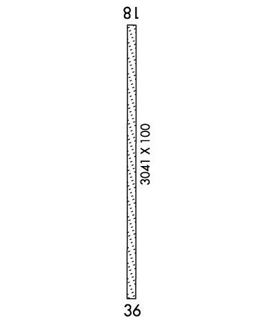
    Runway Identification: 18/36
    Length: 3041 ft
    Width: 100 ft
    Surface: GRASS-GOOD CONDITION
    Edge lights:

    Treatment: NONE

     Runway: 18   Runway: 36
    Mag heading: 181°Mag heading:
    Rwy Slope: -.72% DownRwy Slope: .72% Up
    Approach: Approach:
    Pattern: Right TrafficPattern: Left Traffic
    Markings: NONSTANDARDMarkings: NONSTANDARD
    Marking Condition: FAIR; WHITE BARREL HALVES & LGT FIXTURES.Marking Condition: FAIR; WHITE BARREL HALVES & LGT FIXTURES.
    Arresting Dev: Arresting Dev:
    Lat & Long: N4114.1  W08730.5Lat. & Long.: N4113.6  W08730.5
    Elev: 671.8 ft. MSLElev: 650.0 ft. MSL
    TCH: TCH:
    Visual Glide Path: Visual Glide Path:
    Displaced Threshold: 775 feetDisplaced Threshold: No
    Touchdown Zone: YESTouchdown Zone: YES
    Touchdown Elev.: 671.8 feetTouchdown Elev.: 671.8 feet
    Visual Glide Slope: Visual Glide Slope:
    RVR Equipment: RVR Equipment:
    RVV Equipment: NORVV Equipment: NO
    Approach Lights: Approach Lights:
    REIL: NOREIL: NO
    Centerline Lights: NOCenterline Lights: NO
    Touchdown lights: NOTouchdown lights: NO
    Runway Category: Runway with a Visual ApproachRunway Category: Runway with a Visual Approach
    Declared Distances: Declared Distances:
    Obstructions: CROPSObstructions: CROPS
    Marked: NOT Marked/LightedMarked: NOT Marked/Lighted
    Clearance slope: APCH SLOPE 15:1 FM DSPLCD THR; 65 FT TREE 985 FT & 110 FT R.Clearance slope:
    Obstruction height: 10 feet AGLObstruction height: 10 feet AGL
    Dist. from runway: 0 feetDist. from runway: 0 feet
    Centerline offset: Centerline offset:
    Comments: Comments:
    C:/P: