Current Weather/Notams (Metars, TAFs, Notams, NWS Forecast, PIREPS, and nearby weather)
Customs Information Send updates to Support@FltPlan.com
Customs Not Available
Database effective 05/16/2024
Airport Diagram might not be current.
|
| Facility Name: | BRAWLEY MUNI |
| City Name: | BRAWLEY |
| County: | IMPERIAL |
| State abbrev: | CA |
| State Name: | CALIFORNIA |
| | |
| Ownership: | PUBLICLY OWNED |
| Use: | OPEN TO THE PUBLIC |
| Owner's Name: | CITY OF BRAWLEY |
| Address: | 400 MAIN STREET |
| | BRAWLEY, CA 92227 |
| Owner's Phone: | 760-344-5800 |
| | |
| Manager's Name: | ALAN CHAN |
| Address: | 180 S. WESTERN AVENUE |
| | BRAWLEY, CA 92227 |
| Phone: | 760-587-4122; PUBLIC WORKS DEPT OFFICE IN BRAWLEY |
| | |
| FAA Region: | WESTERN-PACIFIC |
| FAA Field Office: | LAX |
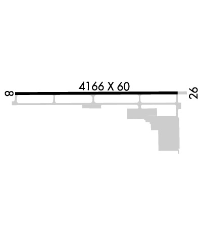
Runway Identifications
Runway Identification: 08/26Length: 4166 ft
Width: 60 ft
Surface: ASPHALT
Edge lights: Medium IntensityTreatment: NONE
| | Runway: 08 | | Runway: 26 |
| Mag heading: | 77° | Mag heading: | 257° |
| Rwy Slope: | -.11% Down | Rwy Slope: | .11% Up |
| Approach: | | Approach: | |
| Pattern: | Left Traffic | Pattern: | Right Traffic |
| Markings: | NONPRECISION INSTRUMENT | Markings: | NONPRECISION INSTRUMENT |
| Marking Condition: | GOOD | Marking Condition: | GOOD |
| Arresting Dev: | | Arresting Dev: | |
| Lat & Long: | N3259.6 W11531.4 | Lat. & Long.: | N3259.6 W11530.6 |
| Elev: | -128.1 ft. MSL | Elev: | -132.5 ft. MSL |
| TCH: | 43 ft. AGL | TCH: | 43 ft. AGL |
| Visual Glide Path: | 3.00 degrees | Visual Glide Path: | 3.00 degrees |
| Displaced Threshold: | 394 feet | Displaced Threshold: | 160 feet |
| Touchdown Zone: | YES | Touchdown Zone: | YES |
| Touchdown Elev.: | -128.2 feet | Touchdown Elev.: | -128.9 feet |
| Visual Glide Slope: | 2-Light PAPI on LEFT side of Runway | Visual Glide Slope: | 2-Light PAPI on RIGHT side of Runway |
| RVR Equipment: | | RVR Equipment: | |
| RVV Equipment: | NO | RVV Equipment: | NO |
| Approach Lights: | | Approach Lights: | |
| REIL: | YES | REIL: | YES |
| Centerline Lights: | NO | Centerline Lights: | NO |
| Touchdown lights: | NO | Touchdown lights: | NO |
| Runway Category: | Runway with a Visual Approach | Runway Category: | Runway with a Non-precision Approach |
| Declared Distances: | | Declared Distances: | |
| Obstructions: | RR | Obstructions: | |
| Marked: | NOT Marked/Lighted | Marked: | |
| Clearance slope: | RWY 08 APCH RATIO 26:1 TO DSPLCD THR. | Clearance slope: | 20:1; APCH RATIO TO DSPLCD THR +15 FT ROAD 510 FT FM DSPLCD THR 34:1. |
| Obstruction height: | 23 feet AGL | Obstruction height: | |
| Dist. from runway: | 210 feet | Dist. from runway: | |
| Centerline offset: | | Centerline offset: | |
| Comments: | RWY 08 +7 FT FENCE 170 FT FM END OF RY. | Comments: | RY 26 +15 FT ROAD 115 FT FM RY END +7 FT FENCE 66 FT FM RY END. |

