Current Weather/Notams (Metars, TAFs, Notams, NWS Forecast, PIREPS, and nearby weather)
Customs Information Send updates to Support@FltPlan.com
Customs Not Available
Database effective 04/18/2024
Airport Diagram might not be current.
|
| Facility Name: | ALBION MUNI |
| City Name: | ALBION |
| County: | BOONE |
| State abbrev: | NE |
| State Name: | NEBRASKA |
| | |
| Ownership: | PUBLICLY OWNED |
| Use: | OPEN TO THE PUBLIC |
| Owner's Name: | ALBION ARPT AUTH |
| Address: | P.O. BOX 3 |
| | ALBION, NE 68620-0003 |
| Owner's Phone: | (402) 741-1290 |
| | |
| Manager's Name: | BOB SANDMAN |
| Address: | P.O. BOX 3 |
| | ALBION, NE 68620-0003 |
| Phone: | 402-741-1290 |
| | |
| FAA Region: | CENTRAL |
| FAA Field Office: | NONE |
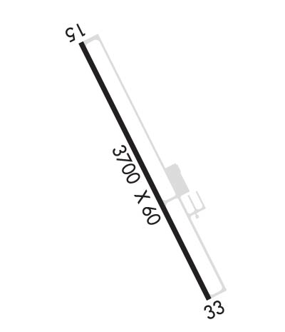
Runway Identifications
Runway Identification: 15/33Length: 3700 ft
Width: 60 ft
Surface: CONCRETE
Edge lights: Medium IntensityTreatment: NONE
| | Runway: 15 | | Runway: 33 |
| Mag heading: | 148° | Mag heading: | 328° |
| Rwy Slope: | -.75% Down | Rwy Slope: | .75% Up |
| Approach: | | Approach: | |
| Pattern: | Left Traffic | Pattern: | Left Traffic |
| Markings: | NONPRECISION INSTRUMENT | Markings: | NONPRECISION INSTRUMENT |
| Marking Condition: | GOOD | Marking Condition: | GOOD |
| Arresting Dev: | | Arresting Dev: | |
| Lat & Long: | N4144.0 W09803.5 | Lat. & Long.: | N4143.4 W09803.2 |
| Elev: | 1806.2 ft. MSL | Elev: | 1778.4 ft. MSL |
| TCH: | 40 ft. AGL | TCH: | 40 ft. AGL |
| Visual Glide Path: | 3.00 degrees | Visual Glide Path: | 3.00 degrees |
| Displaced Threshold: | No | Displaced Threshold: | No |
| Touchdown Zone: | YES | Touchdown Zone: | YES |
| Touchdown Elev.: | 1806.2 feet | Touchdown Elev.: | 1803.3 feet |
| Visual Glide Slope: | 2-Light PAPI on LEFT side of Runway | Visual Glide Slope: | 2-Light PAPI on LEFT side of Runway |
| RVR Equipment: | | RVR Equipment: | |
| RVV Equipment: | NO | RVV Equipment: | NO |
| Approach Lights: | | Approach Lights: | |
| REIL: | NO | REIL: | NO |
| Centerline Lights: | NO | Centerline Lights: | NO |
| Touchdown lights: | NO | Touchdown lights: | NO |
| Runway Category: | Runway with a Non-precision Approach | Runway Category: | Runway with a Non-precision Approach |
| Declared Distances: | | Declared Distances: | |
| Obstructions: | TREE; RWY 15 APCH; TREE AT 42 FT ABV RWY; 882 FT FM RWY END, 310 FT R; CREATES A 16:1. | Obstructions: | TREE |
| Marked: | NOT Marked/Lighted | Marked: | NOT Marked/Lighted |
| Clearance slope: | 12:1 | Clearance slope: | 18:1 |
| Obstruction height: | 66 feet AGL | Obstruction height: | 30 feet AGL |
| Dist. from runway: | 1022 feet | Dist. from runway: | 766 feet |
| Centerline offset: | 356 right of centerline | Centerline offset: | 252 feet left of centerline |
| Comments: | | Comments: | |

