Click here for more info on on SMS!

KBRO

BROWNSVILLE/SOUTH PADRE ISLAND
BROWNSVILLE
TX
Time Zone: Central
Lat: N 2554.4
Long: W 09725.6
Elev: 22
Var: -03
Longest Runway: 7399
Dept. ATIS: 128.55
Arr. ATIS: 128.55
Ground: 121.9
Tower: 118.9

FBO & Flight Services info for KBRO

FBOs: Update your Fuel Prices

  click here  
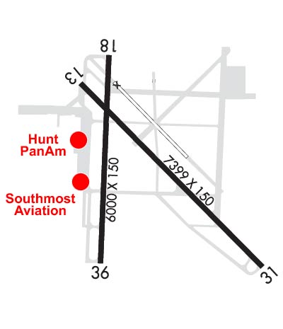
NO RAMP/FACILITY FEES. Newly remodeled executive passenger terminal. Red Carpet VIP service. Brownsville's largest full service FBO, we offer COMPLETE service. Major repairs and maintenance, parts, aircraft sales and line services. Amenities include: Hotel reservations, Catering, Customer lounge, Conference room, Pilot's lounge, Courtesy cars, Hangar, Tie downs, Starbucks Coffee and Ice.
Ph: 956-542-9111 Fax: 956-542-9133 Freq: 122.95WebsiteE-Mail
                     
Service
Jet
100LL
SAF
MoGas
Fuel Avail: PRIST +$0.05/gal. 5:00 A- 10:00 P, M-FRI,. 4:00 A- 10:00 SAT/SUN
Full5.296.64    Last Update: 04/08/2024 22:48

Self        
Misc. Info: Fuel Discounts availableAddress: 505 AMELIA EARHART DRIVE,   BROWNSVILLE, TX 78521
Family owned and operated since 1967! We give each and every customer personal attention. We strive to make your visit enjoyable and hassle-free. We can service your aircraft at the customs ramp or taxi to our ramp to take advantage of our services and amenities: aviation fuel, A/C maintenance, catering, courtesy cars (for local use by pilots), restrooms, pilots lounge/snooze room, and more!
Ph: 956-542-5852 Fax: 956-548-0411 Freq: 122.95WebsiteE-Mail
                          
Service
Jet
100LL
SAF
MoGas
Fuel Avail: PRIST PREMIXED. 7am-10pm on call 10pm-7am
Full5.496.89    Last Update: 03/27/2024 14:15

Self        
Misc. Info: We offer discounts on JET-A and 100LLAddress: 973 S MINNESOTA AVE.,   BROWNSVILLE, TX 78521

ASOSPh: 956-546-4540
-
-
 
If you are an FBO, call 1-203-262-1700 to update your info or email: FltPlan.Advertising@garmin.com
Advertise your FBO on FltPlan.com

Runway & Approach Info for KBRO
Rwy
Length
Land Dist**
Approach*
  Rwy
Length
Land Dist**
Approach*
13
7399x150  7399'          
ILS/DME
 110.30 - 132°  
  
31
  7399x150  7399'          
 
18
6000x150  5810'          
 
  
36
  6000x150  6000'          
 
 * only ILS, LOC, LDA, and SDF approaches to a specific runway are shown
** For any Declared Landing Distance Available, please see A/FD or Approach plates
Runway Weight Capability (lbs.) Help
Runway IDSingle WheelDouble WheelDouble Tandem WheelDual Double Wheel
13/3175,000170,000240,000N/A
18/3675,000144,000150,000N/A
These numbers are Advisory and are not limits.   The Airport Manager should have more accurate Weight Limits
Approach Charts
Approaches    
Current Weather/Notams
Customs Information Send updates to Support@FltPlan.com
Phone 956-592-3447
Fax 956-550-9846

Comments 1 hr advance notice required. *Call prior to 2400 on preceding weekday.
Database effective 04/18/2024
Airport Diagram of KBRO
Airport Diagram might not be current.

Facility Name: BROWNSVILLE/SOUTH PADRE ISLAND INTL
City Name: BROWNSVILLE
County: CAMERON
State abbrev: TX
State Name: TEXAS
   
Ownership: PUBLICLY OWNED
Use: OPEN TO THE PUBLIC
Owner's Name: CITY OF BROWNSVILLE
Address: BOX 911
 BROWNSVILLE, TX 78520
Owner's Phone: 956-542-4373
  
Manager's Name: DOROTEO GARCIA JR; INTERIM DIRECTOR OF AVIATION.
Address: 700 AMELIA EARHART
 BROWNSVILLE, TX 78521-5721
Phone: 956-542-4373
   
FAA Region: SOUTHWEST
FAA Field Office: TEX


Sunrise / Sunset times for BROWNSVILLE/SOUTH PADRE ISLAND INTL

DateSunriseSunset
04/17/24 Wednesday7:0419:54
04/18/24 Thursday7:0319:55
04/19/24 Friday7:0219:55
04/20/24 Saturday7:0119:56
04/21/24 Sunday7:0019:56
04/22/24 Monday7:0019:57
04/23/24 Tuesday6:5919:57
04/24/24 Wednesday6:5819:58
04/25/24 Thursday6:5719:58
04/26/24 Friday6:5619:59
04/27/24 Saturday6:5520:00
04/28/24 Sunday6:5420:00
04/29/24 Monday6:5420:01
04/30/24 Tuesday6:5320:01

Airport Facilities

Airport Attendance ScheduleCONTINUOUS; FOR ACFT SVC CALL 956-542-5852 OR 956-542-9111.
Airport Status OPERATIONAL (This Status can change at any time - please check NOTAMS)
Airport Lighting ScheduleDUSK-DAWN. WHEN ATCT CLSD ACTVT MALSR RWY 13 - CTAF.
Airport Storage AvailableTie Downs, Hanger
Extra Services AvailableAir Freight, Avionics, Cargo Handling, Charter, Flight Instruction, Aircraft Rental, Aircraft Sales
Wind IndicatorYES - (lighted)
Control TowerYES
CTAF Frequency118.900
Unicom Frequency122.950
Rotating Beacon ColorWG
Segmented CircleYES
Landing FeeYES

Airport Inspection Data

Airport InspectedFEDERAL - performed by FAA AIRPORTS FIELD PERSONNEL
Inspection Date08/30/2023

Airport Services

Type of Fuel AvailableGrade 100LL, JET A (freeze point -40C)
Airframe Repair ServiceMAJOR
Power Plant Repair ServiceMAJOR

Geographic Data

LatitudeN2554.4
LongitudeW09725.6 (ESTIMATED)
Arpt Elevation22ft (SURVEYED)
Magnetic Variation03E
4 miles Eof BROWNSVILLE
Traffic Pattern Altitude
Sectional ChartBROWNSVILLE

Aircraft Data

Operations (Reported)YearlyAvg. Daily
General Aviation Transient 1080030
General Aviation Local 14994
Air Taxi 443812
Commerical 32649
Commuter 00
Military 352510
Aircraft based on Field
General Aviation Singles 33
General Aviation Multi 8
Jet Aircraft 4
General Aviation Helicopters 0
Military Aircraft 0
Gliders 0
Ultralights 0

FAA Services

FSS on field NO
FSS tie-in SAN ANGELO
FSS Phone 1-800-WX-BRIEF
Who issues Notams BRO
Notam D service at airport YES
ARTCC Name HOUSTON

Federal Status

Airport CertificationAIRPORT RECEIVING SCHEDULED AIR CARRIER SERVICE FROM CARRIERS CERTIFICATED BY THE CIVIL AERONAUTICS BOARD; WHEN ATCT CLSD REQ ARFF ASSISTANCE THRU HOUSTON ARTCC OR FLT SVC. PPR 24 HRS FOR UNSKED ACR OPNS WITH MORE THAN 30 PSGR SEATS CALL AMGR 956-542-4373.
Aircraft Rescue & Firefighting IndexAIRPORT HAS A CERTIFICATE UNDER CFR PART 139
Airport of EntryYES
Custom Landing RightsNo
Joint Civil/MilitaryNo
Military Landing rightsYES

Federal Agreements

NATIONAL PLAN OF INTEGRATED AIRPORT SYSTEMS (NPIAS)
GRANT AGREEMENTS UNDER FAAP/ADAP/AIP
SURPLUS PROPERTY AGREEMENT UNDER PUBLIC LAW 289
ASSURANCES PURSUANT TO TITLE VI, CIVIL RIGHTS ACT OF 1964
AGREEMENT UNDER DLAND OR DCLA HAS EXPIRED.

Remarks

FLIGHT NOTIFICATION SERVICE (ADCUS) AVAILABLE.
LGTD OIL DERRICKS LCTN APRXLY 5 NM NE MAX 500 FT AGL.
BIRDS ON & INVOF ARPT.
FOR CD WHEN ATCT IS CLSD CTC CRP APCH AT 361-299-4230.
TXY J NORTH OF TXY H OPEN TO TFC UNDER 12500 LBS.
FOR CUST AND BDR PROTECTION SVCS CTC: 956-547-5760 DLY 0800-2400; KBRO.GAP@CBP.DHS.GOV. AFT HRS: 956-983-5704, 956-982-3653; BROWNSVILLEOPSCENTER@CBP.DHS.GOV.
Airport Communications & Frequencies:
ATIS Frequencies:   Hours(local) of Operation: CONTINUOUS
128.55
BROWNSVILLE Tower Frequencies:   Hours(local) of operation: 0600-0000   
118.9
239.3
BROWNSVILLE Ground Frequencies:
121.9
Emergency Frequencies:
121.5
243.0
CTAF Frequency:
118.900
Unicom Frequency:
122.950
VALLEY Primary Approach Frequencies:  
119.5
257.6
VALLEY Primary Departure Frequencies:  
119.5
257.6
Runway Identifications
Runway Identification: 13/31
Length: 7399 ft
Width: 150 ft
Surface: ASPHALT-GOOD CONDITION
Edge lights: High Intensity

Treatment: GROOVED
Weight: PCN 67 /R/D/X/T

 Runway: 13   Runway: 31
Mag heading: 132°Mag heading: 312°
Rwy Slope: .04% UpRwy Slope: -.04% Down
Approach: ILS/DMEApproach:
Pattern: Left TrafficPattern: Left Traffic
Markings: PRECISION INSTRUMENTMarkings: PRECISION INSTRUMENT
Marking Condition: GOODMarking Condition: GOOD
Arresting Dev: Arresting Dev:
Lat & Long: N2554.8  W09725.9Lat. & Long.: N2553.9  W09724.9
Elev: 17.3 ft. MSLElev: 20.0 ft. MSL
TCH: TCH: 68 ft. AGL
Visual Glide Path: Visual Glide Path: 3.00 degrees
Displaced Threshold: NoDisplaced Threshold: No
Touchdown Zone: YESTouchdown Zone: YES
Touchdown Elev.: 19.2 feetTouchdown Elev.: 20.2 feet
Visual Glide Slope: Visual Glide Slope: 4-Light PAPI on LEFT side of Runway
RVR Equipment: TOUCHDOWNRVR Equipment: ROLLOUT
RVV Equipment: NORVV Equipment: NO
Approach Lights: MALSR - 1,400 foot medium intensity approach lighting system with runway alignment indicator lightsApproach Lights:
REIL: NOREIL: NO
Centerline Lights: NOCenterline Lights: NO
Touchdown lights: NOTouchdown lights: NO
Runway Category: Precision Instrument RunwayRunway Category: Runway with a Non-precision Approach having visibility minimums greater than 3/4 mile
Declared Distances: TORA:7399' TODA:7399' ASDA:7399' LDA:7399'Declared Distances: TORA:7399' TODA:7399' ASDA:7399' LDA:7399'
Obstructions: TREEObstructions: TREE
Marked: NOT Marked/LightedMarked: NOT Marked/Lighted
Clearance slope: 33:1Clearance slope: 22:1
Obstruction height: 31 feet AGLObstruction height: 24 feet AGL
Dist. from runway: 1224 feetDist. from runway: 751 feet
Centerline offset: 369 left of centerlineCenterline offset: 611 feet left of centerline
Comments: Comments:
Runway Identification: 18/36
Length: 6000 ft
Width: 150 ft
Surface: ASPHALT-FAIR CONDITION
Edge lights: Medium Intensity

Treatment: GROOVED
Weight: PCN 7 /F/C/X/T

 Runway: 18   Runway: 36
Mag heading: 179°Mag heading: 359°
Rwy Slope: .04% UpRwy Slope: -.04% Down
Approach: Approach:
Pattern: Left TrafficPattern: Left Traffic
Markings: NONPRECISION INSTRUMENTMarkings: NONPRECISION INSTRUMENT
Marking Condition: GOODMarking Condition: GOOD
Arresting Dev: Arresting Dev:
Lat & Long: N2554.9  W09725.7Lat. & Long.: N2553.9  W09725.8
Elev: 19.7 ft. MSLElev: 22.3 ft. MSL
TCH: 50 ft. AGLTCH: 51 ft. AGL
Visual Glide Path: 3.00 degreesVisual Glide Path: 3.00 degrees
Displaced Threshold: 190 feetDisplaced Threshold: No
Touchdown Zone: YESTouchdown Zone: YES
Touchdown Elev.: 19.5 feetTouchdown Elev.: 22.4 feet
Visual Glide Slope: 4-Light PAPI on LEFT side of RunwayVisual Glide Slope: 4-BOX VASI ON LEFT SIDE OF RUNWAY
RVR Equipment: RVR Equipment:
RVV Equipment: NORVV Equipment: NO
Approach Lights: Approach Lights:
REIL: NOREIL: NO
Centerline Lights: NOCenterline Lights: NO
Touchdown lights: NOTouchdown lights: NO
Runway Category: Runway with a Non-precision Approach having visibility minimums greater than 3/4 mileRunway Category: Runway with a Non-precision Approach having visibility minimums greater than 3/4 mile
Declared Distances: TORA:6000' TODA:6000' ASDA:6000' LDA:5810'Declared Distances: TORA:5532' TODA:5532' ASDA:5532' LDA:5532'
Obstructions: TREEObstructions: TREE
Marked: NOT Marked/LightedMarked: NOT Marked/Lighted
Clearance slope: 14:1Clearance slope: 15:1
Obstruction height: 37 feet AGLObstruction height: 30 feet AGL
Dist. from runway: 722 feetDist. from runway: 660 feet
Centerline offset: 140 left of centerlineCenterline offset: 312 feet right of centerline
Comments: Comments:
C:68/P: