Click here for more info on on SMS!

KBIL

BILLINGS LOGAN INTL
BILLINGS
MT
Time Zone: Mountain
Lat: N 4548.5
Long: W 10832.6
Elev: 3662
Var: -10
Longest Runway: 10518
Clr Del: 121.9
Dept. ATIS: 126.3
Arr. ATIS: 126.3
Ground: 121.9
Tower: 127.2

FBO & Flight Services info for KBIL

FBOs: Update your Fuel Prices
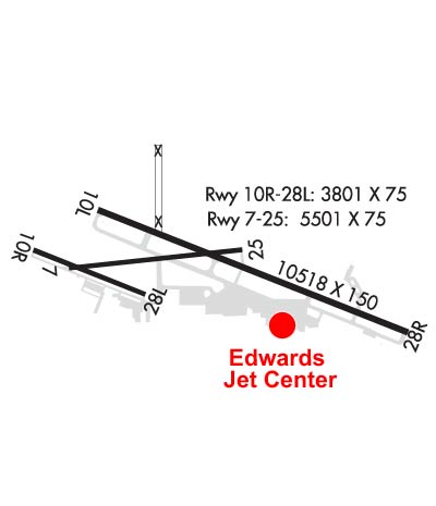
Service... it's what Edwards Jet Center is all about. Fast & Friendly Service Everytime * Desire to Surpass Customer Expectations * Attention to Every Detail * Anticipate and Accommodate Your Every Need. We are your Montana Aviation Headquarters.
Ph: 866-353-8245 Fax: 406-245-9491 Freq: 123.3WebsiteE-Mail
                          
Service
Jet
100LL
SAF
MoGas
Fuel Avail: 24 Hours
Full5.255.75    Last Update: 04/16/2024 11:29
PRICES GUARANTEED by FBO.
Self  5.15    
Misc. Info: Self-Serve 100LL Unit available 24/7.Address: 1691 AVIATION PLACE,   BILLINGS, MT 59105

BEACON AIR GROUPPh: 800-700-5107
-
Freq: 128.82
Service
Jet
100LL
SAF
MoGas
Fuel Avail: Open 7am-7pm with 24/7 available
Full4.535.37    Last Update: 04/17/2024 09:00  
Self        
 Address: 2390 OVERLOOK DR,   BILLINGS, MT 59105
ASOSPh: 406-248-2773
-
-
 
If you are an FBO, call 1-203-262-1700 to update your info or email: FltPlan.Advertising@garmin.com
Advertise your FBO on FltPlan.com

Runway & Approach Info for KBIL
Rwy
Length
Land Dist**
Approach*
  Rwy
Length
Land Dist**
Approach*
07
5501x75  5501'          
 
  
25
  5501x75  5501'          
 
10L
10518x150  10518'          
ILS/DME
 111.50 - 101°  
  
28R
  10518x150  10518'          
ILS/DME
 111.50 - 281°  
10R
3800x75  3800'          
 
  
28L
  3800x75  3800'          
 
 * only ILS, LOC, LDA, and SDF approaches to a specific runway are shown
** For any Declared Landing Distance Available, please see A/FD or Approach plates
Runway Weight Capability (lbs.) Help
Runway IDSingle WheelDouble WheelDouble Tandem WheelDual Double Wheel
07/2512,500N/AN/AN/A
10L/28R120,000214,000365,000N/A
10R/28L12,500N/AN/AN/A
These numbers are Advisory and are not limits.   The Airport Manager should have more accurate Weight Limits
Approach Charts
Approaches    
Current Weather/Notams
Customs Information Send updates to Support@FltPlan.com
Customs Not Available
Database effective 04/18/2024
Airport Diagram of KBIL
Airport Diagram might not be current.

Facility Name: BILLINGS LOGAN INTL
City Name: BILLINGS
County: YELLOWSTONE
State abbrev: MT
State Name: MONTANA
   
Ownership: PUBLICLY OWNED
Use: OPEN TO THE PUBLIC
Owner's Name: CITY OF BILLINGS
Address: CITY HALL
 BILLINGS, MT 59101
Owner's Phone: 406-657-8495
  
Manager's Name: JEFF ROACH, MANAGER
Address: 1901 TERMINAL CIRCLE DR., ROOM 216
 BILLINGS, MT 59105
Phone: (406) 657-8484; 406-657-8495
   
FAA Region: NORTHWEST MOUNTAIN
FAA Field Office: HLN


Sunrise / Sunset times for BILLINGS LOGAN INTL

DateSunriseSunset
04/19/24 Friday6:2020:07
04/20/24 Saturday6:1820:09
04/21/24 Sunday6:1620:10
04/22/24 Monday6:1520:11
04/23/24 Tuesday6:1320:12
04/24/24 Wednesday6:1120:14
04/25/24 Thursday6:1020:15
04/26/24 Friday6:0820:16
04/27/24 Saturday6:0620:18
04/28/24 Sunday6:0520:19
04/29/24 Monday6:0320:20
04/30/24 Tuesday6:0220:22
05/01/24 Wednesday6:0020:23
05/02/24 Thursday5:5920:24

Airport Facilities

Airport Attendance ScheduleCONTINUOUS
Airport Status OPERATIONAL (This Status can change at any time - please check NOTAMS)
Airport Lighting ScheduleATC-CTL. FOR MIRL RYS 10R/28L & 07/25; HIRL RY 10L/28R; MALSR RY 10L & REIL RYS 25 & 28R - CTC ATCT.
Airport Storage AvailableTie Downs, Hanger
Extra Services AvailableAir Freight, Air Ambulance, Avionics, Cargo Handling, Charter, Flight Instruction, Aircraft Rental, Aircraft Sales
Wind IndicatorYES - (lighted)
Control TowerYES
CTAF Frequency
Unicom Frequency122.950
Rotating Beacon ColorWG
Segmented CircleYES
Landing FeeNO

Airport Inspection Data

Airport InspectedFEDERAL - performed by FAA AIRPORTS FIELD PERSONNEL
Inspection Date09/13/2023

Airport Services

Type of Fuel AvailableGrade 100LL, JET A (freeze point -40C)
Airframe Repair ServiceMAJOR
Power Plant Repair ServiceMAJOR

Geographic Data

LatitudeN4548.5
LongitudeW10832.6 (ESTIMATED)
Arpt Elevation3662ft (SURVEYED)
Magnetic Variation10E
2 miles NWof BILLINGS
Traffic Pattern AltitudeSINGLE ENGINE ACFT 4500 (838), MULTI ENGINE/TURBOJET ACFT 5000 (1338).
Sectional ChartBILLINGS

Aircraft Data

Operations (Reported)YearlyAvg. Daily
General Aviation Transient 3134386
General Aviation Local 2490668
Air Taxi 2979482
Commerical 1218233
Commuter 00
Military 15234
Aircraft based on Field
General Aviation Singles 106
General Aviation Multi 62
Jet Aircraft 22
General Aviation Helicopters 7
Military Aircraft 0
Gliders 0
Ultralights 0

FAA Services

FSS on field NO
FSS tie-in GREAT FALLS
FSS Phone 1-800-WX-BRIEF
Who issues Notams BIL
Notam D service at airport YES
ARTCC Name SALT LAKE CITY

Federal Status

Airport CertificationAIRPORT RECEIVING SCHEDULED AIR CARRIER SERVICE FROM CARRIERS CERTIFICATED BY THE CIVIL AERONAUTICS BOARD; PPR UNSKED ACR OPNS WITH MORE THAN 30 PSGR SEATS CTC ARPT OPS 406-657-8496. ARFF INDEX B 0200-0500.
Aircraft Rescue & Firefighting IndexAIRPORT HAS A CERTIFICATE UNDER CFR PART 139
Airport of EntryNo
Custom Landing RightsNo
Joint Civil/MilitaryNo
Military Landing rightsYES

Federal Agreements

NATIONAL PLAN OF INTEGRATED AIRPORT SYSTEMS (NPIAS)
GRANT AGREEMENTS UNDER FAAP/ADAP/AIP
ASSURANCES PURSUANT TO TITLE VI, CIVIL RIGHTS ACT OF 1964
AGREEMENT UNDER DLAND OR DCLA HAS EXPIRED.

Remarks

TWY D 35 FT WIDE CLSD TO ACFT OVER 12,500 LBS.
NO CUSTOMS, REMOTE ACFT PARKING, LTD GROUND HANDLING SVCS
180 DEG TURNS RY 10L/28R BY ACFT OVER 25000 LBS PROHIBITED.
MIGRATORY WATERFOWL INVOF ARPT.
RYS 07/25 AND 10R/28L CLSD TO ACFT OVER 12,500 LBS.
Airport Communications & Frequencies:
ATIS Frequencies:   Hours(local) of Operation: CONTINUOUS
126.3
BILLINGS Tower Frequencies:   Hours(local) of operation: CONTINUOUS   
127.2
257.8
BILLINGS Ground Frequencies:
121.9
Clearance Delivery Frequencies:
121.9
Pre-Taxi Clearance Frequencies:
121.9
Emergency Frequencies:
121.5
243.0
Unicom Frequency:
122.950
BILLINGS Primary Approach Frequencies:   Hours(local) of operation: CONTINUOUS   
119.2 ;EAST
120.5 ;WEST
284.6
BILLINGS Primary Departure Frequencies:   Hours(local) of operation: CONTINUOUS   
119.2 ;EAST
120.5 ;WEST
284.6
Class C Frequencies:
119.2 ;EAST
120.5 ;WEST
284.6
Runway Identifications
Runway Identification: 07/25
Length: 5501 ft
Width: 75 ft
Surface: ASPHALT-GOOD CONDITION
Edge lights: Medium Intensity

Treatment: GROOVED
Weight: PCN 7 /F/B/X/U

 Runway: 07   Runway: 25
Mag heading: 74°Mag heading: 254°
Rwy Slope: -1.86% DownRwy Slope: 1.86% Up
Approach: Approach:
Pattern: Left TrafficPattern: Left Traffic
Markings: NONPRECISION INSTRUMENTMarkings: NONPRECISION INSTRUMENT
Marking Condition: GOODMarking Condition: GOOD
Arresting Dev: Arresting Dev:
Lat & Long: N4548.5  W10833.5Lat. & Long.: N4548.6  W10832.2
Elev: 3636.3 ft. MSLElev: 3533.8 ft. MSL
TCH: 31 ft. AGLTCH: 36 ft. AGL
Visual Glide Path: 3.00 degreesVisual Glide Path: 3.00 degrees
Displaced Threshold: NoDisplaced Threshold: No
Touchdown Zone: YESTouchdown Zone: YES
Touchdown Elev.: 3636.3 feetTouchdown Elev.: 3585.6 feet
Visual Glide Slope: 4-Light PAPI on LEFT side of RunwayVisual Glide Slope: 4-Light PAPI on RIGHT side of Runway
RVR Equipment: RVR Equipment:
RVV Equipment: NORVV Equipment: NO
Approach Lights: Approach Lights:
REIL: NOREIL: YES
Centerline Lights: NOCenterline Lights: NO
Touchdown lights: NOTouchdown lights: NO
Runway Category: Runway with a Non-precision ApproachRunway Category: Runway with a Non-precision Approach
Declared Distances: TORA:5501' TODA:5501' ASDA:5501' LDA:5501'Declared Distances: TORA:5501' TODA:5501' ASDA:5501' LDA:5501'
Obstructions: GNDObstructions:
Marked: NOT Marked/LightedMarked:
Clearance slope: 20:1Clearance slope: 20:1
Obstruction height: 20 feet AGLObstruction height:
Dist. from runway: 600 feetDist. from runway:
Centerline offset: Centerline offset:
Comments: Comments:
Runway Identification: 10L/28R
Length: 10518 ft
Width: 150 ft
Surface: ASPHALT-GOOD CONDITION
Edge lights: High Intensity

Treatment: GROOVED
Weight: PCN 55 /F/B/X/T

 Runway: 10L   Runway: 28R
Mag heading: 101°Mag heading: 281°
Rwy Slope: -.91% DownRwy Slope: .91% Up
Approach: ILS/DMEApproach: ILS/DME
Pattern: Left TrafficPattern: Left Traffic
Markings: PRECISION INSTRUMENTMarkings: PRECISION INSTRUMENT
Marking Condition: GOODMarking Condition: GOOD
Arresting Dev: Arresting Dev:
Lat & Long: N4548.8  W10833.3Lat. & Long.: N4548.1  W10831.0
Elev: 3584.4 ft. MSLElev: 3488.2 ft. MSL
TCH: 51 ft. AGLTCH: 56 ft. AGL
Visual Glide Path: 3.00 degreesVisual Glide Path: 3.00 degrees
Displaced Threshold: NoDisplaced Threshold: No
Touchdown Zone: YESTouchdown Zone: YES
Touchdown Elev.: 3584.5 feetTouchdown Elev.: 3517.2 feet
Visual Glide Slope: 4-Light PAPI on LEFT side of RunwayVisual Glide Slope: 4-Light PAPI on RIGHT side of Runway
RVR Equipment: TOUCHDOWNRVR Equipment: ROLLOUT
RVV Equipment: YESRVV Equipment: NO
Approach Lights: MALSR - 1,400 foot medium intensity approach lighting system with runway alignment indicator lightsApproach Lights:
REIL: NOREIL: YES
Centerline Lights: NOCenterline Lights: NO
Touchdown lights: NOTouchdown lights: NO
Runway Category: Precision Instrument RunwayRunway Category: Precision Instrument Runway
Declared Distances: TORA:10518' TODA:10518' ASDA:10518' LDA:10518'Declared Distances: TORA:10518' TODA:10518' ASDA:10518' LDA:10518'
Obstructions: Obstructions: GND
Marked: Marked: NOT Marked/Lighted
Clearance slope: 50:1Clearance slope: 34:1
Obstruction height: Obstruction height: 12 feet AGL
Dist. from runway: Dist. from runway: 200 feet
Centerline offset: Centerline offset: 400 feet left of centerline
Comments: Comments: +12' GND 0-200' FM RY END 400' L.
Runway Identification: 10R/28L
Length: 3800 ft
Width: 75 ft
Surface: ASPHALT-GOOD CONDITION
Edge lights: Medium Intensity

Treatment: NONE
Weight: PCN 4 /F/B/X/U

 Runway: 10R   Runway: 28L
Mag heading: 101°Mag heading: 281°
Rwy Slope: -1.27% DownRwy Slope: 1.27% Up
Approach: Approach:
Pattern: Left TrafficPattern: Left Traffic
Markings: BASICMarkings: BASIC
Marking Condition: FAIRMarking Condition: FAIR
Arresting Dev: Arresting Dev:
Lat & Long: N4548.6  W10834.0Lat. & Long.: N4548.4  W10833.1
Elev: 3662.3 ft. MSLElev: 3614.0 ft. MSL
TCH: TCH:
Visual Glide Path: Visual Glide Path:
Displaced Threshold: NoDisplaced Threshold: No
Touchdown Zone: YESTouchdown Zone: YES
Touchdown Elev.: 3651.6 feetTouchdown Elev.: 3641.0 feet
Visual Glide Slope: Visual Glide Slope:
RVR Equipment: RVR Equipment:
RVV Equipment: NORVV Equipment: NO
Approach Lights: Approach Lights:
REIL: NOREIL: NO
Centerline Lights: NOCenterline Lights: NO
Touchdown lights: NOTouchdown lights: NO
Runway Category: Runway with a Visual ApproachRunway Category: Runway with a Visual Approach
Declared Distances: TORA:3801' TODA:3801' ASDA:3801' LDA:3801'Declared Distances: TORA:3801' TODA:3801' ASDA:3801' LDA:3801'
Obstructions: GNDObstructions:
Marked: NOT Marked/LightedMarked:
Clearance slope: 20:1Clearance slope: 20:1
Obstruction height: 52 feet AGLObstruction height:
Dist. from runway: 2251 feetDist. from runway:
Centerline offset: Centerline offset:
Comments: Comments:
C:108/P: