Current Weather/Notams (Metars, TAFs, Notams, NWS Forecast, PIREPS, and nearby weather)
Customs Information Send updates to Support@FltPlan.com
Customs Not Available
Database effective 04/18/2024
Airport Diagram might not be current.
|
| Facility Name: | BLANDING MUNI |
| City Name: | BLANDING |
| County: | SAN JUAN |
| State abbrev: | UT |
| State Name: | UTAH |
| | |
| Ownership: | PUBLICLY OWNED |
| Use: | OPEN TO THE PUBLIC |
| Owner's Name: | BLANDING CITY |
| Address: | 50 WEST 100 SOUTH |
| | BLANDING, UT 84511 |
| Owner's Phone: | 435-678-2791 |
| | |
| Manager's Name: | BRET HOSLER; DIR COMM. DEV/ARPT MGR. 435-678-2791. |
| Address: | 50 WEST 100 SOUTH |
| | BLANDING, UT 84511 |
| Phone: | 435-459-3275; FBO/ARPT ATTENDANT. |
| | |
| FAA Region: | NORTHWEST MOUNTAIN |
| FAA Field Office: | DEN |
Runway Identifications
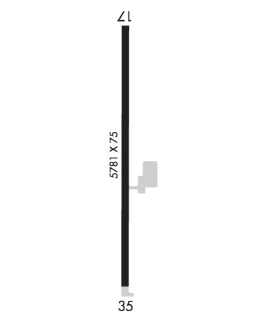
Runway Identification: 17/35Length: 5781 ft
Width: 75 ft
Surface: ASPHALT-GOOD CONDITION
Edge lights: Medium IntensityTreatment: NONE
| | Runway: 17 | | Runway: 35 |
| Mag heading: | 168° | Mag heading: | 348° |
| Rwy Slope: | -1.61% Down | Rwy Slope: | 1.61% Up |
| Approach: | | Approach: | |
| Pattern: | Left Traffic | Pattern: | Left Traffic |
| Markings: | BASIC | Markings: | NONPRECISION INSTRUMENT |
| Marking Condition: | POOR; RWY MKGS FADED. | Marking Condition: | POOR; RWY MKGS FADED. |
| Arresting Dev: | | Arresting Dev: | |
| Lat & Long: | N3735.5 W10929.0 | Lat. & Long.: | N3734.5 W10929.0 |
| Elev: | 5867.8 ft. MSL | Elev: | 5774.5 ft. MSL |
| TCH: | 40 ft. AGL | TCH: | 40 ft. AGL |
| Visual Glide Path: | 3.00 degrees | Visual Glide Path: | 3.00 degrees |
| Displaced Threshold: | No | Displaced Threshold: | No |
| Touchdown Zone: | YES | Touchdown Zone: | YES |
| Touchdown Elev.: | 5867.8 feet | Touchdown Elev.: | 5820.6 feet |
| Visual Glide Slope: | 4-Light PAPI on LEFT side of Runway | Visual Glide Slope: | 4-Light PAPI on LEFT side of Runway |
| RVR Equipment: | | RVR Equipment: | |
| RVV Equipment: | NO | RVV Equipment: | NO |
| Approach Lights: | | Approach Lights: | |
| REIL: | YES | REIL: | YES |
| Centerline Lights: | NO | Centerline Lights: | NO |
| Touchdown lights: | NO | Touchdown lights: | NO |
| Runway Category: | Runway with a Visual Approach | Runway Category: | Runway with a Non-precision Approach having visibility minimums greater than 3/4 mile |
| Declared Distances: | | Declared Distances: | |
| Obstructions: | | Obstructions: | ROAD |
| Marked: | | Marked: | NOT Marked/Lighted |
| Clearance slope: | 50:1 | Clearance slope: | 28:1 |
| Obstruction height: | | Obstruction height: | 15 feet AGL |
| Dist. from runway: | | Dist. from runway: | 620 feet |
| Centerline offset: | | Centerline offset: | |
| Comments: | | Comments: | |

