Click here for more info on on SMS!

KB21

SUGARLOAF RGNL
CARRABASSETT
ME
Time Zone: Eastern
Lat: N 4505.1
Long: W 07013.0
Elev: 880
Var: +17
Longest Runway: 2797
CTAF: 122.8

FBO & Flight Services info for KB21

FBOs: Update your Fuel Prices

SUGARLOAF RGNLPh: 207-235-2646
-
Freq: 122.8
Service
Jet
100LL
SAF
MoGas
Full        Last Update: 03/22/2024 13:33

Self  6.50  4.98
If you are an FBO, call 1-203-262-1700 to update your info or email: FltPlan.Advertising@garmin.com
Advertise your FBO on FltPlan.com

Runway & Approach Info for KB21
Rwy
Length
Land Dist**
Approach*
  Rwy
Length
Land Dist**
Approach*
17
2797x75  2797'          
 
  
35
  2797x75  2708'          
 
 * only ILS, LOC, LDA, and SDF approaches to a specific runway are shown
** For any Declared Landing Distance Available, please see A/FD or Approach plates
Runway Weight Capability (lbs.) Help
Runway IDSingle WheelDouble WheelDouble Tandem WheelDual Double Wheel
17/3512,000N/AN/AN/A
These numbers are Advisory and are not limits.   The Airport Manager should have more accurate Weight Limits
Approach Charts
Approaches    
Current Weather/Notams
Customs Information Send updates to Support@FltPlan.com
Customs Not Available
Database effective 04/18/2024
Airport Diagram of KB21
Airport Diagram might not be current.

Facility Name: SUGARLOAF RGNL
City Name: CARRABASSETT
County: FRANKLIN
State abbrev: ME
State Name: MAINE
   
Ownership: PUBLICLY OWNED
Use: OPEN TO THE PUBLIC
Owner's Name: TOWN OF CARRABASSETT
Address: 1001 CARRIAGE RD
 CARRABASSETT VALLEY, ME 04947
Owner's Phone: 207-235-2646
  
Manager's Name: TOM WALLACE; ADDNL CTC: TOM WALLACE AT TLWCFII@YAHOO.COM.
Address: 1001 CARRIAGE RD
 CARRABASSETT VALLEY, ME 04947
Phone: 207-350-1415
   
FAA Region: NEW ENGLAND
FAA Field Office: NONE


Sunrise / Sunset times for SUGARLOAF RGNL

DateSunriseSunset
04/19/24 Friday5:4819:32
04/20/24 Saturday5:4619:34
04/21/24 Sunday5:4519:35
04/22/24 Monday5:4319:36
04/23/24 Tuesday5:4119:38
04/24/24 Wednesday5:4019:39
04/25/24 Thursday5:3819:40
04/26/24 Friday5:3719:41
04/27/24 Saturday5:3519:43
04/28/24 Sunday5:3319:44
04/29/24 Monday5:3219:45
04/30/24 Tuesday5:3019:46
05/01/24 Wednesday5:2919:48
05/02/24 Thursday5:2719:49

Airport Facilities

Airport Attendance ScheduleUNATTENDED
Airport Status OPERATIONAL (This Status can change at any time - please check NOTAMS)
Airport Lighting Schedule
Airport Storage AvailableTie Downs
Extra Services AvailableNONE
Wind IndicatorYES - (unlit)
Control TowerNO
CTAF Frequency122.800
Unicom Frequency122.800
Rotating Beacon Color
Segmented CircleYES
Landing FeeNO

Airport Inspection Data

Airport InspectedSTATE - performed by PRIVATE CONTRACT PERSONNEL
Inspection Date08/09/2022

Airport Services

Type of Fuel AvailableGrade 100LLMOGAS
Airframe Repair ServiceNONE
Power Plant Repair ServiceNONE

Geographic Data

LatitudeN4505.1
LongitudeW07013.0 (ESTIMATED)
Arpt Elevation880ft (SURVEYED)
Magnetic Variation17W
1 miles Nof CARRABASSETT
Traffic Pattern Altitude2000
Sectional ChartMONTREAL

Aircraft Data

Operations (Reported)YearlyAvg. Daily
General Aviation Transient 25007
General Aviation Local 350010
Air Taxi 00
Commerical 00
Commuter 00
Military 00
Aircraft based on Field
General Aviation Singles 14
General Aviation Multi 0
Jet Aircraft 0
General Aviation Helicopters 0
Military Aircraft 0
Gliders 0
Ultralights 0

FAA Services

FSS on field NO
FSS tie-in BANGOR
FSS Phone 1-800-WX-BRIEF
Who issues Notams BGR
Notam D service at airport YES
ARTCC Name BOSTON

Federal Status

Airport Certification
Aircraft Rescue & Firefighting IndexNone
Airport of EntryNo
Custom Landing RightsNo
Joint Civil/MilitaryNo
Military Landing rightsYES

Federal Agreements

NATIONAL PLAN OF INTEGRATED AIRPORT SYSTEMS (NPIAS)
GRANT AGREEMENTS UNDER FAAP/ADAP/AIP
ASSURANCES PURSUANT TO TITLE VI, CIVIL RIGHTS ACT OF 1964

Remarks

HIGH TRRN 4237 FT MSL NORTH/EAST/WEST OF ARPT.
CALL 207-350-1415 TO CK ARPT CONDS.
RWY 17/35 SNOWMOBILE/ATV TRAIL 40 FT FM WEST SIDE OF RWY, NORTH OF RAMP.
DEER, MOOSE & TURKEY ON & INVOF ARPT.
FOR CD CTC BOSTON ARTCC AT 603-879-6859.
Airport Communications & Frequencies:
CTAF Frequency:
122.800
Unicom Frequency:
122.800
Remarks
  • APCH/DEP SVC PRVDD BY BOSTON ARTCC ON FREQS 120.25/346.4 (BANGOR RCAG).
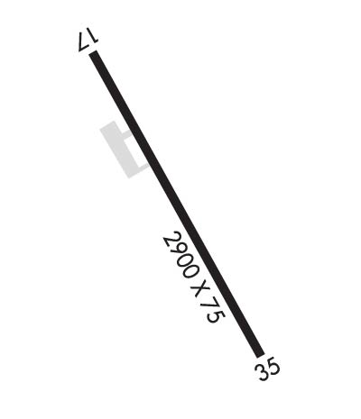
  • Runway Identifications
    Runway Identification: 17/35
    Length: 2797 ft
    Width: 75 ft
    Surface: ASPHALT-GOOD CONDITION
    Edge lights:

    Treatment: NONE

     Runway: 17   Runway: 35
    Mag heading: 166°Mag heading: 346°
    Rwy Slope: -.83% DownRwy Slope: .83% Up
    Approach: Approach:
    Pattern: Left TrafficPattern: Left Traffic
    Markings: BASICMarkings: BASIC
    Marking Condition: POOR; FADED.Marking Condition: POOR; FADED.
    Arresting Dev: Arresting Dev:
    Lat & Long: N4505.3  W07013.1Lat. & Long.: N4504.9  W07012.8
    Elev: 880.0 ft. MSLElev: 856.9 ft. MSL
    TCH: TCH:
    Visual Glide Path: Visual Glide Path:
    Displaced Threshold: NoDisplaced Threshold: 89 feet
    Touchdown Zone: YESTouchdown Zone: YES
    Touchdown Elev.: 880.0 feetTouchdown Elev.: 880.0 feet
    Visual Glide Slope: Visual Glide Slope:
    RVR Equipment: RVR Equipment:
    RVV Equipment: NORVV Equipment: NO
    Approach Lights: Approach Lights:
    REIL: NOREIL: NO
    Centerline Lights: NOCenterline Lights: NO
    Touchdown lights: NOTouchdown lights: NO
    Runway Category: Runway with a Visual ApproachRunway Category: Runway with a Visual Approach
    Declared Distances: Declared Distances:
    Obstructions: ROADObstructions: BLDG
    Marked: NOT Marked/LightedMarked: NOT Marked/Lighted
    Clearance slope: Clearance slope: 2:1
    Obstruction height: 10 feet AGLObstruction height: 53 feet AGL
    Dist. from runway: 200 feetDist. from runway: 316 feet
    Centerline offset: 85 left of centerlineCenterline offset: 160 feet right of centerline
    Comments: +10 FT ROADWAY 100-200 FT FM THR, 85-125 FT L OF CNTRLN.Comments:
    C:1/P: