| |||||||||||||||||||||||||||||||||||||||||||||||||||||||||||||||||||||
| |||||||||||||||||||||||||||||||||||||||||||||||||||||||||||||||||||||
| Rwy | Rwy | |||||||
| 3000x75 | 3000' | 3000x75 | 3000' | |||||
| Runway ID | Single Wheel | Double Wheel | Double Tandem Wheel | Dual Double Wheel |
| 06/24 | 25,000 | N/A | N/A | N/A |
| These numbers are Advisory and are not limits. The Airport Manager should have more accurate Weight Limits | ||||
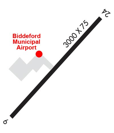 Airport Diagram might not be current. | |
| Facility Name: | BIDDEFORD MUNI |
| City Name: | BIDDEFORD |
| County: | YORK |
| State abbrev: | ME |
| State Name: | MAINE |
| Ownership: | PUBLICLY OWNED |
| Use: | OPEN TO THE PUBLIC |
| Owner's Name: | CITY OF BIDDEFORD |
| Address: | BOX 586 205 MAIN ST. |
| BIDDEFORD, ME 04005 | |
| Owner's Phone: | 207-284-9307 |
| Manager's Name: | JEFF DEMERS; PUB WORKS DEPT. |
| Address: | 371 HILL STREET |
| BIDDEFORD, ME 04005 | |
| Phone: | 207-282-1579 |
| FAA Region: | NEW ENGLAND |
| FAA Field Office: | NONE |
| Date | Sunrise | Sunset |
|---|---|---|
| 04/23/24 Tuesday | 5:45 | 19:35 |
| 04/24/24 Wednesday | 5:44 | 19:37 |
| 04/25/24 Thursday | 5:42 | 19:38 |
| 04/26/24 Friday | 5:41 | 19:39 |
| 04/27/24 Saturday | 5:39 | 19:40 |
| 04/28/24 Sunday | 5:38 | 19:41 |
| 04/29/24 Monday | 5:36 | 19:42 |
| 04/30/24 Tuesday | 5:35 | 19:44 |
| 05/01/24 Wednesday | 5:34 | 19:45 |
| 05/02/24 Thursday | 5:32 | 19:46 |
| 05/03/24 Friday | 5:31 | 19:47 |
| 05/04/24 Saturday | 5:30 | 19:48 |
| 05/05/24 Sunday | 5:28 | 19:49 |
| 05/06/24 Monday | 5:27 | 19:51 |
| Airport Attendance Schedule | SAT-SUN 0900-1600, MON-THUR 1000-1600 |
| Airport Status | OPERATIONAL (This Status can change at any time - please check NOTAMS) |
| Airport Lighting Schedule | ACTVT REIL RWY 06; PAPI RWY 06; MIRL RWY 06/24 - CTAF. |
| Airport Storage Available | Tie Downs, Hanger |
| Extra Services Available | Parachute Jumping |
| Wind Indicator | YES - (lighted) |
| Control Tower | NO |
| CTAF Frequency | 123.000 |
| Unicom Frequency | 123.000 |
| Rotating Beacon Color | WG |
| Segmented Circle | NO |
| Landing Fee | NO |
| Airport Inspected | STATE - performed by PRIVATE CONTRACT PERSONNEL |
| Inspection Date | 08/15/2023 |
| Type of Fuel Available | Grade 100LL; -1024 HR FUEL W/MAJOR CREDIT CARD - SELF SVC. |
| Airframe Repair Service | NONE |
| Power Plant Repair Service | NONE |
| Latitude | N4327.8 |
| Longitude | W07028.3 (ESTIMATED) |
| Arpt Elevation | 157ft (SURVEYED) |
| Magnetic Variation | 17W |
| 2 miles S | of BIDDEFORD |
| Traffic Pattern Altitude | 838 |
| Sectional Chart | NEW YORK |
| Operations (Reported) | Yearly | Avg. Daily |
|---|---|---|
| General Aviation Transient | 2600 | 7 |
| General Aviation Local | 12400 | 34 |
| Air Taxi | 0 | 0 |
| Commerical | 0 | 0 |
| Commuter | 0 | 0 |
| Military | 0 | 0 |
| Aircraft based on Field | |
|---|---|
| General Aviation Singles | 36 |
| General Aviation Multi | 1 |
| Jet Aircraft | 0 |
| General Aviation Helicopters | 0 |
| Military Aircraft | 0 |
| Gliders | 0 |
| Ultralights | 0 |
| FSS on field | NO |
| FSS tie-in | BANGOR |
| FSS Phone | 1-800-WX-BRIEF |
| Who issues Notams | BGR |
| Notam D service at airport | YES |
| ARTCC Name | BOSTON |
| Airport Certification | |
| Aircraft Rescue & Firefighting Index | None |
| Airport of Entry | No |
| Custom Landing Rights | No |
| Joint Civil/Military | No |
| Military Landing rights | YES |
| NATIONAL PLAN OF INTEGRATED AIRPORT SYSTEMS (NPIAS) |
| GRANT AGREEMENTS UNDER FAAP/ADAP/AIP |
| ASSURANCES PURSUANT TO TITLE VI, CIVIL RIGHTS ACT OF 1964 |
| THIS AIRPORT HAS BEEN SURVEYED BY THE NATIONAL GEODETIC SURVEY. |
| DEER & TURKEYS ON & INVOF ARPT. |
| NOISE ABATEMENT CTC AMGR FOR DTLS. |
| ULTRALIGHT & PRCHT ACT ON & INVOF ARPT. |
| FOR CD CTC PORTLAND APCH AT 207-874-7320, WHEN APCH CLSD CTC BOSTON ARTCC AT 603-879-6859. |
| BANNER TOWING AVBL. |
| RWY 24 CALM WIND RWY. |
Airport Communications & Frequencies:
| |||||||||||||||||
| Runway: 06 | Runway: 24 | ||
| Mag heading: | 58° | Mag heading: | 238° |
| Rwy Slope: | .28% Up | Rwy Slope: | -.28% Down |
| Approach: | Approach: | ||
| Pattern: | Left Traffic | Pattern: | Left Traffic |
| Markings: | NONPRECISION INSTRUMENT | Markings: | BASIC |
| Marking Condition: | GOOD | Marking Condition: | GOOD |
| Arresting Dev: | Arresting Dev: | ||
| Lat & Long: | N4327.7 W07028.6 | Lat. & Long.: | N4328.0 W07028.1 |
| Elev: | 146.5 ft. MSL | Elev: | 154.8 ft. MSL |
| TCH: | 31 ft. AGL | TCH: | |
| Visual Glide Path: | 3.50 degrees | Visual Glide Path: | |
| Displaced Threshold: | No | Displaced Threshold: | No |
| Touchdown Zone: | YES | Touchdown Zone: | YES |
| Touchdown Elev.: | 157.0 feet | Touchdown Elev.: | 157.0 feet |
| Visual Glide Slope: | 4-Light PAPI on LEFT side of Runway | Visual Glide Slope: | |
| RVR Equipment: | RVR Equipment: | ||
| RVV Equipment: | NO | RVV Equipment: | NO |
| Approach Lights: | Approach Lights: | ||
| REIL: | YES | REIL: | NO |
| Centerline Lights: | NO | Centerline Lights: | NO |
| Touchdown lights: | NO | Touchdown lights: | NO |
| Runway Category: | Runway with a Non-precision Approach | Runway Category: | Runway with a Visual Approach |
| Declared Distances: | Declared Distances: | ||
| Obstructions: | BRUSH | Obstructions: | BRUSH |
| Marked: | NOT Marked/Lighted | Marked: | NOT Marked/Lighted |
| Clearance slope: | 3:1 | Clearance slope: | 1:1 |
| Obstruction height: | 6 feet AGL | Obstruction height: | 3 feet AGL |
| Dist. from runway: | 220 feet | Dist. from runway: | 204 feet |
| Centerline offset: | 115 right of centerline | Centerline offset: | 130 feet right of centerline |
| Comments: | 7 FT BRUSH 78 FT FM THR, 151 FT R OF CNTRLN; 5 FT BRUSH 114 FT FM THR, 166 FT L OF CNTRLN. | Comments: | +6-8 FT BRUSH & ROCK LEDGE 10-55 FT FM THR, 228 FT R OF CNTRLN. |