| ||||||||||||||||||||||||||||||||||||||||||||||||||||||||||||||||||||
| ||||||||||||||||||||||||||||||||||||||||||||||||||||||||||||||||||||
| ||||||||||||||||||||||||||||||||||||||||||||||||||||||||||||||||||||
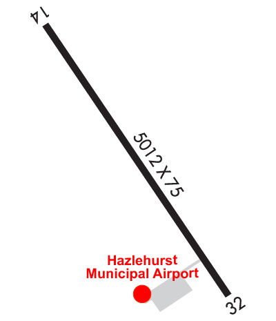
| Rwy | Rwy | |||||||
| 5012x75 | 5012' | 5012x75 | 5012' | |||||
| Runway ID | Single Wheel | Double Wheel | Double Tandem Wheel | Dual Double Wheel |
| 15/33 | 30,000 | N/A | N/A | N/A |
| These numbers are Advisory and are not limits. The Airport Manager should have more accurate Weight Limits | ||||
 Airport Diagram might not be current. | |
| Facility Name: | HAZLEHURST |
| City Name: | HAZLEHURST |
| County: | JEFF DAVIS |
| State abbrev: | GA |
| State Name: | GEORGIA |
| Ownership: | PUBLICLY OWNED |
| Use: | OPEN TO THE PUBLIC |
| Owner's Name: | CITY OF HAZLEHURST |
| Address: | 86 S CROMARTIE ST |
| HAZELHURST, GA 31539 | |
| Owner's Phone: | 912-347-8183 |
| Manager's Name: | CODY WHITE |
| Address: | 528 BURKETTS FERRY ROAD |
| HAZLEHURST, GA 31539 | |
| Phone: | 912-347-8183 |
| FAA Region: | SOUTHERN |
| FAA Field Office: | ATL |

| Date | Sunrise | Sunset |
|---|---|---|
| 04/24/24 Wednesday | 6:51 | 20:07 |
| 04/25/24 Thursday | 6:50 | 20:07 |
| 04/26/24 Friday | 6:49 | 20:08 |
| 04/27/24 Saturday | 6:48 | 20:09 |
| 04/28/24 Sunday | 6:47 | 20:09 |
| 04/29/24 Monday | 6:46 | 20:10 |
| 04/30/24 Tuesday | 6:45 | 20:11 |
| 05/01/24 Wednesday | 6:44 | 20:11 |
| 05/02/24 Thursday | 6:43 | 20:12 |
| 05/03/24 Friday | 6:42 | 20:13 |
| 05/04/24 Saturday | 6:41 | 20:14 |
| 05/05/24 Sunday | 6:41 | 20:14 |
| 05/06/24 Monday | 6:40 | 20:15 |
| 05/07/24 Tuesday | 6:39 | 20:16 |
| Airport Attendance Schedule | MON-FRI 0800-1700; ARPT PHONE AFTER HRS 912-347-8183. |
| Airport Status | OPERATIONAL (This Status can change at any time - please check NOTAMS) |
| Airport Lighting Schedule | ACTVT REIL RWY 14 & 32; PAPI RWY 32; MIRL RWY 14/32- CTAF. |
| Airport Storage Available | Tie Downs, Hanger |
| Extra Services Available | NONE |
| Wind Indicator | YES - (lighted) |
| Control Tower | NO |
| CTAF Frequency | 122.800 |
| Unicom Frequency | 122.800 |
| Rotating Beacon Color | WG |
| Segmented Circle | YES |
| Landing Fee | NO |
| Airport Inspected | STATE - performed by STATE AERONAUTICAL PERSONNEL |
| Inspection Date | 01/12/2023 |
| Type of Fuel Available | Grade 100LL, JET A; -10FUEL 24 HR CREDIT CARD SVC AVBL. |
| Airframe Repair Service | MINOR |
| Power Plant Repair Service | MINOR |
| Latitude | N3153.1 |
| Longitude | W08238.9 (ESTIMATED) |
| Arpt Elevation | 255ft (SURVEYED) |
| Magnetic Variation | 06W |
| 3 miles NW | of HAZLEHURST |
| Traffic Pattern Altitude | |
| Sectional Chart | JACKSONVILLE |
| Operations (Reported) | Yearly | Avg. Daily |
|---|---|---|
| General Aviation Transient | 4300 | 12 |
| General Aviation Local | 5000 | 14 |
| Air Taxi | 0 | 0 |
| Commerical | 0 | 0 |
| Commuter | 0 | 0 |
| Military | 80 | 0 |
| Aircraft based on Field | |
|---|---|
| General Aviation Singles | 14 |
| General Aviation Multi | 4 |
| Jet Aircraft | 1 |
| General Aviation Helicopters | 0 |
| Military Aircraft | 0 |
| Gliders | 0 |
| Ultralights | 0 |
| FSS on field | NO |
| FSS tie-in | MACON |
| FSS Phone | 1-800-WX-BRIEF |
| Who issues Notams | MCN |
| Notam D service at airport | YES |
| ARTCC Name | JACKSONVILLE |
| Airport Certification | |
| Aircraft Rescue & Firefighting Index | None |
| Airport of Entry | No |
| Custom Landing Rights | No |
| Joint Civil/Military | No |
| Military Landing rights | YES |
| NATIONAL PLAN OF INTEGRATED AIRPORT SYSTEMS (NPIAS) |
| ASSURANCES PURSUANT TO TITLE VI, CIVIL RIGHTS ACT OF 1964 |
| GRANT AGREEMENT HAS EXPIRED; HOWEVER, AGREEMENT REMAINS IN EFFECT FOR THIS FACILITY AS LONG AS IT IS PUBLIC USE. |
| DEER & WILDLIFE ON AND INVOF ARPT. |
| FOR CD CTC JACKSONVILLE ARTCC AT 904-845-1592. |
Airport Communications & Frequencies:
| |||||||||
| Runway: 15 | Runway: 33 | ||
| Mag heading: | 147° | Mag heading: | 327° |
| Rwy Slope: | .58% Up | Rwy Slope: | -.58% Down |
| Approach: | Approach: | ||
| Pattern: | Left Traffic | Pattern: | Left Traffic |
| Markings: | NONPRECISION INSTRUMENT | Markings: | NONPRECISION INSTRUMENT |
| Marking Condition: | GOOD | Marking Condition: | GOOD |
| Arresting Dev: | Arresting Dev: | ||
| Lat & Long: | N3153.4 W08239.2 | Lat. & Long.: | N3152.8 W08238.6 |
| Elev: | 221.0 ft. MSL | Elev: | 250.2 ft. MSL |
| TCH: | 26 ft. AGL | TCH: | 27 ft. AGL |
| Visual Glide Path: | 3.00 degrees | Visual Glide Path: | 3.00 degrees |
| Displaced Threshold: | No | Displaced Threshold: | No |
| Touchdown Zone: | YES | Touchdown Zone: | YES |
| Touchdown Elev.: | 255.2 feet | Touchdown Elev.: | 255.2 feet |
| Visual Glide Slope: | 2-Light PAPI on LEFT side of Runway | Visual Glide Slope: | 2-Light PAPI on LEFT side of Runway |
| RVR Equipment: | RVR Equipment: | ||
| RVV Equipment: | NO | RVV Equipment: | NO |
| Approach Lights: | Approach Lights: | ||
| REIL: | YES | REIL: | YES |
| Centerline Lights: | NO | Centerline Lights: | NO |
| Touchdown lights: | NO | Touchdown lights: | NO |
| Runway Category: | Runway with a Non-precision Approach having visibility minimums greater than 3/4 mile | Runway Category: | Runway with a Visual Approach |
| Declared Distances: | Declared Distances: | ||
| Obstructions: | Obstructions: | TREES | |
| Marked: | Marked: | NOT Marked/Lighted | |
| Clearance slope: | 50:1 | Clearance slope: | 45:1 |
| Obstruction height: | Obstruction height: | 25 feet AGL | |
| Dist. from runway: | Dist. from runway: | 1325 feet | |
| Centerline offset: | Centerline offset: | 277 feet right of centerline | |
| Comments: | Comments: |