| |||||||||||||||||||||||||||||||||||||||||||||||||||||||||||||
| |||||||||||||||||||||||||||||||||||||||||||||||||||||||||||||
| |||||||||||||||||||||||||||||||||||||||||||||||||||||||||||||
| Rwy | Rwy | |||||||
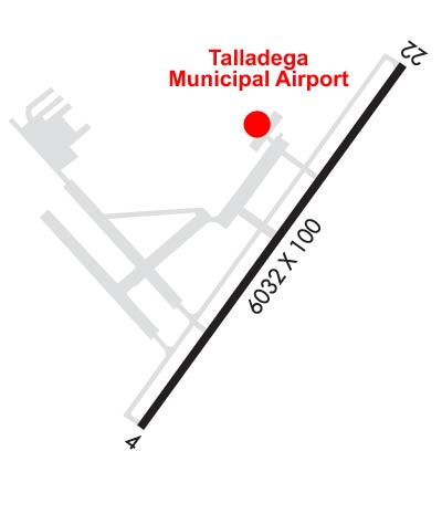
| 6032x100 | 6032' | 109.95 - 038° | 6032x100 | 6032' | ||||
| Runway ID | Single Wheel | Double Wheel | Double Tandem Wheel | Dual Double Wheel |
| 04/22 | 30,000 | 65,000 | 95,000 | N/A |
| These numbers are Advisory and are not limits. The Airport Manager should have more accurate Weight Limits | ||||
 Airport Diagram might not be current. | |
| Facility Name: | TALLADEGA MUNI |
| City Name: | TALLADEGA |
| County: | TALLADEGA |
| State abbrev: | AL |
| State Name: | ALABAMA |
| Ownership: | PUBLICLY OWNED |
| Use: | OPEN TO THE PUBLIC |
| Owner's Name: | CITY OF TALLADEGA |
| Address: | 255 SOUTH ST. WEST, P.O. BOX 498 |
| TALLADEGA, AL 35160 | |
| Owner's Phone: | 256-362-8775 |
| Manager's Name: | JIM BROCK |
| Address: | 566 AIRPORT DRIVE |
| LINCOLN, AL, AL 35096 | |
| Phone: | 256-761-4815 |
| FAA Region: | SOUTHERN |
| FAA Field Office: | JAN |
| Date | Sunrise | Sunset |
|---|---|---|
| 04/18/24 Thursday | 6:09 | 19:18 |
| 04/19/24 Friday | 6:08 | 19:19 |
| 04/20/24 Saturday | 6:07 | 19:20 |
| 04/21/24 Sunday | 6:06 | 19:20 |
| 04/22/24 Monday | 6:05 | 19:21 |
| 04/23/24 Tuesday | 6:03 | 19:22 |
| 04/24/24 Wednesday | 6:02 | 19:23 |
| 04/25/24 Thursday | 6:01 | 19:23 |
| 04/26/24 Friday | 6:00 | 19:24 |
| 04/27/24 Saturday | 5:59 | 19:25 |
| 04/28/24 Sunday | 5:58 | 19:26 |
| 04/29/24 Monday | 5:57 | 19:26 |
| 04/30/24 Tuesday | 5:56 | 19:27 |
| 05/01/24 Wednesday | 5:55 | 19:28 |
| Airport Attendance Schedule | MON-FRI 0800-1600; FBO ATTENDED MON-FRI 0800-1600. |
| Airport Status | OPERATIONAL (This Status can change at any time - please check NOTAMS) |
| Airport Lighting Schedule | ACTVT REIL RWY 04; HIRL RWY 04/22; TWY LGTS - CTAF. PAPI RWY 04 & 22 OPR CONSLY. |
| Airport Storage Available | Tie Downs |
| Extra Services Available | NONE |
| Wind Indicator | YES - (lighted) |
| Control Tower | NO |
| CTAF Frequency | 122.800 |
| Unicom Frequency | 122.800 |
| Rotating Beacon Color | WG |
| Segmented Circle | YES |
| Landing Fee | NO |
| Airport Inspected | FEDERAL - performed by STATE AERONAUTICAL PERSONNEL |
| Inspection Date | 07/31/2023 |
| Type of Fuel Available | Grade 100LL, JET A (freeze point -40C), JET A |
| Airframe Repair Service | MINOR |
| Power Plant Repair Service | MINOR |
| Latitude | N3334.2 |
| Longitude | W08603.1 (ESTIMATED) |
| Arpt Elevation | 528ft (SURVEYED) |
| Magnetic Variation | 03W |
| 8 miles NE | of TALLADEGA |
| Traffic Pattern Altitude | |
| Sectional Chart | ATLANTA |
| Operations (Reported) | Yearly | Avg. Daily |
|---|---|---|
| General Aviation Transient | 36500 | 100 |
| General Aviation Local | 1170 | 3 |
| Air Taxi | 630 | 2 |
| Commerical | 0 | 0 |
| Commuter | 0 | 0 |
| Military | 2700 | 7 |
| Aircraft based on Field | |
|---|---|
| General Aviation Singles | 32 |
| General Aviation Multi | 4 |
| Jet Aircraft | 2 |
| General Aviation Helicopters | 1 |
| Military Aircraft | 0 |
| Gliders | 0 |
| Ultralights | 1 |
| FSS on field | NO |
| FSS tie-in | ANNISTON |
| FSS Phone | 1-800-WX-BRIEF |
| Who issues Notams | ANB |
| Notam D service at airport | YES |
| ARTCC Name | ATLANTA |
| Airport Certification | CLSD TO ACFT OPS WITH MORE THAN 30 PSGR SEATS EXCP PPR CALL AMGR (256) 761-4815. |
| Aircraft Rescue & Firefighting Index | None |
| Airport of Entry | No |
| Custom Landing Rights | No |
| Joint Civil/Military | No |
| Military Landing rights | YES |
| NATIONAL PLAN OF INTEGRATED AIRPORT SYSTEMS (NPIAS) |
| GRANT AGREEMENTS UNDER FAAP/ADAP/AIP |
| SURPLUS PROPERTY AGREEMENT UNDER PUBLIC LAW 289 |
| ASSURANCES PURSUANT TO TITLE VI, CIVIL RIGHTS ACT OF 1964 |
| TMPRY ATCT BY NOTAM FOR SPECIAL EVENTS. |
| DEER ON & INVOF ARPT. |
| AFT HR SVC CALL 205-369-4941. |
| FOR CD CTC BIRMINGHAM APCH AT 205-769-3890. |
Airport Communications & Frequencies:
| ||||||||||||||
| Runway: 04 | Runway: 22 | ||
| Mag heading: | 38° | Mag heading: | 218° |
| Rwy Slope: | .31% Up | Rwy Slope: | -.31% Down |
| Approach: | ILS/DME | Approach: | |
| Pattern: | Right Traffic | Pattern: | Left Traffic |
| Markings: | PRECISION INSTRUMENT | Markings: | PRECISION INSTRUMENT |
| Marking Condition: | POOR; MARKINGS POOR DUE TO FADING. | Marking Condition: | POOR; MARKINGS POOR DUE TO FADING. |
| Arresting Dev: | Arresting Dev: | ||
| Lat & Long: | N3333.8 W08603.4 | Lat. & Long.: | N3334.6 W08602.7 |
| Elev: | 509.2 ft. MSL | Elev: | 528.2 ft. MSL |
| TCH: | 65 ft. AGL | TCH: | 45 ft. AGL |
| Visual Glide Path: | 3.00 degrees | Visual Glide Path: | 3.00 degrees |
| Displaced Threshold: | No | Displaced Threshold: | No |
| Touchdown Zone: | YES | Touchdown Zone: | YES |
| Touchdown Elev.: | 510.8 feet | Touchdown Elev.: | 528.8 feet |
| Visual Glide Slope: | 4-Light PAPI on LEFT side of Runway | Visual Glide Slope: | 4-Light PAPI on LEFT side of Runway |
| RVR Equipment: | RVR Equipment: | ||
| RVV Equipment: | NO | RVV Equipment: | NO |
| Approach Lights: | Approach Lights: | ||
| REIL: | YES | REIL: | NO |
| Centerline Lights: | NO | Centerline Lights: | NO |
| Touchdown lights: | NO | Touchdown lights: | NO |
| Runway Category: | Precision Instrument Runway | Runway Category: | Runway with a Non-precision Approach having visibility minimums greater than 3/4 mile |
| Declared Distances: | Declared Distances: | ||
| Obstructions: | TREES | Obstructions: | TREES |
| Marked: | NOT Marked/Lighted | Marked: | NOT Marked/Lighted |
| Clearance slope: | 8:1 | Clearance slope: | 18:1 |
| Obstruction height: | 72 feet AGL | Obstruction height: | 71 feet AGL |
| Dist. from runway: | 787 feet | Dist. from runway: | 1482 feet |
| Centerline offset: | 566 right of centerline | Centerline offset: | 367 feet right of centerline |
| Comments: | Comments: |