| ||||||||||||||||||||||||||||||||||||||||||||||||||||||||||||||||||||
| ||||||||||||||||||||||||||||||||||||||||||||||||||||||||||||||||||||
| ||||||||||||||||||||||||||||||||||||||||||||||||||||||||||||||||||||
| Rwy | Rwy | |||||||
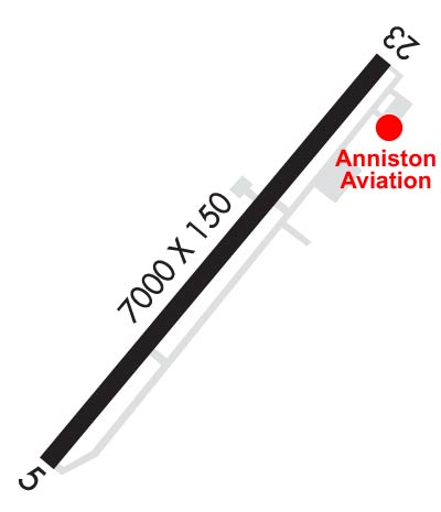
| 7000x150 | 7000' | 111.50 - 052° | 7000x150 | 7000' | ||||
| Runway ID | Single Wheel | Double Wheel | Double Tandem Wheel | Dual Double Wheel |
| 05/23 | 28,000 | 43,500 | 260,000 | N/A |
| These numbers are Advisory and are not limits. The Airport Manager should have more accurate Weight Limits | ||||
 Airport Diagram might not be current. | |
| Facility Name: | ANNISTON RGNL |
| City Name: | ANNISTON |
| County: | CALHOUN |
| State abbrev: | AL |
| State Name: | ALABAMA |
| Ownership: | PUBLICLY OWNED |
| Use: | OPEN TO THE PUBLIC |
| Owner's Name: | CITY OF ANNISTON |
| Address: | P.O. BOX 2185 |
| ANNISTON, AL 36202 | |
| Owner's Phone: | 256-831-4410 |
| Manager's Name: | DAVID ARNETT |
| Address: | BOX 2168 |
| ANNISTON, AL 36202 | |
| Phone: | (256) 241-7171 |
| FAA Region: | SOUTHERN |
| FAA Field Office: | JAN |
| Date | Sunrise | Sunset |
|---|---|---|
| 04/25/24 Thursday | 6:00 | 19:23 |
| 04/26/24 Friday | 5:59 | 19:23 |
| 04/27/24 Saturday | 5:58 | 19:24 |
| 04/28/24 Sunday | 5:57 | 19:25 |
| 04/29/24 Monday | 5:56 | 19:26 |
| 04/30/24 Tuesday | 5:55 | 19:26 |
| 05/01/24 Wednesday | 5:54 | 19:27 |
| 05/02/24 Thursday | 5:53 | 19:28 |
| 05/03/24 Friday | 5:52 | 19:29 |
| 05/04/24 Saturday | 5:51 | 19:29 |
| 05/05/24 Sunday | 5:50 | 19:30 |
| 05/06/24 Monday | 5:49 | 19:31 |
| 05/07/24 Tuesday | 5:49 | 19:32 |
| 05/08/24 Wednesday | 5:48 | 19:32 |
| Airport Attendance Schedule | MON-FRI 0700-1800, SAT-SUN 0800-1700; FBO SVC - 256-831-4410. |
| Airport Status | OPERATIONAL (This Status can change at any time - please check NOTAMS) |
| Airport Lighting Schedule | ACTVT MALSR RWY 05; REIL RWY 23; PAPI RWY 05 & 23, HIRL RWY 05/23 - CTAF. |
| Airport Storage Available | Tie Downs, Hanger |
| Extra Services Available | Avionics |
| Wind Indicator | YES - (lighted) |
| Control Tower | NO |
| CTAF Frequency | 123.600 |
| Unicom Frequency | 123.000 |
| Rotating Beacon Color | WG |
| Segmented Circle | YES |
| Landing Fee | NO |
| Airport Inspected | FEDERAL - performed by FAA AIRPORTS FIELD PERSONNEL |
| Inspection Date | 03/13/2020 |
| Type of Fuel Available | Grade 100LL, JET A (freeze point -40C); -10AFT HR FUEL - 256-831-4410; SVC FEE 1800-0730. |
| Airframe Repair Service | MAJOR |
| Power Plant Repair Service | MAJOR |
| Latitude | N3335.3 |
| Longitude | W08551.5 (ESTIMATED) |
| Arpt Elevation | 612ft (SURVEYED) |
| Magnetic Variation | 04W |
| 5 miles SW | of ANNISTON |
| Traffic Pattern Altitude | |
| Sectional Chart | ATLANTA |
| Operations (Reported) | Yearly | Avg. Daily |
|---|---|---|
| General Aviation Transient | 15221 | 42 |
| General Aviation Local | 2331 | 6 |
| Air Taxi | 4812 | 13 |
| Commerical | 6 | 0 |
| Commuter | 0 | 0 |
| Military | 762 | 2 |
| Aircraft based on Field | |
|---|---|
| General Aviation Singles | 19 |
| General Aviation Multi | 5 |
| Jet Aircraft | 2 |
| General Aviation Helicopters | 0 |
| Military Aircraft | 0 |
| Gliders | 0 |
| Ultralights | 0 |
| FSS on field | NO |
| FSS tie-in | ANNISTON |
| FSS Phone | 1-800-WX-BRIEF |
| Who issues Notams | ANB |
| Notam D service at airport | YES |
| ARTCC Name | ATLANTA |
| Airport Certification | CLSD TO SKED ACR OPS WITH MORE THAN 9 PAX SEATS & UNSKED ACR OPS WITH MORE THAN 30 PAX SEATS. |
| Aircraft Rescue & Firefighting Index | None |
| Airport of Entry | No |
| Custom Landing Rights | No |
| Joint Civil/Military | No |
| Military Landing rights | YES |
| NATIONAL PLAN OF INTEGRATED AIRPORT SYSTEMS (NPIAS) |
| GRANT AGREEMENTS UNDER FAAP/ADAP/AIP |
| ASSURANCES PURSUANT TO TITLE VI, CIVIL RIGHTS ACT OF 1964 |
| THIS AIRPORT HAS BEEN SURVEYED BY THE NATIONAL GEODETIC SURVEY. |
| BIRDS ON AND INVOF RWY. |
| FOR CD CTC BIRMINGHAM APCH AT 205-769-3890. |
Airport Communications & Frequencies:
| ||||||||||||||
| Runway: 05 | Runway: 23 | ||
| Mag heading: | 52° | Mag heading: | 232° |
| Rwy Slope: | .25% Up | Rwy Slope: | -.25% Down |
| Approach: | ILS | Approach: | |
| Pattern: | Right Traffic | Pattern: | Left Traffic |
| Markings: | PRECISION INSTRUMENT | Markings: | NONPRECISION INSTRUMENT |
| Marking Condition: | GOOD | Marking Condition: | GOOD |
| Arresting Dev: | Arresting Dev: | ||
| Lat & Long: | N3334.9 W08552.0 | Lat. & Long.: | N3335.7 W08551.0 |
| Elev: | 594.7 ft. MSL | Elev: | 612.0 ft. MSL |
| TCH: | 40 ft. AGL | TCH: | 39 ft. AGL |
| Visual Glide Path: | 3.00 degrees | Visual Glide Path: | 3.00 degrees |
| Displaced Threshold: | No | Displaced Threshold: | No |
| Touchdown Zone: | YES | Touchdown Zone: | YES |
| Touchdown Elev.: | 595.1 feet | Touchdown Elev.: | 612.0 feet |
| Visual Glide Slope: | 4-Light PAPI on LEFT side of Runway | Visual Glide Slope: | 4-Light PAPI on LEFT side of Runway |
| RVR Equipment: | RVR Equipment: | ||
| RVV Equipment: | NO | RVV Equipment: | NO |
| Approach Lights: | MALSR - 1,400 foot medium intensity approach lighting system with runway alignment indicator lights | Approach Lights: | |
| REIL: | NO | REIL: | YES |
| Centerline Lights: | NO | Centerline Lights: | NO |
| Touchdown lights: | NO | Touchdown lights: | NO |
| Runway Category: | Precision Instrument Runway | Runway Category: | Runway with a Non-precision Approach having visibility minimums greater than 3/4 mile |
| Declared Distances: | Declared Distances: | ||
| Obstructions: | Obstructions: | TREES | |
| Marked: | Marked: | NOT Marked/Lighted | |
| Clearance slope: | 50:1 | Clearance slope: | 25:1 |
| Obstruction height: | Obstruction height: | 40 feet AGL | |
| Dist. from runway: | Dist. from runway: | 2180 feet | |
| Centerline offset: | Centerline offset: | 75 feet left of centerline | |
| Comments: | Comments: |