Click here for more info on on SMS!

KAMG

BACON COUNTY
ALMA
GA
Time Zone: Eastern
Lat: N 3132.2
Long: W 08230.4
Elev: 200
Var: +06
Longest Runway: 5000
AWOS: 118.32
CTAF: 122.7

FBO & Flight Services info for KAMG

FBOs: Update your Fuel Prices
Providing high quality fuel and services to you and your customers, from Phillips 66 Aviation.
Ph: 912-632-7915 Fax: 912-632-8365 Freq: 122.7WebsiteE-Mail
Service
Jet
100LL
SAF
MoGas
Fuel Avail: ~~
Full        Last Update: 04/18/2024 05:44:55

Self        
Misc. Info: Address: 142 AIRPORT LOOP,   ALMA, GA 31510

ASOSPh: 912-632-8738
-
Freq: 118.32  
If you are an FBO, call 1-203-262-1700 to update your info or email: FltPlan.Advertising@garmin.com
Advertise your FBO on FltPlan.com

Runway & Approach Info for KAMG
Rwy
Length
Land Dist**
Approach*
  Rwy
Length
Land Dist**
Approach*
16
5000x100  5000'          
 
  
34
  5000x100  5000'          
 
 * only ILS, LOC, LDA, and SDF approaches to a specific runway are shown
** For any Declared Landing Distance Available, please see A/FD or Approach plates
Runway Weight Capability (lbs.) Help
Runway IDSingle WheelDouble WheelDouble Tandem WheelDual Double Wheel
16/3430,000N/AN/AN/A
These numbers are Advisory and are not limits.   The Airport Manager should have more accurate Weight Limits
Approach Charts
Approaches    
Current Weather/Notams
Customs Information Send updates to Support@FltPlan.com
Customs Not Available
Database effective 04/18/2024
Airport Diagram of KAMG
Airport Diagram might not be current.

Facility Name: BACON COUNTY
City Name: ALMA
County: BACON
State abbrev: GA
State Name: GEORGIA
   
Ownership: PUBLICLY OWNED
Use: OPEN TO THE PUBLIC
Owner's Name: BACON COUNTY
Address: BACON COUNTY COURTHOUSE, 302 WEST 12TH STREET
 ALMA, GA 31510
Owner's Phone: 912-632-5214
  
Manager's Name: CARL LEGGETT
Address: P.O. BOX 356
 ALMA, GA 31510
Phone: 912-282-4887
   
FAA Region: SOUTHERN
FAA Field Office: ATL


Sunrise / Sunset times for BACON COUNTY

DateSunriseSunset
04/17/24 Wednesday6:5920:01
04/18/24 Thursday6:5720:01
04/19/24 Friday6:5620:02
04/20/24 Saturday6:5520:03
04/21/24 Sunday6:5420:03
04/22/24 Monday6:5320:04
04/23/24 Tuesday6:5220:05
04/24/24 Wednesday6:5120:06
04/25/24 Thursday6:5020:06
04/26/24 Friday6:4920:07
04/27/24 Saturday6:4820:08
04/28/24 Sunday6:4720:08
04/29/24 Monday6:4620:09
04/30/24 Tuesday6:4520:10

Airport Facilities

Airport Attendance ScheduleUNATTENDED
Airport Status OPERATIONAL (This Status can change at any time - please check NOTAMS)
Airport Lighting ScheduleACTVT REIL RWY 16 & 34; PAPI RWY 16 & 34; MIRL RWY 16/34 - CTAF.
Airport Storage AvailableTie Downs
Extra Services AvailableNONE
Wind IndicatorYES - (lighted)
Control TowerNO
CTAF Frequency122.700
Unicom Frequency122.700
Rotating Beacon ColorWG
Segmented CircleYES
Landing FeeNO

Airport Inspection Data

Airport InspectedSTATE - performed by STATE AERONAUTICAL PERSONNEL
Inspection Date05/10/2023

Airport Services

Type of Fuel AvailableGrade 100LL, JET A
Airframe Repair ServiceMINOR
Power Plant Repair ServiceMINOR

Geographic Data

LatitudeN3132.2
LongitudeW08230.4 (ESTIMATED)
Arpt Elevation199ft (SURVEYED)
Magnetic Variation06W
3 miles Wof ALMA
Traffic Pattern Altitude
Sectional ChartJACKSONVILLE

Aircraft Data

Operations (Reported)YearlyAvg. Daily
General Aviation Transient 400011
General Aviation Local 20005
Air Taxi 00
Commerical 00
Commuter 00
Military 00
Aircraft based on Field
General Aviation Singles 7
General Aviation Multi 2
Jet Aircraft 0
General Aviation Helicopters 0
Military Aircraft 0
Gliders 0
Ultralights 0

FAA Services

FSS on field NO
FSS tie-in MACON
FSS Phone 1-800-WX-BRIEF
Who issues Notams AMG
Notam D service at airport YES
ARTCC Name JACKSONVILLE

Federal Status

Airport Certification
Aircraft Rescue & Firefighting IndexNone
Airport of EntryNo
Custom Landing RightsNo
Joint Civil/MilitaryNo
Military Landing rightsYES

Federal Agreements

NATIONAL PLAN OF INTEGRATED AIRPORT SYSTEMS (NPIAS)
GRANT AGREEMENTS UNDER FAAP/ADAP/AIP
ASSURANCES PURSUANT TO TITLE VI, CIVIL RIGHTS ACT OF 1964

Remarks

FOR CD IF UNA TO CTC ON FSS FREQ, CTC JACKSONVILLE ARTCC AT 904-845-1592.
Airport Communications & Frequencies:
CTAF Frequency:
122.700
Unicom Frequency:
122.700
Remarks
  • APCH/DEP SVC PRVDD BY JACKSONVILLE ARTCC ON FREQS 127.575/269.025 (ALMA RCAG).
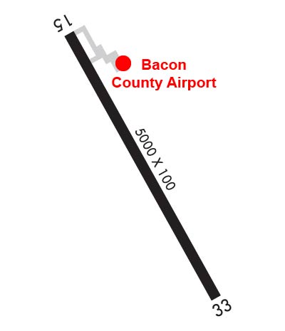
  • Runway Identifications
    Runway Identification: 16/34
    Length: 5000 ft
    Width: 100 ft
    Surface: ASPHALT
    Edge lights: Medium Intensity

    Treatment: NONE

     Runway: 16   Runway: 34
    Mag heading: 157°Mag heading: 337°
    Rwy Slope: -.19% DownRwy Slope: .19% Up
    Approach: Approach:
    Pattern: Left TrafficPattern: Left Traffic
    Markings: NONPRECISION INSTRUMENTMarkings: NONPRECISION INSTRUMENT
    Marking Condition: GOODMarking Condition: GOOD
    Arresting Dev: Arresting Dev:
    Lat & Long: N3132.5  W08230.6Lat. & Long.: N3131.8  W08230.2
    Elev: 199.8 ft. MSLElev: 190.2 ft. MSL
    TCH: 40 ft. AGLTCH: 30 ft. AGL
    Visual Glide Path: 3.00 degreesVisual Glide Path: 3.00 degrees
    Displaced Threshold: NoDisplaced Threshold: No
    Touchdown Zone: YESTouchdown Zone: YES
    Touchdown Elev.: 199.8 feetTouchdown Elev.: 195.9 feet
    Visual Glide Slope: 2-Light PAPI on LEFT side of RunwayVisual Glide Slope: 2-Light PAPI on LEFT side of Runway; PAPI RWY 34 UNUSBL 5 DEG LEFT OF RCL.
    RVR Equipment: RVR Equipment:
    RVV Equipment: NORVV Equipment: NO
    Approach Lights: Approach Lights:
    REIL: YESREIL: YES
    Centerline Lights: NOCenterline Lights: NO
    Touchdown lights: NOTouchdown lights: NO
    Runway Category: DRunway Category: D
    Declared Distances: Declared Distances:
    Obstructions: TREESObstructions: TREES
    Marked: NOT Marked/LightedMarked: NOT Marked/Lighted
    Clearance slope: CTLNG OBSTN EXCEEDS A 45 DEG SLP.Clearance slope:
    Obstruction height: 34 feet AGLObstruction height: 27 feet AGL
    Dist. from runway: 201 feetDist. from runway: 223 feet
    Centerline offset: 375 right of centerlineCenterline offset: 316 feet right of centerline
    Comments: 25 FT TREES, 301 FT RIGHT, BETWEEN EOR AND 200 FT FROM EOR.Comments: 30 FT - 70 FT TREES 300 FT LEFT AND RIGHT, FROM EOR TO 200 FT EOR.
    C:3/P: