Current Weather/Notams (Metars, TAFs, Notams, NWS Forecast, PIREPS, and nearby weather)
Customs Information Send updates to Support@FltPlan.com
Customs Not Available
Database effective 04/18/2024
Airport Diagram might not be current.
|
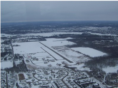
| Facility Name: | PRICES |
| City Name: | LINDEN |
| County: | GENESEE |
| State abbrev: | MI |
| State Name: | MICHIGAN |
| | |
| Ownership: | PUBLICLY OWNED |
| Use: | OPEN TO THE PUBLIC |
| Owner's Name: | STATE OF MICHIGAN - AERONAUTICS |
| Address: | 2700 PORT LANSING RD |
| | LANSING, MI 48906-2160 |
| Owner's Phone: | 517-335-9568 |
| | |
| Manager's Name: | CODY WELCH |
| Address: | 15057 LINDBERGH CT |
| | LINDEN, MI 48451-9054 |
| Phone: | 586-946-5381 |
| | |
| FAA Region: | GREAT LAKES |
| FAA Field Office: | DET |
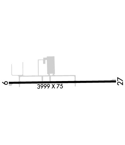
Runway Identifications
Runway Identification: 09/27Length: 3999 ft
Width: 75 ft
Surface: ASPHALT-FAIR CONDITION
Edge lights: Medium IntensityTreatment: NONE
| | Runway: 09 | | Runway: 27 |
| Mag heading: | 95° | Mag heading: | 275° |
| Rwy Slope: | -.34% Down | Rwy Slope: | .34% Up |
| Approach: | | Approach: | |
| Pattern: | Left Traffic | Pattern: | Left Traffic |
| Markings: | NONPRECISION INSTRUMENT | Markings: | NONPRECISION INSTRUMENT |
| Marking Condition: | FAIR | Marking Condition: | FAIR |
| Arresting Dev: | | Arresting Dev: | |
| Lat & Long: | N4248.5 W08346.6 | Lat. & Long.: | N4248.5 W08345.7 |
| Elev: | 919.4 ft. MSL | Elev: | 905.7 ft. MSL |
| TCH: | | TCH: | |
| Visual Glide Path: | | Visual Glide Path: | |
| Displaced Threshold: | 267 feet | Displaced Threshold: | 800 feet |
| Touchdown Zone: | YES | Touchdown Zone: | YES |
| Touchdown Elev.: | 919.0 feet | Touchdown Elev.: | 919.0 feet |
| Visual Glide Slope: | | Visual Glide Slope: | |
| RVR Equipment: | | RVR Equipment: | |
| RVV Equipment: | NO | RVV Equipment: | NO |
| Approach Lights: | | Approach Lights: | |
| REIL: | YES | REIL: | NO |
| Centerline Lights: | NO | Centerline Lights: | NO |
| Touchdown lights: | NO | Touchdown lights: | NO |
| Runway Category: | Runway with a Non-precision Approach | Runway Category: | Runway with a Non-precision Approach |
| Declared Distances: | | Declared Distances: | |
| Obstructions: | TREES | Obstructions: | TREES |
| Marked: | NOT Marked/Lighted | Marked: | NOT Marked/Lighted |
| Clearance slope: | 7:1; APCH RATIO 24:1 TO DTHR OVR +28 FT TREE, 690 FT DIST. | Clearance slope: | 4:1; APCH RATIO 25:1 TO DTHR OVR +54 FT TREE, 1346 FT DIST. |
| Obstruction height: | 28 feet AGL | Obstruction height: | 35 feet AGL |
| Dist. from runway: | 423 feet | Dist. from runway: | 351 feet |
| Centerline offset: | 250 right of centerline | Centerline offset: | 100 feet left of centerline |
| Comments: | -7 FT POND, 140 FT DIST. | Comments: | |