Click here for more info on on SMS!

K9F9

SYCAMORE STRIP
FORT WORTH
TX
Time Zone: Central
Lat: N 3237.6
Long: W 09721.2
Elev: 762
Var: -07
Longest Runway: 3375
CTAF: 122.8

FBO & Flight Services info for K9F9

FBOs: Update your Fuel Prices

A & W AIRCRAFTPh: 817-293-0510
-
Freq: 122.8
Service
Jet
100LL
SAF
MoGas
Fuel Avail: 9AM to 4PM daily
Full  6.00    Caution: Fuel prices have not been updated in 46 days.
Last Update: 03/08/2024 11:17

Self        
 Address: 2300 CUMMINGHAM ST   FORTH WORTH, TX 76134
If you are an FBO, call 1-203-262-1700 to update your info or email: FltPlan.Advertising@garmin.com
Advertise your FBO on FltPlan.com

Runway & Approach Info for K9F9
Rwy
Length
Land Dist**
Approach*
  Rwy
Length
Land Dist**
Approach*
17
3375x30  3375'          
 
  
35
  3375x30  3200'          
 
 * only ILS, LOC, LDA, and SDF approaches to a specific runway are shown
** For any Declared Landing Distance Available, please see A/FD or Approach plates
Runway Weight Capability (lbs.) Help
Runway IDSingle WheelDouble WheelDouble Tandem WheelDual Double Wheel
17/35N/AN/AN/AN/A
These numbers are Advisory and are not limits.   The Airport Manager should have more accurate Weight Limits
Approach Charts
FltPlan does not have IFR approach charts available for K9F9.
Current Weather/Notams
Customs Information Send updates to Support@FltPlan.com
Customs Not Available
Database effective 05/16/2024
Airport Diagram of K9F9
Airport Diagram might not be current.

Facility Name: SYCAMORE STRIP
City Name: FORT WORTH
County: TARRANT
State abbrev: TX
State Name: TEXAS
   
Ownership: PRIVATELY OWNED
Use: OPEN TO THE PUBLIC
Owner's Name: CONNIE AND RON GYURE
Address: 2300 CUMMINGHAM STREET
 FORT WORTH, TX 76134
Owner's Phone: 817-293-0510
  
Manager's Name: CONNIE AND RON GYURE
Address: 2300 CUNNINGHAM ST
 FORT WORTH, TX 76134
Phone: 817-293-0510
   
FAA Region: SOUTHWEST
FAA Field Office: TEX


Sunrise / Sunset times for SYCAMORE STRIP

DateSunriseSunset
04/22/24 Monday6:5120:05
04/23/24 Tuesday6:5020:06
04/24/24 Wednesday6:4920:06
04/25/24 Thursday6:4820:07
04/26/24 Friday6:4720:08
04/27/24 Saturday6:4620:09
04/28/24 Sunday6:4520:09
04/29/24 Monday6:4420:10
04/30/24 Tuesday6:4320:11
05/01/24 Wednesday6:4220:12
05/02/24 Thursday6:4120:12
05/03/24 Friday6:4020:13
05/04/24 Saturday6:3920:14
05/05/24 Sunday6:3820:14

Airport Facilities

Airport Attendance Schedule7 Days A Week 0900-1700
Airport Status OPERATIONAL (This Status can change at any time - please check NOTAMS)
Airport Lighting ScheduleLIRL RWY 17/35 CALL AHEAD, 817-293-0510 M-F 09:00-17:00.
Airport Storage AvailableTie Downs
Extra Services AvailableFlight Instruction, Aircraft Rental
Wind IndicatorYES - (unlit)
Control TowerNO
CTAF Frequency122.800
Unicom Frequency122.800
Rotating Beacon Color
Segmented CircleYES
Landing FeeYES; LNDG FEE FOR ALL TSNT ACFT.

Airport Inspection Data

Airport InspectedSTATE - performed by PRIVATE CONTRACT PERSONNEL
Inspection Date09/24/2022

Airport Services

Type of Fuel AvailableGrade 100LL
Airframe Repair ServiceMINOR
Power Plant Repair ServiceMINOR

Geographic Data

LatitudeN3237.6
LongitudeW09721.2 (ESTIMATED)
Arpt Elevation762ft (ESTIMATED)
Magnetic Variation07E
8 miles Sof FORT WORTH
Traffic Pattern Altitude800
Sectional ChartDALLAS-FT WORTH

Aircraft Data

Operations (Reported)YearlyAvg. Daily
General Aviation Transient 200
General Aviation Local 9002
Air Taxi 00
Commerical 00
Commuter 00
Military 00
Aircraft based on Field
General Aviation Singles 22
General Aviation Multi 3
Jet Aircraft 0
General Aviation Helicopters 0
Military Aircraft 0
Gliders 0
Ultralights 0

FAA Services

FSS on field NO
FSS tie-in FORT WORTH
FSS Phone 1-800-WX-BRIEF
Who issues Notams FTW
Notam D service at airport YES
ARTCC Name FORT WORTH

Federal Status

Airport Certification
Aircraft Rescue & Firefighting IndexNone
Airport of EntryNo
Custom Landing RightsNo
Joint Civil/MilitaryNo
Military Landing rightsNo

Remarks

RWY 17/35 7 FT WALL 76 FT EAST OF CNTRLN PARALLEL TO RWY 730 FT N END OF RWY.
ARPT CLSD TO TSNT ACFT EXCP 2 HRS PPR CALL 817-293-0510.
FOR CD CTC REGIONAL APCH AT 972-615-2799.
WINDSOCK MAY BE UNREL DUE TO PROXIMITY OF TREES.
RWY 17/3 5 NSTD LIRL - SINGLE WHITE THR LGT EACH SIDE, NSTD 15 FT FM RWY EDGE. 2766 FT USBL AT NGT. RWY 35 THR 609 FT AT NGT.
Runway Identifications
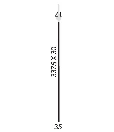
Runway Identification: 17/35
Length: 3375 ft
Width: 30 ft
Surface: CONCRETE
Edge lights: Non-Standard Lighting System

Treatment: NONE

 Runway: 17   Runway: 35
Mag heading: 175°Mag heading: 355°
Rwy Slope: .06% UpRwy Slope: -.06% Down
Approach: Approach:
Pattern: Right TrafficPattern: Left Traffic
Markings: BASICMarkings: BASIC
Marking Condition: FAIRMarking Condition: FAIR
Arresting Dev: Arresting Dev:
Lat & Long: N3237.9  W09721.2Lat. & Long.: N3237.3  W09721.3
Elev: 760.0 ft. MSLElev: 762.0 ft. MSL
TCH: TCH:
Visual Glide Path: Visual Glide Path:
Displaced Threshold: NoDisplaced Threshold: 175 feet
Touchdown Zone: NOTouchdown Zone: NO
Touchdown Elev.: Touchdown Elev.:
Visual Glide Slope: Visual Glide Slope:
RVR Equipment: RVR Equipment:
RVV Equipment: NORVV Equipment: NO
Approach Lights: Approach Lights:
REIL: NOREIL: NO
Centerline Lights: NOCenterline Lights: NO
Touchdown lights: NOTouchdown lights: NO
Runway Category: Runway with a Visual ApproachRunway Category: Runway with a Visual Approach
Declared Distances: Declared Distances:
Obstructions: POLEObstructions: RR
Marked: NOT Marked/LightedMarked: NOT Marked/Lighted
Clearance slope: Clearance slope: APCH RATIO 0:1 FM DAY DSPLCD THR AND 0:1 FM NGT RELCTD THR.
Obstruction height: 30 feet AGLObstruction height: 25 feet AGL
Dist. from runway: 201 feetDist. from runway: 201 feet
Centerline offset: 123 right of centerlineCenterline offset: 100 feet left of centerline
Comments: 27 FT RAILROAD 59 FT R & 30 PLINE 123 FT R.Comments: 27 FT RAILROAD, 0-199 FT DSTC, 85 FT L; 15 FT ROAD, 90 FT DSTC, 0 FT BOTH; 12 FT BLDG, 55 FT DSTC, 53 FT R.
C:/P: