Click here for more info on on SMS!

K9A8

UGASHIK AIRPORT
UGASHIK
AK
Time Zone: Alaska
Lat: N 5731.4
Long: W 15723.8
Elev: 44
Var: -20
Longest Runway: 3100
CTAF: 122.9

FBO & Flight Services info for K9A8

FBOs: Update your Fuel Prices

AIRPORTPh: 907-246-3325
-
Freq: 122.9
RUNWAY - GRAVEL
-
-
 
If you are an FBO, call 1-203-262-1700 to update your info or email: FltPlan.Advertising@garmin.com
Advertise your FBO on FltPlan.com

Runway & Approach Info for K9A8
Rwy
Length
Land Dist**
Approach*
  Rwy
Length
Land Dist**
Approach*
06
3100x60  3100'          
 
  
24
  3100x60  3100'          
 
 * only ILS, LOC, LDA, and SDF approaches to a specific runway are shown
** For any Declared Landing Distance Available, please see A/FD or Approach plates
Runway Weight Capability (lbs.) Help
Runway IDSingle WheelDouble WheelDouble Tandem WheelDual Double Wheel
06/24N/AN/AN/AN/A
These numbers are Advisory and are not limits.   The Airport Manager should have more accurate Weight Limits
Approach Charts
FltPlan does not have IFR approach charts available for K9A8.
Current Weather/Notams
Customs Information Send updates to Support@FltPlan.com
Customs Not Available
Database effective 05/16/2024
Airport Diagram of K9A8
Airport Diagram might not be current.

Facility Name: UGASHIK
City Name: UGASHIK
County: LAKE AND PENINSULA
State abbrev: AK
State Name: ALASKA
   
Ownership: PUBLICLY OWNED
Use: OPEN TO THE PUBLIC
Owner's Name: ALASKA DOT&PF SOUTHCOAST REGION
Address: PO BOX 112500
 JUNEA\U, AK 99811-2500
Owner's Phone: 907-465-4512
  
Manager's Name: FLOYD WILSON
Address: BOX 65
 KING SALMON, AK 99613
Phone: 907-246-3325
   
FAA Region: ALASKA
FAA Field Office: NONE


Sunrise / Sunset times for UGASHIK

DateSunriseSunset
04/24/24 Wednesday6:5422:02
04/25/24 Thursday6:5122:05
04/26/24 Friday6:4922:07
04/27/24 Saturday6:4622:09
04/28/24 Sunday6:4422:11
04/29/24 Monday6:4222:13
04/30/24 Tuesday6:3922:15
05/01/24 Wednesday6:3722:18
05/02/24 Thursday6:3422:20
05/03/24 Friday6:3222:22
05/04/24 Saturday6:3022:24
05/05/24 Sunday6:2722:26
05/06/24 Monday6:2522:28
05/07/24 Tuesday6:2322:30

Airport Facilities

Airport Attendance ScheduleUNATTENDED
Airport Status OPERATIONAL (This Status can change at any time - please check NOTAMS)
Airport Lighting Schedule
Airport Storage AvailableTie Downs
Extra Services AvailableNONE
Wind IndicatorYES - (unlit)
Control TowerNO
CTAF Frequency122.900
Unicom Frequency
Rotating Beacon Color
Segmented CircleNO
Landing Fee

Airport Inspection Data

Airport InspectedCONTRACTOR - performed by PRIVATE CONTRACT PERSONNEL
Inspection Date05/23/2021

Airport Services

Type of Fuel AvailableNone
Airframe Repair ServiceNone
Power Plant Repair ServiceNone

Geographic Data

LatitudeN5731.4
LongitudeW15723.8 (ESTIMATED)
Arpt Elevation43ft (ESTIMATED)
Magnetic Variation20E
1 miles Nof UGASHIK
Traffic Pattern Altitude
Sectional ChartKODIAK

Aircraft Data

Operations (Reported)YearlyAvg. Daily
General Aviation Transient 2501
General Aviation Local 5001
Air Taxi 7002
Commerical 00
Commuter 00
Military 00
Aircraft based on Field
General Aviation Singles 0
General Aviation Multi 0
Jet Aircraft 0
General Aviation Helicopters 0
Military Aircraft 0
Gliders 0
Ultralights 0

FAA Services

FSS on field NO
FSS tie-in KENAI
FSS Phone 1-800-866-864-1737
Who issues Notams ENA
Notam D service at airport YES
ARTCC Name ANCHORAGE

Federal Status

Airport Certification
Aircraft Rescue & Firefighting IndexNone
Airport of EntryNo
Custom Landing RightsNo
Joint Civil/MilitaryNo
Military Landing rightsYES

Federal Agreements

NATIONAL PLAN OF INTEGRATED AIRPORT SYSTEMS (NPIAS)

Remarks

RY CONDITION NOT MONITORED; RECOMMEND VISUAL INSPECTION PRIOR TO LANDING.
BRUSH ALONG BOTH SIDES OF RY AND NEAR RY THLDS.
BE ALERT: PVT RY APPROXIMATELY 2500 FT SSE OF PUBLIC ARPT 9A8.
RWY 06/2 4 RY SOFT WHEN WET; WATER POND MID-FLD 3 FT X 5 FT X 3 IN DEEP.
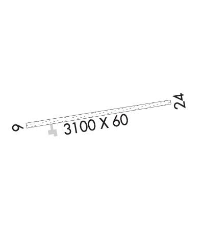
Runway Identifications
Runway Identification: 06/24
Length: 3100 ft
Width: 60 ft
Surface: GRAVEL-GOOD CONDITION
Edge lights:

Treatment: NONE

 Runway: 06   Runway: 24
Mag heading: N/AMag heading: N/A
Rwy Slope: .59% UpRwy Slope: -.59% Down
Approach: Approach:
Pattern: Left TrafficPattern: Right Traffic
Markings: NONSTANDARDMarkings: NONSTANDARD
Marking Condition: RYS 06/24 MKD WITH REFLECTIVE ORANGE CONES & THLD PANELS.Marking Condition:
Arresting Dev: Arresting Dev:
Lat & Long: N5731.4  W15724.2Lat. & Long.: N5731.5  W15723.3
Elev: 25.5 ft. MSLElev: 43.8 ft. MSL
TCH: TCH:
Visual Glide Path: Visual Glide Path:
Displaced Threshold: NoDisplaced Threshold: No
Touchdown Zone: NOTouchdown Zone: NO
Touchdown Elev.: Touchdown Elev.:
Visual Glide Slope: Visual Glide Slope:
RVR Equipment: RVR Equipment:
RVV Equipment: NORVV Equipment: NO
Approach Lights: Approach Lights:
REIL: NOREIL: NO
Centerline Lights: NOCenterline Lights: NO
Touchdown lights: NOTouchdown lights: NO
Runway Category: Runway with a Visual ApproachRunway Category: Runway with a Visual Approach
Declared Distances: Declared Distances:
Obstructions: BRUSHObstructions: BRUSH
Marked: NOT Marked/LightedMarked: NOT Marked/Lighted
Clearance slope: Clearance slope:
Obstruction height: 6 feet AGLObstruction height: 7 feet AGL
Dist. from runway: 0 feetDist. from runway: 0 feet
Centerline offset: 96 right of centerlineCenterline offset: 65 feet right of centerline
Comments: Comments:
C:/P: