
| ||||||
|
| Rwy | Rwy | |||||||
| 3798x75 | 3798' | 3798x75 | 3798' | |||||
| Runway ID | Single Wheel | Double Wheel | Double Tandem Wheel | Dual Double Wheel |
| 13/31 | 12,500 | N/A | N/A | N/A |
| These numbers are Advisory and are not limits. The Airport Manager should have more accurate Weight Limits | ||||
| FltPlan does not have IFR approach charts available for K97M. |
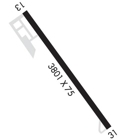 Airport Diagram might not be current. | |
| Facility Name: | EKALAKA |
| City Name: | EKALAKA |
| County: | CARTER |
| State abbrev: | MT |
| State Name: | MONTANA |
| Ownership: | PUBLICLY OWNED |
| Use: | OPEN TO THE PUBLIC |
| Owner's Name: | COUNTY OF CARTER |
| Address: | COUNTY COURT HOUSE PO BOX 315 |
| EKALAKA, MT 59324 | |
| Owner's Phone: | 406-775-8749 |
| Manager's Name: | TROY FRUIT |
| Address: | PO BOX 315 |
| EKALAKA, MT 59324 | |
| Phone: | 406-853-5377 |
| FAA Region: | NORTHWEST MOUNTAIN |
| FAA Field Office: | HLN |
| Date | Sunrise | Sunset |
|---|---|---|
| 04/18/24 Thursday | 6:05 | 19:50 |
| 04/19/24 Friday | 6:04 | 19:51 |
| 04/20/24 Saturday | 6:02 | 19:53 |
| 04/21/24 Sunday | 6:00 | 19:54 |
| 04/22/24 Monday | 5:59 | 19:55 |
| 04/23/24 Tuesday | 5:57 | 19:57 |
| 04/24/24 Wednesday | 5:55 | 19:58 |
| 04/25/24 Thursday | 5:54 | 19:59 |
| 04/26/24 Friday | 5:52 | 20:00 |
| 04/27/24 Saturday | 5:50 | 20:02 |
| 04/28/24 Sunday | 5:49 | 20:03 |
| 04/29/24 Monday | 5:47 | 20:04 |
| 04/30/24 Tuesday | 5:46 | 20:06 |
| 05/01/24 Wednesday | 5:44 | 20:07 |
| Airport Attendance Schedule | UNATTENDED |
| Airport Status | OPERATIONAL (This Status can change at any time - please check NOTAMS) |
| Airport Lighting Schedule | DUSK-0000. MIRL RY 13/31 & PAPI RYS 13 & 31 PRESET MEDIUM INTST DUSK-0000; OTHER HRS ACTVT - CTAF. |
| Airport Storage Available | Tie Downs |
| Extra Services Available | NONE |
| Wind Indicator | YES - (lighted) |
| Control Tower | NO |
| CTAF Frequency | 122.900 |
| Unicom Frequency | |
| Rotating Beacon Color | WG; BCN IS LCTD 1 MI NE ON HILL TOP. |
| Segmented Circle | YES |
| Landing Fee |
| Airport Inspected | STATE - performed by STATE AERONAUTICAL PERSONNEL |
| Inspection Date | 08/23/2022 |
| Type of Fuel Available | Grade 100LL; -10SELF SVC CREDIT CARD 24/7 |
| Airframe Repair Service | None |
| Power Plant Repair Service | None |
| Latitude | N4552.6 |
| Longitude | W10432.3 (ESTIMATED) |
| Arpt Elevation | 3504ft (SURVEYED) |
| Magnetic Variation | 12E |
| 2 miles SE | of EKALAKA |
| Traffic Pattern Altitude | |
| Sectional Chart | BILLINGS |
| Operations (Reported) | Yearly | Avg. Daily |
|---|---|---|
| General Aviation Transient | 75 | 0 |
| General Aviation Local | 100 | 0 |
| Air Taxi | 25 | 0 |
| Commerical | 0 | 0 |
| Commuter | 0 | 0 |
| Military | 0 | 0 |
| Aircraft based on Field | |
|---|---|
| General Aviation Singles | 6 |
| General Aviation Multi | 0 |
| Jet Aircraft | 0 |
| General Aviation Helicopters | 0 |
| Military Aircraft | 0 |
| Gliders | 0 |
| Ultralights | 0 |
| FSS on field | NO |
| FSS tie-in | GREAT FALLS |
| FSS Phone | 1-800-WX-BRIEF |
| Who issues Notams | GTF |
| Notam D service at airport | YES |
| ARTCC Name | SALT LAKE CITY |
| Airport Certification | |
| Aircraft Rescue & Firefighting Index | None |
| Airport of Entry | No |
| Custom Landing Rights | No |
| Joint Civil/Military | No |
| Military Landing rights | No |
| NATIONAL PLAN OF INTEGRATED AIRPORT SYSTEMS (NPIAS) |
| FOR CD IF UNA TO CTC ON FSS FREQ, CTC SALT LAKE ARTCC AT 801-320-2568. |
| Runway: 13 | Runway: 31 | ||
| Mag heading: | 126° | Mag heading: | 306° |
| Rwy Slope: | .83% Up | Rwy Slope: | -.83% Down |
| Approach: | Approach: | ||
| Pattern: | Left Traffic | Pattern: | Left Traffic |
| Markings: | BASIC | Markings: | BASIC |
| Marking Condition: | GOOD | Marking Condition: | GOOD |
| Arresting Dev: | Arresting Dev: | ||
| Lat & Long: | N4552.8 W10432.6 | Lat. & Long.: | N4552.4 W10432.0 |
| Elev: | 3473.5 ft. MSL | Elev: | 3504.9 ft. MSL |
| TCH: | 24 ft. AGL | TCH: | 29 ft. AGL |
| Visual Glide Path: | 3.00 degrees | Visual Glide Path: | 3.00 degrees |
| Displaced Threshold: | No | Displaced Threshold: | No |
| Touchdown Zone: | YES | Touchdown Zone: | YES |
| Touchdown Elev.: | 3497.1 feet | Touchdown Elev.: | 3504.9 feet |
| Visual Glide Slope: | 2-Light PAPI on LEFT side of Runway | Visual Glide Slope: | 2-Light PAPI on LEFT side of Runway |
| RVR Equipment: | RVR Equipment: | ||
| RVV Equipment: | NO | RVV Equipment: | NO |
| Approach Lights: | Approach Lights: | ||
| REIL: | NO | REIL: | NO |
| Centerline Lights: | NO | Centerline Lights: | NO |
| Touchdown lights: | NO | Touchdown lights: | NO |
| Runway Category: | Runway with a Visual Approach | Runway Category: | Runway with a Visual Approach |
| Declared Distances: | Declared Distances: | ||
| Comments: | Comments: | 80' TALL HILLS IN TRANSITIONAL SURFACE, SOUTH SIDE OF APT, 700' FROM RWY EDGE |
