Click here for more info on on SMS!

K8G6

HARRISON COUNTY
CADIZ
OH
Time Zone: Eastern
Lat: N 4014.3
Long: W 08100.8
Elev: 1176
Var: +08
Longest Runway: 4154
CTAF: 122.8

FBO & Flight Services info for K8G6

FBOs: Update your Fuel Prices

DESAPI AIR SERVPh: 740-942-2316 Fax: 740-942-3691
-
Service
Jet
100LL
SAF
MoGas
Full        Last Update: 04/13/2024 14:33

Self        
 Address: 4300 AIRPORT RD   CADIZ, OH 43907
If you are an FBO, call 1-203-262-1700 to update your info or email: FltPlan.Advertising@garmin.com
Advertise your FBO on FltPlan.com

Runway & Approach Info for K8G6
Rwy
Length
Land Dist**
Approach*
  Rwy
Length
Land Dist**
Approach*
13
4154x60  3280'          
 
  
31
  4154x60  3744'          
 
 * only ILS, LOC, LDA, and SDF approaches to a specific runway are shown
** For any Declared Landing Distance Available, please see A/FD or Approach plates
Runway Weight Capability (lbs.) Help
Runway IDSingle WheelDouble WheelDouble Tandem WheelDual Double Wheel
13/3130,000N/AN/AN/A
These numbers are Advisory and are not limits.   The Airport Manager should have more accurate Weight Limits
Approach Charts
Approaches    
Current Weather/Notams
Customs Information Send updates to Support@FltPlan.com
Customs Not Available
Database effective 05/16/2024
Airport Diagram of K8G6
Airport Diagram might not be current.

Facility Name: HARRISON COUNTY
City Name: CADIZ
County: HARRISON
State abbrev: OH
State Name: OHIO
   
Ownership: PUBLICLY OWNED
Use: OPEN TO THE PUBLIC
Owner's Name: HARRISON CO ARPT AUTH
Address: 43000 AIRPORT RD
 CADIZ, OH 43907-9605
Owner's Phone: 740-942-2316
  
Manager's Name: DARRIN LEAS
Address: 43000 AIRPORT RD
 CADIZ, OH 43907-9605
Phone: 740-942-2316
   
FAA Region: GREAT LAKES
FAA Field Office: DET


Sunrise / Sunset times for HARRISON COUNTY

DateSunriseSunset
04/24/24 Wednesday6:3220:13
04/25/24 Thursday6:3020:14
04/26/24 Friday6:2920:15
04/27/24 Saturday6:2820:16
04/28/24 Sunday6:2620:17
04/29/24 Monday6:2520:18
04/30/24 Tuesday6:2420:19
05/01/24 Wednesday6:2320:20
05/02/24 Thursday6:2120:21
05/03/24 Friday6:2020:22
05/04/24 Saturday6:1920:23
05/05/24 Sunday6:1820:24
05/06/24 Monday6:1720:25
05/07/24 Tuesday6:1620:26

Airport Facilities

Airport Attendance ScheduleMON-SAT 0900-1700
Airport Status OPERATIONAL (This Status can change at any time - please check NOTAMS)
Airport Lighting ScheduleACTVT PAPI RWY 13 & 31; MIRL RWY 13/31 - CTAF.
Airport Storage AvailableTie Downs
Extra Services AvailableNONE
Wind IndicatorYES - (lighted)
Control TowerNO
CTAF Frequency122.800
Unicom Frequency122.800
Rotating Beacon ColorWG
Segmented CircleNO
Landing FeeNO

Airport Inspection Data

Airport InspectedSTATE - performed by STATE AERONAUTICAL PERSONNEL
Inspection Date06/17/2022

Airport Services

Type of Fuel AvailableGrade 100LL
Airframe Repair ServiceMAJOR; PAINT SHOP ON FLD CALL AMGR.
Power Plant Repair ServiceMAJOR

Geographic Data

LatitudeN4014.3
LongitudeW08100.8 (ESTIMATED)
Arpt Elevation1176ft (SURVEYED)
Magnetic Variation08W
2 miles Sof CADIZ
Traffic Pattern Altitude
Sectional ChartDETROIT

Aircraft Data

Operations (Reported)YearlyAvg. Daily
General Aviation Transient 395011
General Aviation Local 10003
Air Taxi 00
Commerical 00
Commuter 00
Military 500
Aircraft based on Field
General Aviation Singles 21
General Aviation Multi 0
Jet Aircraft 0
General Aviation Helicopters 1
Military Aircraft 0
Gliders 0
Ultralights 0

FAA Services

FSS on field NO
FSS tie-in CLEVELAND
FSS Phone 1-800-WX-BRIEF
Who issues Notams CLE
Notam D service at airport YES
ARTCC Name CLEVELAND

Federal Status

Airport Certification
Aircraft Rescue & Firefighting IndexNone
Airport of EntryNo
Custom Landing RightsNo
Joint Civil/MilitaryNo
Military Landing rightsNo

Federal Agreements

NATIONAL PLAN OF INTEGRATED AIRPORT SYSTEMS (NPIAS)

Remarks

FOR CD CTC CLEVELAND ARTCC AT 440-774-0226/0490.
Airport Communications & Frequencies:
CTAF Frequency:
122.800
Unicom Frequency:
122.800
Remarks
  • APCH/DEP SVC PRVDD BY CLEVELAND ARTCC (ZOB) ON FREQS 126.95/239.3 (BELMONT RCAG).
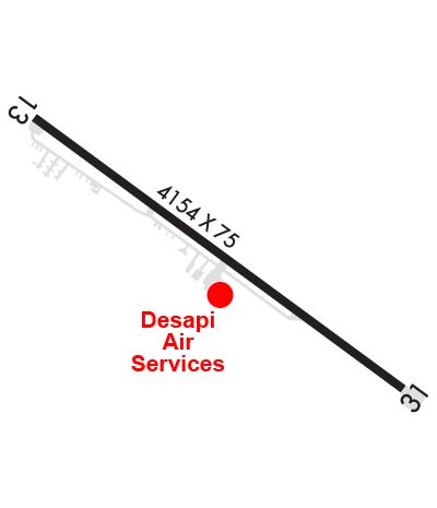
  • Runway Identifications
    Runway Identification: 13/31
    Length: 4154 ft
    Width: 60 ft
    Surface: ASPHALT
    Edge lights: Medium Intensity

    Treatment: NONE

     Runway: 13   Runway: 31
    Mag heading: 134°Mag heading: 314°
    Rwy Slope: -1.70% DownRwy Slope: 1.70% Up
    Approach: Approach:
    Pattern: Right TrafficPattern: Left Traffic
    Markings: NONPRECISION INSTRUMENTMarkings: NONPRECISION INSTRUMENT
    Marking Condition: GOODMarking Condition: GOOD
    Arresting Dev: Arresting Dev:
    Lat & Long: N4014.5  W08101.1Lat. & Long.: N4014.1  W08100.4
    Elev: 1176.2 ft. MSLElev: 1105.5 ft. MSL
    TCH: 40 ft. AGLTCH: 40 ft. AGL
    Visual Glide Path: 4.00 degreesVisual Glide Path: 4.00 degrees
    Displaced Threshold: 874 feetDisplaced Threshold: 410 feet
    Touchdown Zone: YESTouchdown Zone: YES
    Touchdown Elev.: 1160.5 feetTouchdown Elev.: 1162.9 feet
    Visual Glide Slope: 2-Light PAPI on LEFT side of RunwayVisual Glide Slope: 2-Light PAPI on LEFT side of Runway
    RVR Equipment: RVR Equipment:
    RVV Equipment: NORVV Equipment: NO
    Approach Lights: Approach Lights:
    REIL: NOREIL: NO
    Centerline Lights: NOCenterline Lights: NO
    Touchdown lights: NOTouchdown lights: NO
    Runway Category: Runway with a Non-precision ApproachRunway Category: Runway with a Non-precision Approach
    Declared Distances: Declared Distances:
    Obstructions: HILLObstructions: TREES
    Marked: NOT Marked/LightedMarked: NOT Marked/Lighted
    Clearance slope: APCH SLP 0:1 TO DTHR DUE TO +40 FT HNGR, 0 FT DIST, 198 FT R.Clearance slope: 5:1; APCH SLP 12:1 TO DTHR DUE TO +72 FT TREE, 809 FT DIST, 368 FT R.
    Obstruction height: 40 feet AGLObstruction height: 44 feet AGL
    Dist. from runway: 201 feetDist. from runway: 435 feet
    Centerline offset: 118 right of centerlineCenterline offset: 238 feet right of centerline
    Comments: 0-40 FT HILL, 0-200 FT DIST, 100 FT L TO 140 FT R.Comments: 6 FT MOUND, 115-200 FT DIST, 165-250 FT L.
    C:/P: