Click here for more info on on SMS!

K84R

SMITHVILLE CRAWFORD MUNI
SMITHVILLE
TX
Time Zone: Central
Lat: N 3001.7
Long: W 09710.0
Elev: 323
Var: -03
Longest Runway: 4000
CTAF: 122.9

FBO & Flight Services info for K84R

FBOs: Update your Fuel Prices

TWN OF SMITHVILLEPh: 979-224-6304
-
-
Service
Jet
100LL
SAF
MoGas
Full        Last Update: 04/26/2024 12:17

Self  4.86    
 Address: 840 AIRPORT RD   LE GRANGE, TX 78945
If you are an FBO, call 1-203-262-1700 to update your info or email: FltPlan.Advertising@garmin.com
Advertise your FBO on FltPlan.com

Runway & Approach Info for K84R
Rwy
Length
Land Dist**
Approach*
  Rwy
Length
Land Dist**
Approach*
17
4000x75  4000'          
 
  
35
  4000x75  4000'          
 
 * only ILS, LOC, LDA, and SDF approaches to a specific runway are shown
** For any Declared Landing Distance Available, please see A/FD or Approach plates
Runway Weight Capability (lbs.) Help
Runway IDSingle WheelDouble WheelDouble Tandem WheelDual Double Wheel
17/3512,500N/AN/AN/A
These numbers are Advisory and are not limits.   The Airport Manager should have more accurate Weight Limits
Approach Charts
Approaches    
Current Weather/Notams
Customs Information Send updates to Support@FltPlan.com
Customs Not Available
Database effective 05/16/2024
Airport Diagram of K84R
Airport Diagram might not be current.

Facility Name: SMITHVILLE CRAWFORD MUNI
City Name: SMITHVILLE
County: BASTROP
State abbrev: TX
State Name: TEXAS
   
Ownership: PUBLICLY OWNED
Use: OPEN TO THE PUBLIC
Owner's Name: CITY OF SMITHVILLE
Address: PO BOX 449
 SMITHVILLE, TX 78957
Owner's Phone: 512-237-3282
  
Manager's Name: ROBERT TAMBLE
Address: BOX 449
 SMITHVILLE, TX 78957
Phone: 512-237-3282; ON SITE ARPT CTC SANDY MEYERSON 979-224-6304, SMBUILDS@GMAIL.COM.
   
FAA Region: SOUTHWEST
FAA Field Office: TEX


Sunrise / Sunset times for SMITHVILLE CRAWFORD MUNI

DateSunriseSunset
04/25/24 Thursday6:5120:03
04/26/24 Friday6:5020:03
04/27/24 Saturday6:4920:04
04/28/24 Sunday6:4820:05
04/29/24 Monday6:4720:05
04/30/24 Tuesday6:4620:06
05/01/24 Wednesday6:4520:07
05/02/24 Thursday6:4420:07
05/03/24 Friday6:4320:08
05/04/24 Saturday6:4320:09
05/05/24 Sunday6:4220:09
05/06/24 Monday6:4120:10
05/07/24 Tuesday6:4020:11
05/08/24 Wednesday6:3920:11

Airport Facilities

Airport Attendance ScheduleMON-SAT 0900-1700
Airport Status OPERATIONAL (This Status can change at any time - please check NOTAMS)
Airport Lighting ScheduleSS-SR ACTVT MIRL RWY 17/35 123.3; PAPI OPR CONSLY.
Airport Storage AvailableTie Downs, Hanger
Extra Services AvailableFlight Instruction
Wind IndicatorYES - (lighted)
Control TowerNO
CTAF Frequency122.900
Unicom Frequency
Rotating Beacon ColorWG
Segmented CircleYES
Landing FeeNO

Airport Inspection Data

Airport InspectedSTATE - performed by STATE AERONAUTICAL PERSONNEL
Inspection Date05/23/2023

Airport Services

Type of Fuel AvailableGrade 100LL
Airframe Repair ServiceMAJOR
Power Plant Repair ServiceMAJOR

Geographic Data

LatitudeN3001.7
LongitudeW09710.0 (ESTIMATED)
Arpt Elevation323ft (SURVEYED)
Magnetic Variation03E
2 miles Nof SMITHVILLE
Traffic Pattern Altitude
Sectional ChartSAN ANTONIO

Aircraft Data

Operations (Reported)YearlyAvg. Daily
General Aviation Transient 420112
General Aviation Local 1260035
Air Taxi 00
Commerical 00
Commuter 00
Military 5201
Aircraft based on Field
General Aviation Singles 27
General Aviation Multi 2
Jet Aircraft 0
General Aviation Helicopters 2
Military Aircraft 0
Gliders 0
Ultralights 3

FAA Services

FSS on field NO
FSS tie-in SAN ANGELO
FSS Phone 1-800-WX-BRIEF
Who issues Notams SJT
Notam D service at airport YES
ARTCC Name HOUSTON

Federal Status

Airport Certification
Aircraft Rescue & Firefighting IndexNone
Airport of EntryNo
Custom Landing RightsNo
Joint Civil/MilitaryNo
Military Landing rightsNo

Federal Agreements

NATIONAL PLAN OF INTEGRATED AIRPORT SYSTEMS (NPIAS)

Remarks

WILDLIFE & LIVESTOCK INVOF ARPT.
FOR CD CTC AUSTIN APCH AT 512-369-7865.
35 FT MKD/LGTD PLINE 1300 FT DSTC, ACRS APCH.
Airport Communications & Frequencies:
CTAF Frequency:
122.900
AUSTIN Primary Approach Frequencies:  
120.875
270.25
AUSTIN Primary Departure Frequencies:  
120.875
270.25
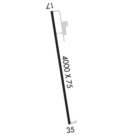
Runway Identifications
Runway Identification: 17/35
Length: 4000 ft
Width: 75 ft
Surface: ASPHALT-GOOD CONDITION
Edge lights: Medium Intensity

Treatment: NONE

 Runway: 17   Runway: 35
Mag heading: 169°Mag heading: 349°
Rwy Slope: -.03% DownRwy Slope: .03% Up
Approach: Approach:
Pattern: Left TrafficPattern: Left Traffic
Markings: NONPRECISION INSTRUMENTMarkings: NONPRECISION INSTRUMENT
Marking Condition: GOODMarking Condition: GOOD
Arresting Dev: Arresting Dev:
Lat & Long: N3002.0  W09710.1Lat. & Long.: N3001.4  W09710.0
Elev: 323.2 ft. MSLElev: 322.0 ft. MSL
TCH: 40 ft. AGLTCH: 40 ft. AGL
Visual Glide Path: 4.00 degreesVisual Glide Path: 3.00 degrees
Displaced Threshold: NoDisplaced Threshold: No
Touchdown Zone: YESTouchdown Zone: YES
Touchdown Elev.: 323.3 feetTouchdown Elev.: 322.8 feet
Visual Glide Slope: 2-Light PAPI on LEFT side of RunwayVisual Glide Slope: 2-Light PAPI on LEFT side of Runway
RVR Equipment: RVR Equipment:
RVV Equipment: NORVV Equipment: NO
Approach Lights: Approach Lights:
REIL: NOREIL: NO
Centerline Lights: NOCenterline Lights: NO
Touchdown lights: NOTouchdown lights: NO
Runway Category: Runway with a Non-precision ApproachRunway Category: Runway with a Non-precision Approach
Declared Distances: Declared Distances:
Obstructions: TREESObstructions: TREES
Marked: NOT Marked/LightedMarked: MARKED and LIGHTED
Clearance slope: 18:1Clearance slope: 20:1
Obstruction height: 106 feet AGLObstruction height: 35 feet AGL
Dist. from runway: 2200 feetDist. from runway: 920 feet
Centerline offset: 30 left of centerlineCenterline offset: 109 feet right of centerline
Comments: Comments:
C:1/P: