Click here for more info on on SMS!

K7W5

HENRY COUNTY
NAPOLEON
OH
Time Zone: Eastern
Lat: N 4122.5
Long: W 08404.1
Elev: 683
Var: +05
Longest Runway: 4001
CTAF: 123.0

FBO & Flight Services info for K7W5

FBOs: Update your Fuel Prices

AMES AVIATIONPh: 419-599-6494 Fax: 419-599-6494
-
Service
Jet
100LL
SAF
MoGas
Full6.255.829    Caution: Fuel prices have not been updated in 39 days.
Last Update: 03/11/2024 16:29

Self        
 Address: 10-646 COUNTY ROAD O   NAPOLEON, OH 43545
If you are an FBO, call 1-203-262-1700 to update your info or email: FltPlan.Advertising@garmin.com
Advertise your FBO on FltPlan.com

Runway & Approach Info for K7W5
Rwy
Length
Land Dist**
Approach*
  Rwy
Length
Land Dist**
Approach*
10
4001x60  4001'          
 
  
28
  4001x60  4001'          
 
 * only ILS, LOC, LDA, and SDF approaches to a specific runway are shown
** For any Declared Landing Distance Available, please see A/FD or Approach plates
Runway Weight Capability (lbs.) Help
Runway IDSingle WheelDouble WheelDouble Tandem WheelDual Double Wheel
10/28N/AN/AN/AN/A
These numbers are Advisory and are not limits.   The Airport Manager should have more accurate Weight Limits
Approach Charts
Approaches    
Current Weather/Notams
Customs Information Send updates to Support@FltPlan.com
Customs Not Available
Database effective 04/18/2024
Airport Diagram of K7W5
Airport Diagram might not be current.

Facility Name: HENRY COUNTY
City Name: NAPOLEON
County: HENRY
State abbrev: OH
State Name: OHIO
   
Ownership: PUBLICLY OWNED
Use: OPEN TO THE PUBLIC
Owner's Name: HENRY CO ARPT AUTH
Address: 10646 COUNTY ROAD O
 NAPOLEON, OH 43545-6217
Owner's Phone: 419-599-6494
  
Manager's Name: JARED AMES, ACTING AMGR
Address: 10646 COUNTY ROAD O
 NAPOLEON, OH 43545-6217
Phone: 419-599-6494; CELL 419-388-9259.
   
FAA Region: GREAT LAKES
FAA Field Office: DET


Sunrise / Sunset times for HENRY COUNTY

DateSunriseSunset
04/18/24 Thursday6:5120:21
04/19/24 Friday6:4920:22
04/20/24 Saturday6:4820:23
04/21/24 Sunday6:4620:24
04/22/24 Monday6:4520:25
04/23/24 Tuesday6:4420:26
04/24/24 Wednesday6:4220:27
04/25/24 Thursday6:4120:28
04/26/24 Friday6:3920:29
04/27/24 Saturday6:3820:30
04/28/24 Sunday6:3720:31
04/29/24 Monday6:3520:32
04/30/24 Tuesday6:3420:34
05/01/24 Wednesday6:3320:35

Airport Facilities

Airport Attendance ScheduleMON-FRI 0800-1730, SAT-SUN ON CALL; FOR SVC CALL AMGR CELL.
Airport Status OPERATIONAL (This Status can change at any time - please check NOTAMS)
Airport Lighting ScheduleACTVT REIL RWY 10 & 28; PAPI RWY 10 & 28; MIRL RWY 10/28 - CTAF.
Airport Storage AvailableTie Downs, Hanger
Extra Services AvailableAircraft Sales
Wind IndicatorYES - (lighted)
Control TowerNO
CTAF Frequency123.000
Unicom Frequency123.000
Rotating Beacon ColorWG
Segmented CircleNO
Landing FeeNO

Airport Inspection Data

Airport InspectedSTATE - performed by STATE AERONAUTICAL PERSONNEL
Inspection Date10/03/2023

Airport Services

Type of Fuel AvailableGrade 100LL, JET A (freeze point -40C)
Airframe Repair ServiceMAJOR
Power Plant Repair ServiceMAJOR

Geographic Data

LatitudeN4122.5
LongitudeW08404.1 (ESTIMATED)
Arpt Elevation682ft (SURVEYED)
Magnetic Variation05W
3 miles Eof NAPOLEON
Traffic Pattern Altitude
Sectional ChartDETROIT

Aircraft Data

Operations (Reported)YearlyAvg. Daily
General Aviation Transient 5001
General Aviation Local 500014
Air Taxi 100
Commerical 00
Commuter 00
Military 100
Aircraft based on Field
General Aviation Singles 15
General Aviation Multi 1
Jet Aircraft 0
General Aviation Helicopters 0
Military Aircraft 0
Gliders 0
Ultralights 0

FAA Services

FSS on field NO
FSS tie-in CLEVELAND
FSS Phone 1-800-WX-BRIEF
Who issues Notams CLE
Notam D service at airport YES
ARTCC Name CLEVELAND

Federal Status

Airport Certification
Aircraft Rescue & Firefighting IndexNone
Airport of EntryNo
Custom Landing RightsNo
Joint Civil/MilitaryNo
Military Landing rightsNo

Federal Agreements

NATIONAL PLAN OF INTEGRATED AIRPORT SYSTEMS (NPIAS)

Remarks

FOR CD CTC TOLEDO APCH AT 419-865-1495.
Airport Communications & Frequencies:
CTAF Frequency:
123.000
Unicom Frequency:
123.000
TOLEDO Primary Approach Frequencies:  
134.35
307.0
TOLEDO Primary Departure Frequencies:  
134.35
307.0
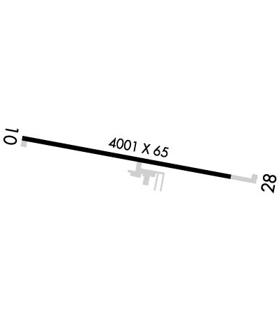
Runway Identifications
Runway Identification: 10/28
Length: 4001 ft
Width: 60 ft
Surface: ASPHALT
Edge lights: Medium Intensity

Treatment: NONE

 Runway: 10   Runway: 28
Mag heading: 106°Mag heading: 286°
Rwy Slope: .05% UpRwy Slope: -.05% Down
Approach: Approach:
Pattern: Left TrafficPattern: Left Traffic
Markings: NONPRECISION INSTRUMENTMarkings: NONPRECISION INSTRUMENT
Marking Condition: GOODMarking Condition: GOOD
Arresting Dev: Arresting Dev:
Lat & Long: N4122.5  W08404.5Lat. & Long.: N4122.4  W08403.6
Elev: 680.8 ft. MSLElev: 682.8 ft. MSL
TCH: 25 ft. AGLTCH: 25 ft. AGL
Visual Glide Path: 3.00 degreesVisual Glide Path: 3.00 degrees
Displaced Threshold: NoDisplaced Threshold: No
Touchdown Zone: YESTouchdown Zone: YES
Touchdown Elev.: 682.9 feetTouchdown Elev.: 682.9 feet
Visual Glide Slope: 2-Light PAPI on LEFT side of RunwayVisual Glide Slope: 2-Light PAPI on LEFT side of Runway
RVR Equipment: RVR Equipment:
RVV Equipment: NORVV Equipment: NO
Approach Lights: Approach Lights:
REIL: YESREIL: YES
Centerline Lights: NOCenterline Lights: NO
Touchdown lights: NOTouchdown lights: NO
Runway Category: Runway with a Visual ApproachRunway Category: Runway with a Non-precision Approach
Declared Distances: Declared Distances:
Obstructions: CROPSObstructions: CROPS
Marked: NOT Marked/LightedMarked: NOT Marked/Lighted
Clearance slope: CTLG OBSTN EXCEEDS A 45 DEG SLP.Clearance slope: CTLG OBSTN EXCEEDS A 45 DEG SLP.
Obstruction height: 5 feet AGLObstruction height: 6 feet AGL
Dist. from runway: 200 feetDist. from runway: 200 feet
Centerline offset: 95 right of centerlineCenterline offset: 125 feet left of centerline
Comments: +5 FT CROPS/CULTIVATED FLD, 140-200 FT DIST, 95-125 FT R.Comments: +6 FT CROPS/CULTIVATED FLD, 0-200 FT DIST, 125 FT L TO 130 FT R.
C:/P: