
| ||||||||||||||||||||||||||||||||||||||||||||
| ||||||||||||||||||||||||||||||||||||||||||||
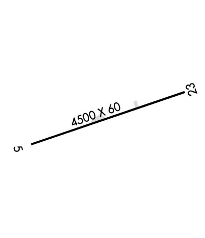
| Rwy | Rwy | |||||||
| 4500x60 | 4500' | 4500x60 | 4500' | |||||
| Runway ID | Single Wheel | Double Wheel | Double Tandem Wheel | Dual Double Wheel |
| 06/24 | N/A | N/A | N/A | N/A |
| These numbers are Advisory and are not limits. The Airport Manager should have more accurate Weight Limits | ||||
| FltPlan does not have IFR approach charts available for K7V2. |
 Airport Diagram might not be current. | |
| Facility Name: | NORTH FORK VALLEY |
| City Name: | PAONIA |
| County: | DELTA |
| State abbrev: | CO |
| State Name: | COLORADO |
| Ownership: | PUBLICLY OWNED |
| Use: | OPEN TO THE PUBLIC |
| Owner's Name: | DELTA COUNTY WITH TOWN OF PAONIA |
| Address: | 38506 BACK RIVER RD |
| PAONIA, CO 81428 | |
| Owner's Phone: | 970-527-3345 |
| Manager's Name: | MIKE CLAWSON |
| Address: | 38506 BACK RIVER RD |
| PAONIA, CO 81428 | |
| Phone: | 970-527-3345; 970-260-2138 |
| FAA Region: | NORTHWEST MOUNTAIN |
| FAA Field Office: | DEN |
| Date | Sunrise | Sunset |
|---|---|---|
| 04/18/24 Thursday | 6:29 | 19:51 |
| 04/19/24 Friday | 6:27 | 19:52 |
| 04/20/24 Saturday | 6:26 | 19:53 |
| 04/21/24 Sunday | 6:25 | 19:54 |
| 04/22/24 Monday | 6:23 | 19:55 |
| 04/23/24 Tuesday | 6:22 | 19:56 |
| 04/24/24 Wednesday | 6:21 | 19:57 |
| 04/25/24 Thursday | 6:19 | 19:58 |
| 04/26/24 Friday | 6:18 | 19:59 |
| 04/27/24 Saturday | 6:17 | 20:00 |
| 04/28/24 Sunday | 6:16 | 20:01 |
| 04/29/24 Monday | 6:14 | 20:02 |
| 04/30/24 Tuesday | 6:13 | 20:03 |
| 05/01/24 Wednesday | 6:12 | 20:04 |
| Airport Attendance Schedule | MON-FRI 0800-1800, SAT-SUN IREG |
| Airport Status | OPERATIONAL (This Status can change at any time - please check NOTAMS) |
| Airport Lighting Schedule | ACTVT PAPI RWY 06 & 24; MIRL RWY 06/24 - CTAF. |
| Airport Storage Available | Tie Downs, Hanger |
| Extra Services Available | Flight Instruction |
| Wind Indicator | YES - (lighted) |
| Control Tower | NO |
| CTAF Frequency | 122.700 |
| Unicom Frequency | 122.700 |
| Rotating Beacon Color | |
| Segmented Circle | NO |
| Landing Fee | NO |
| Airport Inspected | STATE - performed by STATE AERONAUTICAL PERSONNEL |
| Inspection Date | 07/26/2021 |
| Type of Fuel Available | Grade 100LL; -10SELF SERVE H24. |
| Airframe Repair Service | MAJOR |
| Power Plant Repair Service | MAJOR |
| Latitude | N3849.9 |
| Longitude | W10738.8 (ESTIMATED) |
| Arpt Elevation | 5788ft (ESTIMATED) |
| Magnetic Variation | 13E |
| 3 miles SW | of PAONIA |
| Traffic Pattern Altitude | 800 |
| Sectional Chart | DENVER |
| Operations (Reported) | Yearly | Avg. Daily |
|---|---|---|
| General Aviation Transient | 1000 | 3 |
| General Aviation Local | 1000 | 3 |
| Air Taxi | 0 | 0 |
| Commerical | 0 | 0 |
| Commuter | 0 | 0 |
| Military | 0 | 0 |
| Aircraft based on Field | |
|---|---|
| General Aviation Singles | 17 |
| General Aviation Multi | 3 |
| Jet Aircraft | 0 |
| General Aviation Helicopters | 1 |
| Military Aircraft | 0 |
| Gliders | 0 |
| Ultralights | 2 |
| FSS on field | NO |
| FSS tie-in | DENVER |
| FSS Phone | 1-800-WX-BRIEF |
| Who issues Notams | DEN |
| Notam D service at airport | YES |
| ARTCC Name | DENVER |
| Airport Certification | |
| Aircraft Rescue & Firefighting Index | None |
| Airport of Entry | No |
| Custom Landing Rights | No |
| Joint Civil/Military | No |
| Military Landing rights | No |
| FOR CD CTC DENVER ARTCC AT 303-651-4257. |
| LCL WX - CTAF; 4 CLICKS. |
| Runway: 06 | Runway: 24 | ||
| Mag heading: | N/A | Mag heading: | N/A |
| Rwy Slope: | .11% Up | Rwy Slope: | -.11% Down |
| Approach: | Approach: | ||
| Pattern: | Left Traffic | Pattern: | Left Traffic |
| Markings: | BASIC | Markings: | BASIC |
| Marking Condition: | GOOD | Marking Condition: | GOOD |
| Arresting Dev: | Arresting Dev: | ||
| Lat & Long: | N3849.7 W10739.2 | Lat. & Long.: | N3850.0 W10738.3 |
| Elev: | 5783.0 ft. MSL | Elev: | 5788.0 ft. MSL |
| TCH: | TCH: | ||
| Visual Glide Path: | Visual Glide Path: | ||
| Displaced Threshold: | No | Displaced Threshold: | No |
| Touchdown Zone: | YES | Touchdown Zone: | YES |
| Touchdown Elev.: | 5783.0 feet | Touchdown Elev.: | 5788.0 feet |
| Visual Glide Slope: | 2-Light PAPI on LEFT side of Runway | Visual Glide Slope: | 2-Light PAPI on LEFT side of Runway |
| RVR Equipment: | RVR Equipment: | ||
| RVV Equipment: | NO | RVV Equipment: | NO |
| Approach Lights: | Approach Lights: | ||
| REIL: | NO | REIL: | NO |
| Centerline Lights: | NO | Centerline Lights: | NO |
| Touchdown lights: | NO | Touchdown lights: | NO |
| Runway Category: | Runway Category: | ||
| Declared Distances: | Declared Distances: |
