Approach Charts
| FltPlan does not have IFR approach charts available for K7S9. |
Current Weather/Notams (Metars, TAFs, Notams, NWS Forecast, PIREPS, and nearby weather)
Customs Information Send updates to Support@FltPlan.com
Customs Not Available
Database effective 04/18/2024
Airport Diagram might not be current.
|
| Facility Name: | LENHARDT AIRPARK |
| City Name: | HUBBARD |
| County: | CLACKAMAS |
| State abbrev: | OR |
| State Name: | OREGON |
| | |
| Ownership: | PRIVATELY OWNED |
| Use: | OPEN TO THE PUBLIC |
| Owner's Name: | LENHARDT FAMILY; TERRI@AIRHAVEN.NET |
| Address: | 29502 S MERIDIAN RD |
| | HUBBARD, OR 97032 |
| Owner's Phone: | 503-651-2187 |
| | |
| Manager's Name: | GLENN LENHARDT; TERRI COLEMAN LEASING MANAGER |
| Address: | 29502 S MERIDIAN RD |
| | HUBBARD, OR 97032 |
| Phone: | 503-651-2187 |
| | |
| FAA Region: | NORTHWEST MOUNTAIN |
| FAA Field Office: | SEA |
Runway Identifications
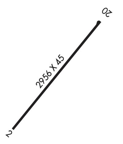
Runway Identification: 02/20Length: 2956 ft
Width: 45 ft
Surface: ASPHALT-GOOD CONDITION
Edge lights: Low IntensityTreatment: NONE
| | Runway: 02 | | Runway: 20 |
| Mag heading: | N/A | Mag heading: | N/A |
| Approach: | | Approach: | |
| Pattern: | Left Traffic | Pattern: | Left Traffic |
| Markings: | BASIC | Markings: | BASIC |
| Marking Condition: | GOOD | Marking Condition: | GOOD |
| Arresting Dev: | | Arresting Dev: | |
| Lat & Long: | N4510.7 W12244.8 | Lat. & Long.: | N4511.1 W12244.4 |
| Elev: | N/A | Elev: | N/A |
| TCH: | | TCH: | |
| Visual Glide Path: | 7.00 degrees | Visual Glide Path: | 4.00 degrees |
| Displaced Threshold: | No | Displaced Threshold: | No |
| Touchdown Zone: | NO | Touchdown Zone: | NO |
| Touchdown Elev.: | | Touchdown Elev.: | |
| Visual Glide Slope: | NONSTANDARD VASI SYSTEM; RY 02 NSTD VASI ONE FLASHING/STEADY LIGHT ON RIGHT SIDE OF RY. | Visual Glide Slope: | NONSTANDARD VASI SYSTEM; RY 20 NSTD VASI ONE FLASHING/STEADY LIGHT ON LEFT SIDE OF RY. |
| RVR Equipment: | | RVR Equipment: | |
| RVV Equipment: | NO | RVV Equipment: | NO |
| Approach Lights: | | Approach Lights: | |
| REIL: | NO | REIL: | NO |
| Centerline Lights: | NO | Centerline Lights: | NO |
| Touchdown lights: | NO | Touchdown lights: | NO |
| Runway Category: | Runway with a Visual Approach | Runway Category: | Runway with a Visual Approach |
| Declared Distances: | | Declared Distances: | |
| Obstructions: | ROAD; BEYOND ROAD, 171' TREES AT 1558' FROM RWY END ON CNTRLN. OBSTRUCTION CLEARANCE SLOPE IS 8:1. | Obstructions: | TREES |
| Marked: | NOT Marked/Lighted | Marked: | NOT Marked/Lighted |
| Clearance slope: | | Clearance slope: | 9:1 |
| Obstruction height: | 15 feet AGL | Obstruction height: | 100 feet AGL |
| Dist. from runway: | 201 feet | Dist. from runway: | 1170 feet |
| Centerline offset: | 25 left of centerline | Centerline offset: | 150 feet right of centerline |
| Comments: | 5' FENCE AT 28-200' FROM RUNWAY END AND 28-125 LEFT OF CENTERLINE. ROAD 130 FT TO 160 FT FM END OF RY; 99 FT LEFT OF CENTER LINE. | Comments: | 8' BRIARS AT 0-15' FROM RUNWAY END AND 5-100' RIGHT OF CENTERLINE. |

