Click here for more info on on SMS!

K7N8

BUTTER VALLEY GOLF PORT
BALLY
PA
Time Zone: Eastern
Lat: N 4023.8
Long: W 07533.8
Elev: 500
Var: +11
Longest Runway: 2420T
CTAF: 122.9

FBO & Flight Services info for K7N8

FBOs: Update your Fuel Prices

AIRPORTPh: 610-845-2491
-
Freq: 122.8
Service
Jet
100LL
SAF
MoGas
Fuel Avail: NO FUEL AVAILABLE
Full        Last Update: 04/19/2024 00:01:46

Self        
If you are an FBO, call 1-203-262-1700 to update your info or email: FltPlan.Advertising@garmin.com
Advertise your FBO on FltPlan.com

Runway & Approach Info for K7N8
Rwy
Length
Land Dist**
Approach*
  Rwy
Length
Land Dist**
Approach*
16
2420x85  2215'          
 
  
34
  2420x85  2170'          
 
 * only ILS, LOC, LDA, and SDF approaches to a specific runway are shown
** For any Declared Landing Distance Available, please see A/FD or Approach plates
Runway Weight Capability (lbs.) Help
Runway IDSingle WheelDouble WheelDouble Tandem WheelDual Double Wheel
16/34N/AN/AN/AN/A
These numbers are Advisory and are not limits.   The Airport Manager should have more accurate Weight Limits
Approach Charts
FltPlan does not have IFR approach charts available for K7N8.
Current Weather/Notams
Customs Information Send updates to Support@FltPlan.com
Customs Not Available
Database effective 04/18/2024
Facility Name: BUTTER VALLEY GOLF PORT
City Name: BALLY
County: MONTGOMERY
State abbrev: PA
State Name: PENNSYLVANIA
   
Ownership: PRIVATELY OWNED
Use: OPEN TO THE PUBLIC
Owner's Name: JOHN L GEHMAN
Address: 3243 GEHMAN RD
 BARTO, PA 19504
Owner's Phone: 610-845-2491
  
Manager's Name: JOHN L. GEHMAN
Address: 3243 GEHMAN RD
 BARTO, PA 19504
Phone: 610-845-2491
   
FAA Region: EASTERN
FAA Field Office: HAR
Parking at approach end of 34S. Steven Neuf 8/15.


Click here for full scale & interactive Sectional view of K7N8


Sunrise / Sunset times for BUTTER VALLEY GOLF PORT

DateSunriseSunset
04/18/24 Thursday6:1819:45
04/19/24 Friday6:1719:46
04/20/24 Saturday6:1519:47
04/21/24 Sunday6:1419:48
04/22/24 Monday6:1319:49
04/23/24 Tuesday6:1119:50
04/24/24 Wednesday6:1019:51
04/25/24 Thursday6:0819:52
04/26/24 Friday6:0719:53
04/27/24 Saturday6:0619:54
04/28/24 Sunday6:0419:55
04/29/24 Monday6:0319:56
04/30/24 Tuesday6:0219:58
05/01/24 Wednesday6:0119:59

Airport Facilities

Airport Attendance Schedule7 Days A Week DALGT
Airport Status OPERATIONAL (This Status can change at any time - please check NOTAMS)
Airport Lighting Schedule
Airport Storage AvailableTie Downs
Extra Services AvailableNONE
Wind IndicatorYES - (unlit)
Control TowerNO
CTAF Frequency122.900
Unicom Frequency
Rotating Beacon Color
Segmented CircleNO
Landing FeeNO

Airport Inspection Data

Airport InspectedSTATE - performed by STATE AERONAUTICAL PERSONNEL
Inspection Date05/11/2023

Airport Services

Type of Fuel AvailableNone
Airframe Repair ServiceNONE
Power Plant Repair ServiceNONE

Geographic Data

LatitudeN4023.8
LongitudeW07533.8 (ESTIMATED)
Arpt Elevation500ft (ESTIMATED)
Magnetic Variation11W
1 miles Eof BALLY
Traffic Pattern Altitude
Sectional ChartNEW YORK

Aircraft Data

Operations (Reported)YearlyAvg. Daily
General Aviation Transient 2001
General Aviation Local 4001
Air Taxi 00
Commerical 00
Commuter 00
Military 00
Aircraft based on Field
General Aviation Singles 15
General Aviation Multi 0
Jet Aircraft 0
General Aviation Helicopters 0
Military Aircraft 0
Gliders 0
Ultralights 0

FAA Services

FSS on field NO
FSS tie-in WILLIAMSPORT
FSS Phone 1-800-WX-BRIEF
Who issues Notams IPT
Notam D service at airport YES
ARTCC Name NEW YORK

Federal Status

Airport Certification
Aircraft Rescue & Firefighting IndexNone
Airport of EntryNo
Custom Landing RightsNo
Joint Civil/MilitaryNo
Military Landing rightsNo

Remarks

RWY 16/34 LCTD IN MIDDLE OF GOLF COURSE.
TREES & SUBSTANTIAL TRRN ELEV CHGS WITHIN 125 FT OF EACH RWY EDGE.
FOR CD CTC ALLENTOWN APCH AT 800-728-6322.
RWY 34 119 FT TREE LINE 1472 FT FM RWY END; 233 FT RIGHT. 12:1 SLOPE TO DTHR.
RWY 16/3 4 RWY 16/34 1535 FT X 24 FT ASPH INSERT AT S END; REMAINDER TURF.
Runway Identifications
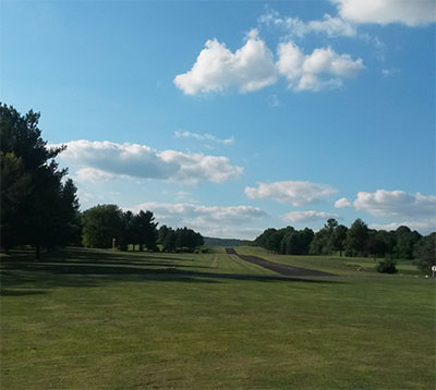
Runway Identification: 16/34
Length: 2420 ft
Width: 85 ft
Surface: ASPHALT GRASS-GOOD CONDITION
Edge lights:

Treatment: NONE

 Runway: 16   Runway: 34
Mag heading: N/AMag heading: N/A
Approach: Approach:
Pattern: Left TrafficPattern: Left Traffic
Markings: Markings:
Marking Condition: MARKED WITH YELLOW WOOD PANELS; TURF RWY EDGES MARKED WITH TIRES PAINTED YELLOW.Marking Condition:
Arresting Dev: Arresting Dev:
Lat & Long:   Lat. & Long.:   
Elev: N/AElev: N/A
TCH: TCH:
Visual Glide Path: Visual Glide Path:
Displaced Threshold: 205 feet; DSPLCD THLD MKD BY 3 YELLOW TIRES.Displaced Threshold: 250 feet; DSPLCD THLD MKD BY 3 WHITE LINES.
Touchdown Zone: NOTouchdown Zone: NO
Touchdown Elev.: Touchdown Elev.:
Visual Glide Slope: Visual Glide Slope:
RVR Equipment: RVR Equipment:
RVV Equipment: NORVV Equipment: NO
Approach Lights: Approach Lights:
REIL: NOREIL: NO
Centerline Lights: NOCenterline Lights: NO
Touchdown lights: NOTouchdown lights: NO
Runway Category: Runway with a Visual ApproachRunway Category: Runway with a Visual Approach
Declared Distances: Declared Distances:
Obstructions: ROADObstructions: ROAD
Marked: NOT Marked/LightedMarked: NOT Marked/Lighted
Clearance slope: 5:1; APCH RATIO 22:1 TO 205 FT DSPLCD THLD.Clearance slope: APCH RATIO 25:1 TO 250 FT DSPLCD THLD.
Obstruction height: 12 feet AGLObstruction height: 10 feet AGL
Dist. from runway: 69 feetDist. from runway: 0 feet
Centerline offset: 50 right of centerlineCenterline offset:
Comments: Comments:
C:/P: