Click here for more info on on SMS!

K7M8

RECTOR
RECTOR
AR
Time Zone: Central
Lat: N 3615.0
Long: W 09019.2
Elev: 281
Var: -02
Longest Runway: 3405
CTAF: 122.9

FBO & Flight Services info for K7M8

FBOs: Update your Fuel Prices

AIRPORTPh: 870-595-2423
-
Freq: 122.9
Service
Jet
100LL
SAF
MoGas
Fuel Avail: NO FUEL AVAILABLE
Full        Last Update: 04/24/2024 06:02:16

Self        
If you are an FBO, call 1-203-262-1700 to update your info or email: FltPlan.Advertising@garmin.com
Advertise your FBO on FltPlan.com

Runway & Approach Info for K7M8
Rwy
Length
Land Dist**
Approach*
  Rwy
Length
Land Dist**
Approach*
18
3405x60  3405'          
 
  
36
  3405x60  3139'          
 
 * only ILS, LOC, LDA, and SDF approaches to a specific runway are shown
** For any Declared Landing Distance Available, please see A/FD or Approach plates
Runway Weight Capability (lbs.) Help
Runway IDSingle WheelDouble WheelDouble Tandem WheelDual Double Wheel
18/365,000N/AN/AN/A
These numbers are Advisory and are not limits.   The Airport Manager should have more accurate Weight Limits
Approach Charts
FltPlan does not have IFR approach charts available for K7M8.
Current Weather/Notams
Customs Information Send updates to Support@FltPlan.com
Customs Not Available
Database effective 05/16/2024
Airport Diagram of K7M8
Airport Diagram might not be current.

Facility Name: RECTOR
City Name: RECTOR
County: CLAY
State abbrev: AR
State Name: ARKANSAS
   
Ownership: PUBLICLY OWNED
Use: OPEN TO THE PUBLIC
Owner's Name: CITY OF RECTOR
Address: 409 SOUTH STUART
 RECTOR, AR 72461
Owner's Phone: 870-595-2423
  
Manager's Name: BAILEY HILL
Address: 409 SOUTH STUART
 RECTOR, AR 72461
Phone: 870-243-8421
   
FAA Region: SOUTHWEST
FAA Field Office: AOK


Sunrise / Sunset times for RECTOR

DateSunriseSunset
04/23/24 Tuesday6:1719:43
04/24/24 Wednesday6:1519:44
04/25/24 Thursday6:1419:44
04/26/24 Friday6:1319:45
04/27/24 Saturday6:1219:46
04/28/24 Sunday6:1119:47
04/29/24 Monday6:1019:48
04/30/24 Tuesday6:0919:49
05/01/24 Wednesday6:0719:50
05/02/24 Thursday6:0619:50
05/03/24 Friday6:0519:51
05/04/24 Saturday6:0419:52
05/05/24 Sunday6:0319:53
05/06/24 Monday6:0219:54

Airport Facilities

Airport Attendance ScheduleUNATTENDED
Airport Status OPERATIONAL (This Status can change at any time - please check NOTAMS)
Airport Lighting ScheduleACTVT MIRL RY 18/36 - CTAF.
Airport Storage AvailableTie Downs
Extra Services AvailableCrop Dusting
Wind IndicatorYES - (lighted)
Control TowerNO
CTAF Frequency122.900
Unicom Frequency
Rotating Beacon ColorWG
Segmented CircleNO
Landing FeeNO

Airport Inspection Data

Airport InspectedSTATE - performed by STATE AERONAUTICAL PERSONNEL
Inspection Date05/03/2023

Airport Services

Type of Fuel AvailableNone
Airframe Repair ServiceNONE
Power Plant Repair ServiceNONE

Geographic Data

LatitudeN3615.0
LongitudeW09019.2 (ESTIMATED)
Arpt Elevation281ft (ESTIMATED)
Magnetic Variation02E
2 miles SWof RECTOR
Traffic Pattern Altitude
Sectional ChartST LOUIS

Aircraft Data

Operations (Reported)YearlyAvg. Daily
General Aviation Transient 2501
General Aviation Local 1100030
Air Taxi 00
Commerical 00
Commuter 00
Military 1500
Aircraft based on Field
General Aviation Singles 0
General Aviation Multi 0
Jet Aircraft 0
General Aviation Helicopters 0
Military Aircraft 0
Gliders 0
Ultralights 0

FAA Services

FSS on field NO
FSS tie-in JONESBORO
FSS Phone 1-800-WX-BRIEF
Who issues Notams JBR
Notam D service at airport YES
ARTCC Name MEMPHIS

Federal Status

Airport Certification
Aircraft Rescue & Firefighting IndexNone
Airport of EntryNo
Custom Landing RightsNo
Joint Civil/MilitaryNo
Military Landing rightsNo

Remarks

FOR CD CTC MEMPHIS ARTCC AT 901-368-8453/8449.
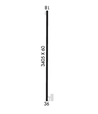
Runway Identifications
Runway Identification: 18/36
Length: 3405 ft
Width: 60 ft
Surface: ASPHALT-GOOD CONDITION
Edge lights: Medium Intensity

Treatment: NONE

 Runway: 18   Runway: 36
Mag heading: N/AMag heading: N/A
Approach: Approach:
Pattern: Left TrafficPattern: Left Traffic
Markings: NONPRECISION INSTRUMENTMarkings: NONPRECISION INSTRUMENT
Marking Condition: GOODMarking Condition: GOOD
Arresting Dev: Arresting Dev:
Lat & Long:   Lat. & Long.:   
Elev: N/AElev: N/A
TCH: TCH:
Visual Glide Path: Visual Glide Path:
Displaced Threshold: NoDisplaced Threshold: 266 feet
Touchdown Zone: NOTouchdown Zone: NO
Touchdown Elev.: Touchdown Elev.:
Visual Glide Slope: Visual Glide Slope:
RVR Equipment: RVR Equipment:
RVV Equipment: NORVV Equipment: NO
Approach Lights: Approach Lights:
REIL: NOREIL: NO
Centerline Lights: NOCenterline Lights: NO
Touchdown lights: NOTouchdown lights: NO
Runway Category: Runway with a Visual ApproachRunway Category: Runway with a Visual Approach
Declared Distances: Declared Distances:
Obstructions: TREEObstructions: TREE
Marked: NOT Marked/LightedMarked: NOT Marked/Lighted
Clearance slope: 20:1Clearance slope: 5:1; APCH SLOPE 24:1 TO DSPLCD THLD.
Obstruction height: 50 feet AGLObstruction height: 25 feet AGL
Dist. from runway: 1200 feetDist. from runway: 340 feet
Centerline offset: Centerline offset:
Comments: Comments: RWY 36 6 FT FENCE 180 FT' FM THLD.
C:/P: