
| ||||||||||||||||||||||||||||||||||||||||||||
| ||||||||||||||||||||||||||||||||||||||||||||
| Rwy | Rwy | |||||||
| 4007x75 | 4007' | 4007x75 | 4007' | |||||
| Runway ID | Single Wheel | Double Wheel | Double Tandem Wheel | Dual Double Wheel |
| 18/36 | 12,500 | N/A | N/A | N/A |
| These numbers are Advisory and are not limits. The Airport Manager should have more accurate Weight Limits | ||||
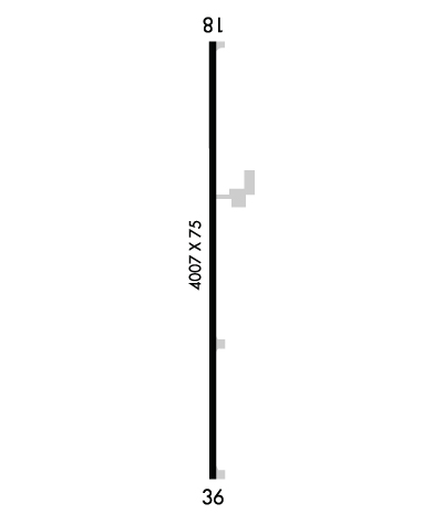 Airport Diagram might not be current. | |
| Facility Name: | MC GEHEE MUNI |
| City Name: | MC GEHEE |
| County: | DESHA |
| State abbrev: | AR |
| State Name: | ARKANSAS |
| Ownership: | PUBLICLY OWNED |
| Use: | OPEN TO THE PUBLIC |
| Owner's Name: | CITY OF MC GEHEE |
| Address: | P.O. BOX 612 |
| MC GEHEE, AR 71654 | |
| Owner's Phone: | 870-222-3160 |
| Manager's Name: | BILL SIMMONS |
| Address: | P.O. BOX 612 |
| MC GEHEE, AR 71654 | |
| Phone: | 870-919-5172 |
| FAA Region: | SOUTHWEST |
| FAA Field Office: | AOK |
| Date | Sunrise | Sunset |
|---|---|---|
| 04/17/24 Wednesday | 6:32 | 19:39 |
| 04/18/24 Thursday | 6:30 | 19:39 |
| 04/19/24 Friday | 6:29 | 19:40 |
| 04/20/24 Saturday | 6:28 | 19:41 |
| 04/21/24 Sunday | 6:27 | 19:42 |
| 04/22/24 Monday | 6:26 | 19:42 |
| 04/23/24 Tuesday | 6:25 | 19:43 |
| 04/24/24 Wednesday | 6:24 | 19:44 |
| 04/25/24 Thursday | 6:22 | 19:45 |
| 04/26/24 Friday | 6:21 | 19:45 |
| 04/27/24 Saturday | 6:20 | 19:46 |
| 04/28/24 Sunday | 6:19 | 19:47 |
| 04/29/24 Monday | 6:18 | 19:48 |
| 04/30/24 Tuesday | 6:17 | 19:48 |
| Airport Attendance Schedule | FEB - OCT MON-FRI 0800-1700; FOR SRVC AFT HRS CALL 870-644-0069 OR 870-222-8830 |
| Airport Status | OPERATIONAL (This Status can change at any time - please check NOTAMS) |
| Airport Lighting Schedule | SS-SR |
| Airport Storage Available | Tie Downs |
| Extra Services Available | Crop Dusting |
| Wind Indicator | YES - (unlit) |
| Control Tower | NO |
| CTAF Frequency | 122.900 |
| Unicom Frequency | |
| Rotating Beacon Color | WG |
| Segmented Circle | YES |
| Landing Fee | NO |
| Airport Inspected | STATE - performed by STATE AERONAUTICAL PERSONNEL |
| Inspection Date | 05/17/2022 |
| Type of Fuel Available | Grade 100LL, JET A (freeze point -40C); -1024 HR SELF SERVICE FUEL AVBL WITH CREDIT CARD. |
| Airframe Repair Service | None |
| Power Plant Repair Service | None |
| Latitude | N3337.2 |
| Longitude | W09121.9 (ESTIMATED) |
| Arpt Elevation | 141ft (SURVEYED) |
| Magnetic Variation | 01E |
| 2 miles E | of MC GEHEE |
| Traffic Pattern Altitude | |
| Sectional Chart | MEMPHIS |
| Operations (Reported) | Yearly | Avg. Daily |
|---|---|---|
| General Aviation Transient | 5000 | 14 |
| General Aviation Local | 20000 | 55 |
| Air Taxi | 0 | 0 |
| Commerical | 0 | 0 |
| Commuter | 0 | 0 |
| Military | 100 | 0 |
| Aircraft based on Field | |
|---|---|
| General Aviation Singles | 10 |
| General Aviation Multi | 0 |
| Jet Aircraft | 0 |
| General Aviation Helicopters | 0 |
| Military Aircraft | 0 |
| Gliders | 0 |
| Ultralights | 0 |
| FSS on field | NO |
| FSS tie-in | JONESBORO |
| FSS Phone | 1-800-WX-BRIEF |
| Who issues Notams | JBR |
| Notam D service at airport | YES |
| ARTCC Name | MEMPHIS |
| Airport Certification | |
| Aircraft Rescue & Firefighting Index | None |
| Airport of Entry | No |
| Custom Landing Rights | No |
| Joint Civil/Military | No |
| Military Landing rights | YES |
| NATIONAL PLAN OF INTEGRATED AIRPORT SYSTEMS (NPIAS) |
| GRANT AGREEMENTS UNDER FAAP/ADAP/AIP |
| ASSURANCES PURSUANT TO TITLE VI, CIVIL RIGHTS ACT OF 1964 |
| THIS AIRPORT HAS BEEN SURVEYED BY THE NATIONAL GEODETIC SURVEY. |
| RY 36 TURNAROUND HAS 3-4 FT DROP-OFF ON EAST & NORTH SIDE. |
| NUMEROUS AGRICULTURE ACFT OPS FROM FEB-NOV 500 FT AGL AND BELOW. |
| FOR CD CTC MEMPHIS ARTCC AT 901-368-8453/8449. |
Airport Communications & Frequencies:
| |||||||
| Runway: 18 | Runway: 36 | ||
| Mag heading: | 180° | Mag heading: | 0° |
| Rwy Slope: | .00% | Rwy Slope: | .00% |
| Approach: | Approach: | ||
| Pattern: | Left Traffic | Pattern: | Left Traffic |
| Markings: | NONPRECISION INSTRUMENT | Markings: | NONPRECISION INSTRUMENT |
| Marking Condition: | FAIR | Marking Condition: | FAIR |
| Arresting Dev: | Arresting Dev: | ||
| Lat & Long: | N3337.5 W09121.9 | Lat. & Long.: | N3336.9 W09121.9 |
| Elev: | 141.0 ft. MSL | Elev: | 141.0 ft. MSL |
| TCH: | TCH: | ||
| Visual Glide Path: | Visual Glide Path: | ||
| Displaced Threshold: | No | Displaced Threshold: | No |
| Touchdown Zone: | YES | Touchdown Zone: | YES |
| Touchdown Elev.: | 141.0 feet | Touchdown Elev.: | 141.0 feet |
| Visual Glide Slope: | Visual Glide Slope: | ||
| RVR Equipment: | RVR Equipment: | ||
| RVV Equipment: | NO | RVV Equipment: | NO |
| Approach Lights: | Approach Lights: | ||
| REIL: | NO | REIL: | NO |
| Centerline Lights: | NO | Centerline Lights: | NO |
| Touchdown lights: | NO | Touchdown lights: | NO |
| Runway Category: | Runway with a Visual Approach | Runway Category: | Runway with a Visual Approach |
| Declared Distances: | Declared Distances: | ||
| Obstructions: | TREES | Obstructions: | |
| Marked: | NOT Marked/Lighted | Marked: | |
| Clearance slope: | 12:1 | Clearance slope: | 50:1 |
| Obstruction height: | 33 feet AGL | Obstruction height: | |
| Dist. from runway: | 600 feet | Dist. from runway: | |
| Centerline offset: | 300 right of centerline | Centerline offset: | |
| Comments: | DITCH 100 FT B0TH SIDES OF EXTDD CNTRLN APRXLY 3 FT DEEP. | Comments: | EROSION FM END OF CULVERT TOWARD CNTR, BOTH SIDES 6 FT LONG 1-3 FT DEEP. |
