Current Weather/Notams (Metars, TAFs, Notams, NWS Forecast, PIREPS, and nearby weather)
Customs Information Send updates to Support@FltPlan.com
Customs Not Available
Database effective 05/16/2024
Airport Diagram might not be current.
|
| Facility Name: | CAIRO-GRADY COUNTY |
| City Name: | CAIRO |
| County: | GRADY |
| State abbrev: | GA |
| State Name: | GEORGIA |
| | |
| Ownership: | PUBLICLY OWNED |
| Use: | OPEN TO THE PUBLIC |
| Owner's Name: | CITY OF CAIRO |
| Address: | BOX 29 |
| | CAIRO, GA 39828 |
| Owner's Phone: | 229-377-1722 |
| | |
| Manager's Name: | JULIAN BROWN, CITY MGR |
| Address: | PO BOX 29, 259 EDNA LANE |
| | CAIRO, GA 39828 |
| Phone: | 229-377-1722 |
| | |
| FAA Region: | SOUTHERN |
| FAA Field Office: | ATL |
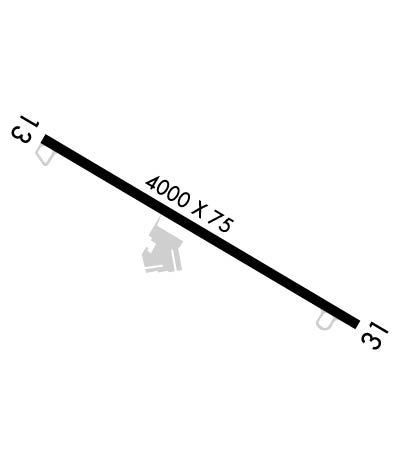
Runway Identifications
Runway Identification: 13/31Length: 4000 ft
Width: 75 ft
Surface: ASPHALT-GOOD CONDITION
Edge lights: Medium IntensityTreatment: NONE
| | Runway: 13 | | Runway: 31 |
| Mag heading: | 125° | Mag heading: | 305° |
| Rwy Slope: | -.69% Down | Rwy Slope: | .69% Up |
| Approach: | | Approach: | |
| Pattern: | Left Traffic | Pattern: | Left Traffic |
| Markings: | NONPRECISION INSTRUMENT | Markings: | NONPRECISION INSTRUMENT |
| Marking Condition: | GOOD | Marking Condition: | GOOD |
| Arresting Dev: | | Arresting Dev: | |
| Lat & Long: | N3053.4 W08409.6 | Lat. & Long.: | N3053.1 W08409.0 |
| Elev: | 263.6 ft. MSL | Elev: | 236.2 ft. MSL |
| TCH: | 34 ft. AGL | TCH: | 27 ft. AGL |
| Visual Glide Path: | 3.50 degrees | Visual Glide Path: | 3.00 degrees |
| Displaced Threshold: | No | Displaced Threshold: | No |
| Touchdown Zone: | YES | Touchdown Zone: | YES |
| Touchdown Elev.: | 263.7 feet | Touchdown Elev.: | 260.5 feet |
| Visual Glide Slope: | 2-Light PAPI on LEFT side of Runway | Visual Glide Slope: | 2-Light PAPI on LEFT side of Runway |
| RVR Equipment: | | RVR Equipment: | |
| RVV Equipment: | NO | RVV Equipment: | NO |
| Approach Lights: | | Approach Lights: | |
| REIL: | NO | REIL: | NO |
| Centerline Lights: | NO | Centerline Lights: | NO |
| Touchdown lights: | NO | Touchdown lights: | NO |
| Runway Category: | Runway with a Non-precision Approach | Runway Category: | Runway with a Non-precision Approach |
| Declared Distances: | | Declared Distances: | |
| Obstructions: | TREES | Obstructions: | TREES |
| Marked: | NOT Marked/Lighted | Marked: | NOT Marked/Lighted |
| Clearance slope: | 16:1 | Clearance slope: | 5:1 |
| Obstruction height: | 20 feet AGL | Obstruction height: | 8 feet AGL |
| Dist. from runway: | 520 feet | Dist. from runway: | 240 feet |
| Centerline offset: | 125 right of centerline | Centerline offset: | 242 feet right of centerline |
| Comments: | | Comments: | |

