Click here for more info on on SMS!

K6S1

BRIDGER MUNI
BRIDGER
MT
Time Zone: Mountain
Lat: N 4517.5
Long: W 10855.5
Elev: 3720
Var: -15
Longest Runway: 3400
CTAF: 122.9

FBO & Flight Services info for K6S1

FBOs: Update your Fuel Prices

AIRPORTPh: 406-662-3319
-
Freq: 122.9
Service
Jet
100LL
SAF
MoGas
Fuel Avail: NO FUEL AVAILABLE
Full        Last Update: 04/24/2024 06:02:16

Self        
If you are an FBO, call 1-203-262-1700 to update your info or email: FltPlan.Advertising@garmin.com
Advertise your FBO on FltPlan.com

Runway & Approach Info for K6S1
Rwy
Length
Land Dist**
Approach*
  Rwy
Length
Land Dist**
Approach*
16
3400x42  3280'          
 
  
34
  3400x42  2925'          
 
 * only ILS, LOC, LDA, and SDF approaches to a specific runway are shown
** For any Declared Landing Distance Available, please see A/FD or Approach plates
Runway Weight Capability (lbs.) Help
Runway IDSingle WheelDouble WheelDouble Tandem WheelDual Double Wheel
16/344,000N/AN/AN/A
These numbers are Advisory and are not limits.   The Airport Manager should have more accurate Weight Limits
Approach Charts
FltPlan does not have IFR approach charts available for K6S1.
Current Weather/Notams
Customs Information Send updates to Support@FltPlan.com
Customs Not Available
Database effective 05/16/2024
Airport Diagram of K6S1
Airport Diagram might not be current.

Facility Name: BRIDGER MUNI
City Name: BRIDGER
County: CARBON
State abbrev: MT
State Name: MONTANA
   
Ownership: PUBLICLY OWNED
Use: OPEN TO THE PUBLIC
Owner's Name: CITY OF BRIDGER/CARBON CO
Address: PO BOX 368
 BRIDGER, MT 59014
Owner's Phone: 406-662-3677
  
Manager's Name: MARK DERUDDER
Address: PO BOX 368
 BRIDGER, MT 59014
Phone: 406-662-3505; CELL # 406-698-3505
   
FAA Region: NORTHWEST MOUNTAIN
FAA Field Office: HLN


Sunrise / Sunset times for BRIDGER MUNI

DateSunriseSunset
04/23/24 Tuesday6:1620:13
04/24/24 Wednesday6:1420:14
04/25/24 Thursday6:1220:15
04/26/24 Friday6:1120:17
04/27/24 Saturday6:0920:18
04/28/24 Sunday6:0820:19
04/29/24 Monday6:0620:21
04/30/24 Tuesday6:0520:22
05/01/24 Wednesday6:0320:23
05/02/24 Thursday6:0220:24
05/03/24 Friday6:0020:26
05/04/24 Saturday5:5920:27
05/05/24 Sunday5:5720:28
05/06/24 Monday5:5620:29

Airport Facilities

Airport Attendance ScheduleUNATTENDED
Airport Status OPERATIONAL (This Status can change at any time - please check NOTAMS)
Airport Lighting ScheduleACTVT LIRL RY 16/34, PAPI RY 34 - CTAF.
Airport Storage AvailableTie Downs
Extra Services AvailableNONE
Wind IndicatorYES - (lighted)
Control TowerNO
CTAF Frequency122.900
Unicom Frequency
Rotating Beacon ColorWG
Segmented CircleYES
Landing FeeNO

Airport Inspection Data

Airport InspectedSTATE - performed by STATE AERONAUTICAL PERSONNEL
Inspection Date05/17/2022

Airport Services

Type of Fuel AvailableNone
Airframe Repair ServiceNONE
Power Plant Repair ServiceNONE

Geographic Data

LatitudeN4517.5
LongitudeW10855.5 (ESTIMATED)
Arpt Elevation3720ft (ESTIMATED)
Magnetic Variation15E
0 miles Wof BRIDGER
Traffic Pattern Altitude
Sectional ChartBILLINGS

Aircraft Data

Operations (Reported)YearlyAvg. Daily
General Aviation Transient 3001
General Aviation Local 12003
Air Taxi 00
Commerical 00
Commuter 00
Military 00
Aircraft based on Field
General Aviation Singles 2
General Aviation Multi 0
Jet Aircraft 0
General Aviation Helicopters 0
Military Aircraft 0
Gliders 0
Ultralights 0

FAA Services

FSS on field NO
FSS tie-in GREAT FALLS
FSS Phone 1-800-WX-BRIEF
Who issues Notams GTF
Notam D service at airport YES
ARTCC Name SALT LAKE CITY

Federal Status

Airport Certification
Aircraft Rescue & Firefighting IndexNone
Airport of EntryNo
Custom Landing RightsNo
Joint Civil/MilitaryNo
Military Landing rightsNo

Remarks

DEER AND WATERFOWL ON AND INVOF ARPT.
FOR CD CTC BILLINGS APCH AT 406-255-2798
RWY 16/3 4 LIRL NSTD. WEST SIDE 57 FT FROM PAVEMENT EDGE; EAST SIDE 47 FT FROM PAVEMENT EDGE. EACH THR HAS 4 LGTS TOTAL.
Runway Identifications
Runway Identification: 16/34
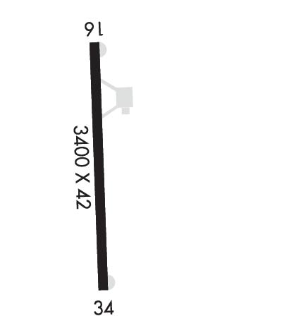
Length: 3400 ft
Width: 42 ft
Surface: ASPHALT-GOOD CONDITION
Edge lights: Non-Standard Lighting System

Treatment: NONE

 Runway: 16   Runway: 34
Mag heading: N/AMag heading: N/A
Approach: Approach:
Pattern: Left TrafficPattern: Right Traffic
Markings: BASICMarkings: BASIC
Marking Condition: GOODMarking Condition: GOOD; RWY 34 DTHR MKD BY NRS; 2880 FT AVBL FOR NIGHT OPR.
Arresting Dev: Arresting Dev:
Lat & Long:   Lat. & Long.:   
Elev: N/AElev: N/A
TCH: TCH:
Visual Glide Path: Visual Glide Path: 3.00 degrees
Displaced Threshold: 120 feet; RWY 16 THR RELOCATED 120 FT FOR NGT OPS ONLY NOT MARKED.Displaced Threshold: 475 feet
Touchdown Zone: NOTouchdown Zone: NO
Touchdown Elev.: Touchdown Elev.:
Visual Glide Slope: Visual Glide Slope: 2-Light PAPI on LEFT side of Runway
RVR Equipment: RVR Equipment:
RVV Equipment: NORVV Equipment: NO
Approach Lights: Approach Lights:
REIL: NOREIL: NO
Centerline Lights: NOCenterline Lights: NO
Touchdown lights: NOTouchdown lights: NO
Runway Category: Runway with a Visual ApproachRunway Category: Runway with a Visual Approach
Declared Distances: Declared Distances:
Obstructions: TREEObstructions:
Marked: NOT Marked/LightedMarked:
Clearance slope: 2:1Clearance slope: 20:1; ACPH RATIO 50:1 FM DSPLCD THLD.
Obstruction height: 30 feet AGLObstruction height:
Dist. from runway: 262 feetDist. from runway:
Centerline offset: 96 left of centerlineCenterline offset:
Comments: RWY 16 +4 FT FENCE 140 FT FM END OF RWY, +15 FT ROAD 161 FT FM END OF RWY, ALL XNG RWY CNTRLN PERPENDICULAR. 9 FT SIGN 100 L CNTRLN 142 FT FM END OF RWY.Comments: RWY 34 +4FT FENCE 65 FT L & PARL TO RWY; SIGN 66 FT L & 65 FT FM END OF RWY; +60 FT POLES IN TRANS SURF W SIDE OF RWY 34 THLD. RWY 34 3% UPHILL GRADE.
C:/P: