Approach Charts
| FltPlan does not have IFR approach charts available for K6I4. |
Current Weather/Notams (Metars, TAFs, Notams, NWS Forecast, PIREPS, and nearby weather)
Customs Information Send updates to Support@FltPlan.com
Customs Not Available
Database effective 04/18/2024
Airport Diagram might not be current.
|
| Facility Name: | BOONE COUNTY |
| City Name: | LEBANON |
| County: | BOONE |
| State abbrev: | IN |
| State Name: | INDIANA |
| | |
| Ownership: | PRIVATELY OWNED |
| Use: | OPEN TO THE PUBLIC |
| Owner's Name: | DONALD A. GEISLER AND KAY GEISLER |
| Address: | 1600 E 250 S |
| | LEBANON, IN 46052 |
| Owner's Phone: | 765-482-0940 |
| | |
| Manager's Name: | RAY RICE |
| Address: | 1600 E 250 S |
| | LEBANON, IN 46052 |
| Phone: | 317-281-6791 |
| | |
| FAA Region: | GREAT LAKES |
| FAA Field Office: | CHI |
Runway Identifications
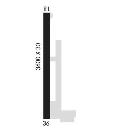
Runway Identification: 18/36Length: 3600 ft
Width: 30 ft
Surface: CONCRETE-POOR CONDITION
Edge lights: Non-Standard Lighting SystemTreatment: NONE
| | Runway: 18 | | Runway: 36 |
| Mag heading: | N/A | Mag heading: | N/A |
| Rwy Slope: | .25% Up | Rwy Slope: | -.25% Down |
| Approach: | | Approach: | |
| Pattern: | Left Traffic | Pattern: | Left Traffic |
| Markings: | BASIC | Markings: | BASIC |
| Marking Condition: | FAIR | Marking Condition: | FAIR |
| Arresting Dev: | | Arresting Dev: | |
| Lat & Long: | N4000.8 W08626.4 | Lat. & Long.: | N4000.2 W08626.4 |
| Elev: | 950.0 ft. MSL | Elev: | 959.0 ft. MSL |
| TCH: | | TCH: | |
| Visual Glide Path: | | Visual Glide Path: | |
| Displaced Threshold: | No | Displaced Threshold: | 200 feet |
| Touchdown Zone: | NO | Touchdown Zone: | NO |
| Touchdown Elev.: | | Touchdown Elev.: | |
| Visual Glide Slope: | | Visual Glide Slope: | |
| RVR Equipment: | | RVR Equipment: | |
| RVV Equipment: | NO | RVV Equipment: | NO |
| Approach Lights: | | Approach Lights: | |
| REIL: | NO | REIL: | NO |
| Centerline Lights: | NO | Centerline Lights: | NO |
| Touchdown lights: | NO | Touchdown lights: | NO |
| Runway Category: | Runway with a Visual Approach | Runway Category: | Runway with a Visual Approach |
| Declared Distances: | | Declared Distances: | |
| Obstructions: | CROPS | Obstructions: | TREE; CROPS |
| Marked: | NOT Marked/Lighted | Marked: | NOT Marked/Lighted |
| Clearance slope: | | Clearance slope: | 6:1; RY 36 APCH RATIO 12:1 TO DSPLCD THR. |
| Obstruction height: | 10 feet AGL | Obstruction height: | 65 feet AGL |
| Dist. from runway: | 201 feet | Dist. from runway: | 610 feet |
| Centerline offset: | | Centerline offset: | 110 feet left of centerline |
| Comments: | RWY 18 -15 FT CREEK 37 FT FM RY END ON CNTRLN; 5 FT BRUSH 80 FT FM RY END. | Comments: | RWY 36 15 FT ROAD, 110 FT FR RWY END. |

