Current Weather/Notams (Metars, TAFs, Notams, NWS Forecast, PIREPS, and nearby weather)
Customs Information Send updates to Support@FltPlan.com
Customs Not Available
Database effective 05/16/2024
Airport Diagram might not be current.
|
| Facility Name: | IOSCO COUNTY |
| City Name: | EAST TAWAS |
| County: | IOSCO |
| State abbrev: | MI |
| State Name: | MICHIGAN |
| | |
| Ownership: | PUBLICLY OWNED |
| Use: | OPEN TO THE PUBLIC |
| Owner's Name: | IOSCO COUNTY |
| Address: | 422 LAKE ST |
| | TAWAS CITY, MI 48763 |
| Owner's Phone: | 989-362-5832 |
| | |
| Manager's Name: | JAY SAMUELS |
| Address: | 1131 AULERICH RD |
| | EAST TAWAS, MI 48730-9565 |
| Phone: | 989-305-0126 |
| | |
| FAA Region: | GREAT LAKES |
| FAA Field Office: | DET |
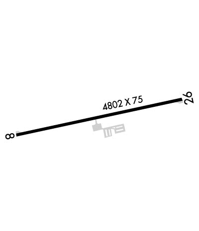
Runway Identifications
Runway Identification: 08/26Length: 4802 ft
Width: 75 ft
Surface: ASPHALT-GOOD CONDITION
Edge lights: Medium IntensityTreatment: NONE
| | Runway: 08 | | Runway: 26 |
| Mag heading: | 86° | Mag heading: | 266° |
| Rwy Slope: | -.02% Down | Rwy Slope: | .02% Up |
| Approach: | | Approach: | |
| Pattern: | Left Traffic | Pattern: | Left Traffic |
| Markings: | NONPRECISION INSTRUMENT | Markings: | NONPRECISION INSTRUMENT |
| Marking Condition: | GOOD | Marking Condition: | GOOD |
| Arresting Dev: | | Arresting Dev: | |
| Lat & Long: | N4418.7 W08325.9 | Lat. & Long.: | N4418.9 W08324.8 |
| Elev: | 605.3 ft. MSL | Elev: | 604.2 ft. MSL |
| TCH: | 39 ft. AGL | TCH: | 32 ft. AGL |
| Visual Glide Path: | 3.00 degrees | Visual Glide Path: | 3.00 degrees |
| Displaced Threshold: | No | Displaced Threshold: | No |
| Touchdown Zone: | YES | Touchdown Zone: | YES |
| Touchdown Elev.: | 605.3 feet | Touchdown Elev.: | 604.6 feet |
| Visual Glide Slope: | 2-Light PAPI on LEFT side of Runway | Visual Glide Slope: | 2-Light PAPI on LEFT side of Runway |
| RVR Equipment: | | RVR Equipment: | |
| RVV Equipment: | NO | RVV Equipment: | NO |
| Approach Lights: | | Approach Lights: | |
| REIL: | YES | REIL: | YES |
| Centerline Lights: | NO | Centerline Lights: | NO |
| Touchdown lights: | NO | Touchdown lights: | NO |
| Runway Category: | Runway with a Non-precision Approach | Runway Category: | Runway with a Visual Approach |
| Declared Distances: | | Declared Distances: | |
| Obstructions: | TREE | Obstructions: | TREE |
| Marked: | NOT Marked/Lighted | Marked: | NOT Marked/Lighted |
| Clearance slope: | 18:1 | Clearance slope: | 4:1 |
| Obstruction height: | 12 feet AGL | Obstruction height: | 34 feet AGL |
| Dist. from runway: | 421 feet | Dist. from runway: | 363 feet |
| Centerline offset: | 270 right of centerline | Centerline offset: | 278 feet right of centerline |
| Comments: | | Comments: | |

