Approach Charts
| FltPlan does not have IFR approach charts available for K5U8. |
Current Weather/Notams (Metars, TAFs, Notams, NWS Forecast, PIREPS, and nearby weather)
Customs Information Send updates to Support@FltPlan.com
Customs Not Available
Database effective 05/16/2024
Airport Diagram might not be current.
|
| Facility Name: | GERALDINE |
| City Name: | GERALDINE |
| County: | CHOUTEAU |
| State abbrev: | MT |
| State Name: | MONTANA |
| | |
| Ownership: | PUBLICLY OWNED |
| Use: | OPEN TO THE PUBLIC |
| Owner's Name: | GERALDINE AND CHOTEAU CO |
| Address: | COUNTY COURTHOUSE |
| | FT BENTON, MT 59442 |
| Owner's Phone: | 406-622-5151 |
| | |
| Manager's Name: | LESTER L HANKINS |
| Address: | 427 BROADWAY AVE. SQUARE BUTTE |
| | GERALDINE, MT 59446 |
| Phone: | 406-737-4244 |
| | |
| FAA Region: | NORTHWEST MOUNTAIN |
| FAA Field Office: | HLN |
Runway Identifications
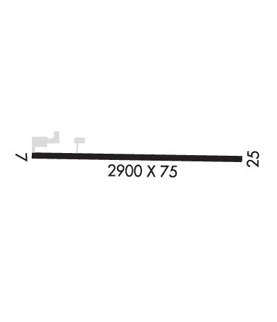
Runway Identification: 08/26Length: 2900 ft
Width: 60 ft
Surface: ASPHALT
Edge lights: Medium IntensityTreatment: NONE
| | Runway: 08 | | Runway: 26 |
| Mag heading: | 74° | Mag heading: | 254° |
| Rwy Slope: | -1.36% Down | Rwy Slope: | 1.36% Up |
| Approach: | | Approach: | |
| Pattern: | Left Traffic | Pattern: | Left Traffic |
| Markings: | BASIC | Markings: | BASIC |
| Marking Condition: | GOOD | Marking Condition: | GOOD |
| Arresting Dev: | | Arresting Dev: | |
| Lat & Long: | N4735.8 W11016.3 | Lat. & Long.: | N4735.8 W11015.6 |
| Elev: | 3185.4 ft. MSL | Elev: | 3145.9 ft. MSL |
| TCH: | | TCH: | |
| Visual Glide Path: | | Visual Glide Path: | |
| Displaced Threshold: | No | Displaced Threshold: | No |
| Touchdown Zone: | YES | Touchdown Zone: | YES |
| Touchdown Elev.: | 3185.4 feet | Touchdown Elev.: | 3185.4 feet |
| Visual Glide Slope: | | Visual Glide Slope: | |
| RVR Equipment: | | RVR Equipment: | |
| RVV Equipment: | NO | RVV Equipment: | NO |
| Approach Lights: | | Approach Lights: | |
| REIL: | NO | REIL: | NO |
| Centerline Lights: | NO | Centerline Lights: | NO |
| Touchdown lights: | NO | Touchdown lights: | NO |
| Runway Category: | Runway with a Visual Approach | Runway Category: | Runway with a Visual Approach |
| Declared Distances: | | Declared Distances: | |
| Obstructions: | GND | Obstructions: | |
| Marked: | NOT Marked/Lighted | Marked: | |
| Clearance slope: | 12:1 | Clearance slope: | 20:1 |
| Obstruction height: | 15 feet AGL | Obstruction height: | |
| Dist. from runway: | 385 feet | Dist. from runway: | |
| Centerline offset: | | Centerline offset: | |
| Comments: | RISING TERRAIN AT 13:1 STARTING AT 150 FT FM RWY END TO A MAX HEIGHT OF +15 FT AT 385 FT FM END OF RWY. | Comments: | |

