Click here for more info on on SMS!

K5S0

OAKRIDGE STATE
OAKRIDGE
OR
Time Zone: Pacific
Lat: N 4345.2
Long: W 12230.3
Elev: 1393
Var: -19
Longest Runway: 3610
CTAF: 122.9

FBO & Flight Services info for K5S0

FBOs: Update your Fuel Prices

AIRPORTPh: 503-378-4880
-
-
Service
Jet
100LL
SAF
MoGas
Fuel Avail: NO FUEL AVAILABLE
Full        Last Update: 04/25/2024 05:27:32

Self        
If you are an FBO, call 1-203-262-1700 to update your info or email: FltPlan.Advertising@garmin.com
Advertise your FBO on FltPlan.com

Runway & Approach Info for K5S0
Rwy
Length
Land Dist**
Approach*
  Rwy
Length
Land Dist**
Approach*
09
3610x47  3610'          
 
  
27
  3610x47  3610'          
 
 * only ILS, LOC, LDA, and SDF approaches to a specific runway are shown
** For any Declared Landing Distance Available, please see A/FD or Approach plates
Runway Weight Capability (lbs.) Help
Runway IDSingle WheelDouble WheelDouble Tandem WheelDual Double Wheel
09/27N/AN/AN/AN/A
These numbers are Advisory and are not limits.   The Airport Manager should have more accurate Weight Limits
Approach Charts
FltPlan does not have IFR approach charts available for K5S0.
Current Weather/Notams
Customs Information Send updates to Support@FltPlan.com
Customs Not Available
Database effective 05/16/2024
Airport Diagram of K5S0
Airport Diagram might not be current.

Facility Name: OAKRIDGE STATE
City Name: OAKRIDGE
County: LANE
State abbrev: OR
State Name: OREGON
   
Ownership: PUBLICLY OWNED
Use: OPEN TO THE PUBLIC
Owner's Name: OREGON DEPARTMENT OF AVIATION
Address: 3040 25TH ST, SE
 SALEM, OR 97310
Owner's Phone: 503-378-4880
  
Manager's Name: STATE AIRPORTS MGR.
Address: 3040 25TH ST, SE
 SALEM, OR 97310
Phone: 503-378-4880
   
FAA Region: NORTHWEST MOUNTAIN
FAA Field Office: SEA


Sunrise / Sunset times for OAKRIDGE STATE

DateSunriseSunset
04/24/24 Wednesday6:1120:05
04/25/24 Thursday6:1020:07
04/26/24 Friday6:0820:08
04/27/24 Saturday6:0720:09
04/28/24 Sunday6:0520:10
04/29/24 Monday6:0420:11
04/30/24 Tuesday6:0220:13
05/01/24 Wednesday6:0120:14
05/02/24 Thursday6:0020:15
05/03/24 Friday5:5820:16
05/04/24 Saturday5:5720:17
05/05/24 Sunday5:5620:18
05/06/24 Monday5:5420:20
05/07/24 Tuesday5:5320:21

Airport Facilities

Airport Attendance ScheduleUNATTENDED
Airport Status OPERATIONAL (This Status can change at any time - please check NOTAMS)
Airport Lighting Schedule
Airport Storage AvailableTie Downs
Extra Services AvailableNONE
Wind IndicatorYES - (unlit)
Control TowerNO
CTAF Frequency122.900
Unicom Frequency
Rotating Beacon Color
Segmented CircleYES; SEGMENTED CIRCLE MKD WITH ORANGE AND WHITE TIRES.
Landing FeeNO

Airport Inspection Data

Airport InspectedSTATE - performed by STATE AERONAUTICAL PERSONNEL
Inspection Date06/22/2023

Airport Services

Type of Fuel AvailableNone
Airframe Repair ServiceNONE
Power Plant Repair ServiceNONE

Geographic Data

LatitudeN4345.2
LongitudeW12230.3 (ESTIMATED)
Arpt Elevation1393ft (ESTIMATED)
Magnetic Variation19E
1 miles Wof OAKRIDGE
Traffic Pattern Altitude
Sectional ChartKLAMATH FALLS

Aircraft Data

Operations (Reported)YearlyAvg. Daily
General Aviation Transient 12003
General Aviation Local 2001
Air Taxi 3001
Commerical 00
Commuter 00
Military 00
Aircraft based on Field
General Aviation Singles 5
General Aviation Multi 0
Jet Aircraft 0
General Aviation Helicopters 0
Military Aircraft 0
Gliders 0
Ultralights 0

FAA Services

FSS on field NO
FSS tie-in MC MINNVILLE
FSS Phone 1-800-WX-BRIEF
Who issues Notams MMV
Notam D service at airport YES
ARTCC Name SEATTLE

Federal Status

Airport Certification
Aircraft Rescue & Firefighting IndexNone
Airport of EntryNo
Custom Landing RightsNo
Joint Civil/MilitaryNo
Military Landing rightsNo

Remarks

USFS HELICOPTERS ACTIVE INVOF ARPT DURING FIRE SEASON.
DEER AND ELK ON AND INVOF ARPT.
IRREGULAR WINTER MAINTENANCE; ARPT MAY BE CLOSED BY SNOW.
SURFACE CONDITIONS NOT REPORTED.
FOR CD CTC SEATTLE ARTCC AT 253-351-3694.
RWY 09/2 7 NUMEROUS AREAS OF UNSEALED LONGITUDINAL AND TRANSVERSE CRACKING ALONG FULL LENGTH OF RUNWAY.
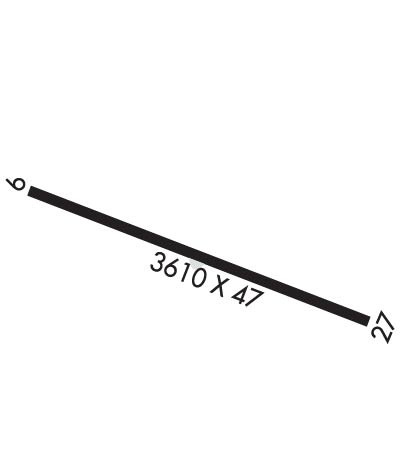
Runway Identifications
Runway Identification: 09/27
Length: 3610 ft
Width: 47 ft
Surface: ASPHALT-POOR CONDITION
Edge lights:

Treatment: NONE

 Runway: 09   Runway: 27
Mag heading: 84°Mag heading: 264°
Rwy Slope: -.72% DownRwy Slope: .72% Up
Approach: Approach:
Pattern: Left TrafficPattern: Left Traffic
Markings: BASICMarkings: BASIC
Marking Condition: FAIRMarking Condition: FAIR
Arresting Dev: Arresting Dev:
Lat & Long: N4345.2  W12230.7Lat. & Long.: N4345.1  W12229.9
Elev: 1393.0 ft. MSLElev: 1367.0 ft. MSL
TCH: TCH:
Visual Glide Path: Visual Glide Path:
Displaced Threshold: NoDisplaced Threshold: No
Touchdown Zone: NOTouchdown Zone: NO
Touchdown Elev.: Touchdown Elev.:
Visual Glide Slope: Visual Glide Slope:
RVR Equipment: RVR Equipment:
RVV Equipment: NORVV Equipment: NO
Approach Lights: Approach Lights:
REIL: NOREIL: NO
Centerline Lights: NOCenterline Lights: NO
Touchdown lights: NOTouchdown lights: NO
Runway Category: Runway with a Visual ApproachRunway Category: Runway with a Visual Approach
Declared Distances: Declared Distances:
Obstructions: TREEObstructions: ROAD
Marked: NOT Marked/LightedMarked: NOT Marked/Lighted
Clearance slope: 10:1; BEYOND ROAD SLOPE IS 8:1 BASED ON 130' TREE AT 1275' FROM RUNWAY END AND 100' RIGHT OF CENTERLINE.Clearance slope: 6:1
Obstruction height: 65 feet AGLObstruction height: 28 feet AGL
Dist. from runway: 850 feetDist. from runway: 390 feet
Centerline offset: 87 left of centerlineCenterline offset:
Comments: RWY 09 +35 FT TREES; 70FT FM RY END 72 FT RIGHT.Comments: TERRAIN RISES SMOOTHLY AT 14:1 FM RY END TO +14 FT AT 200 FT FM RY & CONTINUES TO RISE TO +65 FT AT 920 FT FM RY END ON CNTRLN.
C:/P: