Click here for more info on on SMS!

K5R1

ROY WILCOX
CHATOM
AL
Time Zone: Central
Lat: N 3127.1
Long: W 08811.7
Elev: 166
Var: +01
Longest Runway: 4002
CTAF: 122.8

FBO & Flight Services info for K5R1

FBOs: Update your Fuel Prices

AIRPORTPh: 251-847-2723
-
Freq: 122.8
Service
Jet
100LL
SAF
MoGas
Fuel Avail: NO FUEL AVAILABLE
Full        Last Update: 04/18/2024 05:44:56

Self        
If you are an FBO, call 1-203-262-1700 to update your info or email: FltPlan.Advertising@garmin.com
Advertise your FBO on FltPlan.com

Runway & Approach Info for K5R1
Rwy
Length
Land Dist**
Approach*
  Rwy
Length
Land Dist**
Approach*
12
4002x80  3802'          
 
  
30
  4002x80  4002'          
 
 * only ILS, LOC, LDA, and SDF approaches to a specific runway are shown
** For any Declared Landing Distance Available, please see A/FD or Approach plates
Runway Weight Capability (lbs.) Help
Runway IDSingle WheelDouble WheelDouble Tandem WheelDual Double Wheel
12/3015,000N/AN/AN/A
These numbers are Advisory and are not limits.   The Airport Manager should have more accurate Weight Limits
Approach Charts
Approaches    
Current Weather/Notams
Customs Information Send updates to Support@FltPlan.com
Customs Not Available
Database effective 04/18/2024
Airport Diagram of K5R1
Airport Diagram might not be current.

Facility Name: ROY WILCOX
City Name: CHATOM
County: WASHINGTON
State abbrev: AL
State Name: ALABAMA
   
Ownership: PUBLICLY OWNED
Use: OPEN TO THE PUBLIC
Owner's Name: CITY OF CHATOM
Address: PO BOX 817
 CHATOM, AL 36518
Owner's Phone: 251-847-2580
  
Manager's Name: DALE SINGLETON
Address: PO BOX 817
 CHATOM, AL 36518
Phone: 251-847-2580
   
FAA Region: SOUTHERN
FAA Field Office: JAN


Sunrise / Sunset times for ROY WILCOX

DateSunriseSunset
04/17/24 Wednesday6:2119:23
04/18/24 Thursday6:2019:24
04/19/24 Friday6:1919:25
04/20/24 Saturday6:1819:25
04/21/24 Sunday6:1719:26
04/22/24 Monday6:1619:27
04/23/24 Tuesday6:1519:27
04/24/24 Wednesday6:1419:28
04/25/24 Thursday6:1319:29
04/26/24 Friday6:1219:30
04/27/24 Saturday6:1119:30
04/28/24 Sunday6:1019:31
04/29/24 Monday6:0919:32
04/30/24 Tuesday6:0819:32

Airport Facilities

Airport Attendance ScheduleUNATTENDED
Airport Status OPERATIONAL (This Status can change at any time - please check NOTAMS)
Airport Lighting ScheduleSS-SR
Airport Storage AvailableTie Downs
Extra Services AvailableFlight Instruction, Aircraft Rental
Wind IndicatorYES - (lighted)
Control TowerNO
CTAF Frequency122.800
Unicom Frequency122.800
Rotating Beacon ColorWG
Segmented CircleNO
Landing FeeNO

Airport Inspection Data

Airport InspectedSTATE - performed by STATE AERONAUTICAL PERSONNEL
Inspection Date06/30/2021

Airport Services

Type of Fuel AvailableNone
Airframe Repair ServiceNone
Power Plant Repair ServiceNone

Geographic Data

LatitudeN3127.1
LongitudeW08811.7 (ESTIMATED)
Arpt Elevation166ft (ESTIMATED)
Magnetic Variation01W
3 miles Eof CHATOM
Traffic Pattern Altitude
Sectional ChartNEW ORLEANS

Aircraft Data

Operations (Reported)YearlyAvg. Daily
General Aviation Transient 24127
General Aviation Local 12824
Air Taxi 00
Commerical 00
Commuter 00
Military 00
Aircraft based on Field
General Aviation Singles 6
General Aviation Multi 0
Jet Aircraft 0
General Aviation Helicopters 0
Military Aircraft 0
Gliders 0
Ultralights 0

FAA Services

FSS on field NO
FSS tie-in ANNISTON
FSS Phone 1-800-WX-BRIEF
Who issues Notams ANB
Notam D service at airport YES
ARTCC Name HOUSTON

Federal Status

Airport Certification
Aircraft Rescue & Firefighting IndexNone
Airport of EntryNo
Custom Landing RightsNo
Joint Civil/MilitaryNo
Military Landing rightsNo

Remarks

DEER ON & INVOF RWY.
FOR CD CTC HOUSTON ARTCC AT 281-230-5622.
Airport Communications & Frequencies:
CTAF Frequency:
122.800
Unicom Frequency:
122.800
Remarks
  • APCH/DEP SVC PRVDD BY HOUSTON ARTCC (ZHU) ON FREQS 127.65/285.475 (MOBILE RCAG).
  • Runway Identifications
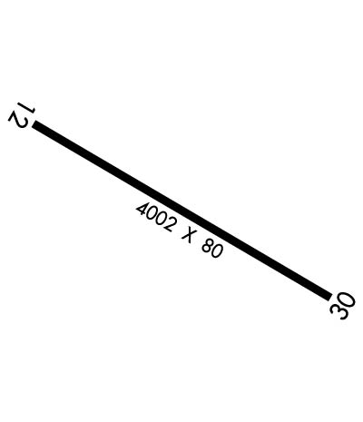
    Runway Identification: 12/30
    Length: 4002 ft
    Width: 80 ft
    Surface: ASPHALT-FAIR CONDITION
    Edge lights: Medium Intensity

    Treatment: NONE

     Runway: 12   Runway: 30
    Mag heading: 121°Mag heading: 301°
    Rwy Slope: -.97% DownRwy Slope: .97% Up
    Approach: Approach:
    Pattern: Left TrafficPattern: Left Traffic
    Markings: NONPRECISION INSTRUMENTMarkings: NONPRECISION INSTRUMENT
    Marking Condition: POOR; RWY 12 MARKINGS FADED.Marking Condition: POOR; RWY 30 MARKINGS FADED.
    Arresting Dev: Arresting Dev:
    Lat & Long: N3127.3  W08812.0Lat. & Long.: N3126.9  W08811.3
    Elev: 165.2 ft. MSLElev: 126.2 ft. MSL
    TCH: TCH:
    Visual Glide Path: Visual Glide Path:
    Displaced Threshold: 200 feetDisplaced Threshold: No
    Touchdown Zone: YESTouchdown Zone: YES
    Touchdown Elev.: 165.2 feetTouchdown Elev.: 129.1 feet
    Visual Glide Slope: Visual Glide Slope:
    RVR Equipment: RVR Equipment:
    RVV Equipment: NORVV Equipment: NO
    Approach Lights: Approach Lights:
    REIL: NOREIL: NO
    Centerline Lights: NOCenterline Lights: NO
    Touchdown lights: NOTouchdown lights: NO
    Runway Category: Runway with a Non-precision Approach having visibility minimums greater than 3/4 mileRunway Category: Runway with a Non-precision Approach having visibility minimums greater than 3/4 mile
    Declared Distances: Declared Distances:
    Obstructions: ROADObstructions: TREE
    Marked: NOT Marked/LightedMarked: NOT Marked/Lighted
    Clearance slope: 14:1; RWY 12 APCH RATIO 27:1 FM DSPLCD THR.Clearance slope: 12:1
    Obstruction height: 13 feet AGLObstruction height: 20 feet AGL
    Dist. from runway: 384 feetDist. from runway: 450 feet
    Centerline offset: 74 left of centerlineCenterline offset: 18 feet left of centerline
    Comments: Comments:
    C:1/P: