Approach Charts
| FltPlan does not have IFR approach charts available for K5N4. |
Current Weather/Notams (Metars, TAFs, Notams, NWS Forecast, PIREPS, and nearby weather)
Customs Information Send updates to Support@FltPlan.com
Customs Not Available
Database effective 05/16/2024
| Facility Name: | SKY HAVEN |
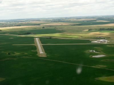
| City Name: | ENDERLIN |
| County: | RANSOM |
| State abbrev: | ND |
| State Name: | NORTH DAKOTA |
| | |
| Ownership: | PUBLICLY OWNED |
| Use: | OPEN TO THE PUBLIC |
| Owner's Name: | ENDERLIN AIRPORT AUTHORITY; CHAIRMAN OF ARPT AUTH BOBBY GESKE. |
| Address: | 13923 53RD ST SE |
| | ENDERLIN, ND 58027 |
| Owner's Phone: | 701-799-6082 |
| | |
| Manager's Name: | BOBBY GESKE |
| Address: | 13923 53RD ST SE |
| | ENDERLIN, ND 58027 |
| Phone: | 701-799-6082; MANAGERS ADDL PHONE 701-437-3437. ADDITIONAL CONTACT IS STEVE LUND AT 701-799-3627. |
| | |
| FAA Region: | GREAT LAKES |
| FAA Field Office: | DMA |
Runway Identifications
Runway Identification: 12/30Length: 2855 ft
Width: 40 ft
Surface: ASPHALT-GOOD CONDITION
Edge lights: Low IntensityTreatment: NONE
| | Runway: 12 | | Runway: 30 |
| Mag heading: | N/A | Mag heading: | N/A |
| Rwy Slope: | -.28% Down | Rwy Slope: | .28% Up |
| Approach: | | Approach: | |
| Pattern: | Left Traffic | Pattern: | Left Traffic |
| Markings: | BASIC | Markings: | BASIC |
| Marking Condition: | FAIR | Marking Condition: | FAIR |
| Arresting Dev: | | Arresting Dev: | |
| Lat & Long: | N4637.7 W09737.5 | Lat. & Long.: | N4637.5 W09737.0 |
| Elev: | 1151.0 ft. MSL | Elev: | 1143.0 ft. MSL |
| TCH: | | TCH: | |
| Visual Glide Path: | | Visual Glide Path: | |
| Displaced Threshold: | No | Displaced Threshold: | No |
| Touchdown Zone: | NO | Touchdown Zone: | NO |
| Touchdown Elev.: | | Touchdown Elev.: | |
| Visual Glide Slope: | | Visual Glide Slope: | |
| RVR Equipment: | | RVR Equipment: | |
| RVV Equipment: | NO | RVV Equipment: | NO |
| Approach Lights: | | Approach Lights: | |
| REIL: | NO | REIL: | NO |
| Centerline Lights: | NO | Centerline Lights: | NO |
| Touchdown lights: | NO | Touchdown lights: | NO |
| Runway Category: | Runway with a Visual Approach | Runway Category: | Runway with a Visual Approach |
| Declared Distances: | | Declared Distances: | |
| Obstructions: | ROAD | Obstructions: | |
| Marked: | NOT Marked/Lighted | Marked: | |
| Clearance slope: | 13:1 | Clearance slope: | 20:1 |
| Obstruction height: | 13 feet AGL | Obstruction height: | |
| Dist. from runway: | 380 feet | Dist. from runway: | |
| Centerline offset: | 130 left of centerline | Centerline offset: | |
| Comments: | | Comments: | |