Current Weather/Notams (Metars, TAFs, Notams, NWS Forecast, PIREPS, and nearby weather)
Customs Information Send updates to Support@FltPlan.com
Customs Not Available
Database effective 05/16/2024
Airport Diagram might not be current.
|
| Facility Name: | HARTSELLE/MORGAN COUNTY RGNL |
| City Name: | HARTSELLE |
| County: | MORGAN |
| State abbrev: | AL |
| State Name: | ALABAMA |
| | |
| Ownership: | PUBLICLY OWNED |
| Use: | OPEN TO THE PUBLIC |
| Owner's Name: | CITY OF HARTSELLE |
| Address: | 200 SPARKMAN ST, NW |
| | HARTSELLE, AL 35640 |
| Owner's Phone: | 256-773-2535 |
| | |
| Manager's Name: | STONEY POWELL |
| Address: | 450 AIRPORT RD SW |
| | HARTSELLE, AL 35640 |
| Phone: | 256-773-1130; AFT HRS 256-303-2777. |
| | |
| FAA Region: | SOUTHERN |
| FAA Field Office: | JAN |
Runway Identifications
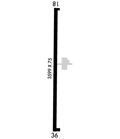
Runway Identification: 18/36Length: 3599 ft
Width: 75 ft
Surface: ASPHALT-GOOD CONDITION
Edge lights: Medium IntensityTreatment: NONE
| | Runway: 18 | | Runway: 36 |
| Mag heading: | 184° | Mag heading: | 4° |
| Rwy Slope: | -.84% Down | Rwy Slope: | .84% Up |
| Approach: | | Approach: | |
| Pattern: | Left Traffic | Pattern: | Left Traffic |
| Markings: | NONPRECISION INSTRUMENT | Markings: | NONPRECISION INSTRUMENT |
| Marking Condition: | GOOD | Marking Condition: | GOOD |
| Arresting Dev: | | Arresting Dev: | |
| Lat & Long: | N3424.8 W08656.0 | Lat. & Long.: | N3424.2 W08656.0 |
| Elev: | 628.5 ft. MSL | Elev: | 598.3 ft. MSL |
| TCH: | | TCH: | 34 ft. AGL |
| Visual Glide Path: | | Visual Glide Path: | 3.00 degrees |
| Displaced Threshold: | No | Displaced Threshold: | No |
| Touchdown Zone: | YES | Touchdown Zone: | YES |
| Touchdown Elev.: | 628.5 feet | Touchdown Elev.: | 619.7 feet |
| Visual Glide Slope: | | Visual Glide Slope: | 2-Box VASI on LEFT side of Runway |
| RVR Equipment: | | RVR Equipment: | |
| RVV Equipment: | NO | RVV Equipment: | NO |
| Approach Lights: | | Approach Lights: | |
| REIL: | NO | REIL: | NO |
| Centerline Lights: | NO | Centerline Lights: | NO |
| Touchdown lights: | NO | Touchdown lights: | NO |
| Runway Category: | Runway with a Non-precision Approach having visibility minimums greater than 3/4 mile | Runway Category: | Runway with a Non-precision Approach having visibility minimums greater than 3/4 mile |
| Declared Distances: | | Declared Distances: | |
| Obstructions: | TREE | Obstructions: | TREE |
| Marked: | NOT Marked/Lighted | Marked: | NOT Marked/Lighted |
| Clearance slope: | 3:1 | Clearance slope: | 5:1 |
| Obstruction height: | 58 feet AGL | Obstruction height: | 87 feet AGL |
| Dist. from runway: | 425 feet | Dist. from runway: | 700 feet |
| Centerline offset: | 149 left of centerline | Centerline offset: | 194 feet right of centerline |
| Comments: | | Comments: | |

