Approach Charts
| FltPlan does not have IFR approach charts available for K5J5. |
Current Weather/Notams (Metars, TAFs, Notams, NWS Forecast, PIREPS, and nearby weather)
Customs Information Send updates to Support@FltPlan.com
Customs Not Available
Database effective 04/18/2024
Airport Diagram might not be current.
|
| Facility Name: | HOLLY HILL |
| City Name: | HOLLY HILL |
| County: | ORANGEBURG |
| State abbrev: | SC |
| State Name: | SOUTH CAROLINA |
| | |
| Ownership: | PUBLICLY OWNED |
| Use: | OPEN TO THE PUBLIC |
| Owner's Name: | TOWN OF HOLLY HILL |
| Address: | PO BOX 1108 |
| | HOLLY HILL, SC 29059 |
| Owner's Phone: | 803-496-3330 |
| | |
| Manager's Name: | BILLY N. CHAVIS |
| Address: | 8423 OLD STATE RD, SUITE # 1, |
| | HOLLY HILL, SC 29059 |
| Phone: | 803-496-3330 |
| | |
| FAA Region: | SOUTHERN |
| FAA Field Office: | ATL |
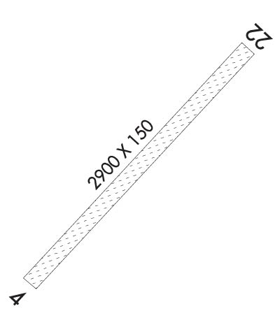
Runway Identifications
Runway Identification: 04/22Length: 3900 ft
Width: 75 ft
Surface: GRASS-GOOD CONDITION
Edge lights: Treatment: NONE
| | Runway: 04 | | Runway: 22 |
| Mag heading: | 48° | Mag heading: | 228° |
| Rwy Slope: | .03% Up | Rwy Slope: | -.03% Down |
| Approach: | | Approach: | |
| Pattern: | Left Traffic | Pattern: | Left Traffic |
| Markings: | | Markings: | |
| Marking Condition: | | Marking Condition: | |
| Arresting Dev: | | Arresting Dev: | |
| Lat & Long: | N3317.9 W08023.8 | Lat. & Long.: | N3318.3 W08023.3 |
| Elev: | 94.0 ft. MSL | Elev: | 95.0 ft. MSL |
| TCH: | | TCH: | |
| Visual Glide Path: | | Visual Glide Path: | |
| Displaced Threshold: | No | Displaced Threshold: | No |
| Touchdown Zone: | NO | Touchdown Zone: | NO |
| Touchdown Elev.: | | Touchdown Elev.: | |
| Visual Glide Slope: | | Visual Glide Slope: | |
| RVR Equipment: | | RVR Equipment: | |
| RVV Equipment: | NO | RVV Equipment: | NO |
| Approach Lights: | | Approach Lights: | |
| REIL: | NO | REIL: | NO |
| Centerline Lights: | NO | Centerline Lights: | NO |
| Touchdown lights: | NO | Touchdown lights: | NO |
| Runway Category: | Runway with a Visual Approach | Runway Category: | Runway with a Visual Approach |
| Declared Distances: | | Declared Distances: | |
| Obstructions: | TREE | Obstructions: | TREE |
| Marked: | NOT Marked/Lighted | Marked: | NOT Marked/Lighted |
| Clearance slope: | 5:1 | Clearance slope: | 12:1 |
| Obstruction height: | 81 feet AGL | Obstruction height: | 98 feet AGL |
| Dist. from runway: | 481 feet | Dist. from runway: | 1233 feet |
| Centerline offset: | 112 left of centerline | Centerline offset: | 132 feet left of centerline |
| Comments: | | Comments: | |

