Current Weather/Notams (Metars, TAFs, Notams, NWS Forecast, PIREPS, and nearby weather)
Customs Information Send updates to Support@FltPlan.com
Customs Not Available
Database effective 05/16/2024
Airport Diagram might not be current.
|
| Facility Name: | HARVEY MUNI |
| City Name: | HARVEY |
| County: | WELLS |
| State abbrev: | ND |
| State Name: | NORTH DAKOTA |
| | |
| Ownership: | PUBLICLY OWNED |
| Use: | OPEN TO THE PUBLIC |
| Owner's Name: | HARVEY AIRPORT AUTHORITY |
| Address: | 120 WEST 8TH STREET |
| | HARVEY, ND 58341 |
| Owner's Phone: | 701-324-2000; HARVEY CITY HALL |
| | |
| Manager's Name: | SHARON NYHUS |
| Address: | 1353 ELM AVE |
| | HARVEY, ND 58341 |
| Phone: | (701) 341-1042; ADDL PHONE #'S - SAM ONGSTAD, MEMBER AUTH. 701-341-2935 OR KEN ERICKSON, MEMBER AUTH. 701-324-2000. |
| | |
| FAA Region: | GREAT LAKES |
| FAA Field Office: | DMA |
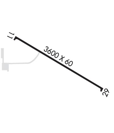
Runway Identifications
Runway Identification: 11/29Length: 3600 ft
Width: 60 ft
Surface: ASPHALT-GOOD CONDITION
Edge lights: Medium IntensityTreatment: NONE
| | Runway: 11 | | Runway: 29 |
| Mag heading: | 112° | Mag heading: | 292° |
| Rwy Slope: | .01% Up | Rwy Slope: | -.01% Down |
| Approach: | | Approach: | |
| Pattern: | Left Traffic | Pattern: | Left Traffic |
| Markings: | NONPRECISION INSTRUMENT | Markings: | NONPRECISION INSTRUMENT |
| Marking Condition: | FAIR | Marking Condition: | FAIR |
| Arresting Dev: | | Arresting Dev: | |
| Lat & Long: | N4747.6 W09956.3 | Lat. & Long.: | N4747.3 W09955.5 |
| Elev: | 1605.4 ft. MSL | Elev: | 1605.7 ft. MSL |
| TCH: | 27 ft. AGL | TCH: | 27 ft. AGL |
| Visual Glide Path: | 3.00 degrees | Visual Glide Path: | 3.00 degrees |
| Displaced Threshold: | No | Displaced Threshold: | No |
| Touchdown Zone: | YES | Touchdown Zone: | YES |
| Touchdown Elev.: | 1607.2 feet | Touchdown Elev.: | 1607.2 feet |
| Visual Glide Slope: | 2-Light PAPI on LEFT side of Runway | Visual Glide Slope: | 2-Light PAPI on LEFT side of Runway |
| RVR Equipment: | | RVR Equipment: | |
| RVV Equipment: | NO | RVV Equipment: | NO |
| Approach Lights: | | Approach Lights: | |
| REIL: | NO | REIL: | NO |
| Centerline Lights: | NO | Centerline Lights: | NO |
| Touchdown lights: | NO | Touchdown lights: | NO |
| Runway Category: | Runway with a Non-precision Approach | Runway Category: | Runway with a Non-precision Approach |
| Declared Distances: | | Declared Distances: | |
| Obstructions: | ROAD | Obstructions: | PLINE |
| Marked: | NOT Marked/Lighted | Marked: | MARKED |
| Clearance slope: | 20:1 | Clearance slope: | 50:1 |
| Obstruction height: | 19 feet AGL | Obstruction height: | 19 feet AGL |
| Dist. from runway: | 590 feet | Dist. from runway: | 1244 feet |
| Centerline offset: | 310 right of centerline | Centerline offset: | 210 feet right of centerline |
| Comments: | | Comments: | |

