Current Weather/Notams (Metars, TAFs, Notams, NWS Forecast, PIREPS, and nearby weather)
Customs Information Send updates to Support@FltPlan.com
Customs Not Available
Database effective 05/16/2024
Airport Diagram might not be current.
|
| Facility Name: | LE ROY |
| City Name: | LE ROY |
| County: | GENESEE |
| State abbrev: | NY |
| State Name: | NEW YORK |
| | |
| Ownership: | PRIVATELY OWNED |
| Use: | OPEN TO THE PUBLIC |
| Owner's Name: | LEROY AVIATION SERVICES INC |
| Address: | 8267 EAST MAIN ROAD |
| | LE ROY, NY 14482 |
| Owner's Phone: | 585-768-4560 |
| | |
| Manager's Name: | RAY DETOR |
| Address: | 283 WESTMINSTER ROAD |
| | ROCHESTER, NY 14607-3229 |
| Phone: | 585-259-9308 |
| | |
| FAA Region: | EASTERN |
| FAA Field Office: | NYC |
Runway Identifications
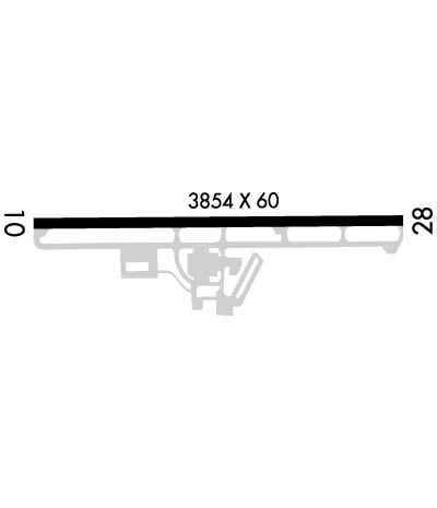
Runway Identification: 10/28Length: 3854 ft
Width: 60 ft
Surface: ASPHALT-GOOD CONDITION
Edge lights: Medium IntensityTreatment: NONE
| | Runway: 10 | | Runway: 28 |
| Mag heading: | 104° | Mag heading: | 284° |
| Rwy Slope: | -.04% Down | Rwy Slope: | .04% Up |
| Approach: | | Approach: | |
| Pattern: | Left Traffic | Pattern: | Left Traffic |
| Markings: | NONPRECISION INSTRUMENT | Markings: | NONPRECISION INSTRUMENT |
| Marking Condition: | GOOD | Marking Condition: | GOOD |
| Arresting Dev: | | Arresting Dev: | |
| Lat & Long: | N4258.9 W07756.5 | Lat. & Long.: | N4258.9 W07755.7 |
| Elev: | 780.0 ft. MSL | Elev: | 778.3 ft. MSL |
| TCH: | 31 ft. AGL | TCH: | 53 ft. AGL |
| Visual Glide Path: | 3.00 degrees | Visual Glide Path: | 3.50 degrees |
| Displaced Threshold: | No | Displaced Threshold: | No |
| Touchdown Zone: | YES | Touchdown Zone: | YES |
| Touchdown Elev.: | 780.3 feet | Touchdown Elev.: | 778.3 feet |
| Visual Glide Slope: | 2-Light PAPI on LEFT side of Runway | Visual Glide Slope: | 2-Light PAPI on LEFT side of Runway |
| RVR Equipment: | | RVR Equipment: | |
| RVV Equipment: | NO | RVV Equipment: | NO |
| Approach Lights: | | Approach Lights: | |
| REIL: | YES | REIL: | YES |
| Centerline Lights: | NO | Centerline Lights: | NO |
| Touchdown lights: | NO | Touchdown lights: | NO |
| Runway Category: | Runway with a Non-precision Approach | Runway Category: | Runway with a Non-precision Approach |
| Declared Distances: | | Declared Distances: | |
| Obstructions: | TREE; ALSO +13 FT FENCE, 275' FROM RWY, 94' LT | Obstructions: | TREE; RWY 28 +12 FT FENCE, 275 FT FROM RWY. RWY 28 +27' TREES, 201' FROM RWY, 192' RT. |
| Marked: | NOT Marked/Lighted | Marked: | NOT Marked/Lighted |
| Clearance slope: | 1:1 | Clearance slope: | 2:1 |
| Obstruction height: | 51 feet AGL | Obstruction height: | 76 feet AGL |
| Dist. from runway: | 235 feet | Dist. from runway: | 392 feet |
| Centerline offset: | 164 left of centerline | Centerline offset: | 255 feet left of centerline |
| Comments: | RWY 10 +5' FENCE, 0-200' FROM RWY,96' LT RWY 10 +40' TREES, 180' FROM RWY, 248' RT | Comments: | RWY 28 +5' FENCE, 180' FROM RWY, 98' RT. |

