Click here for more info on on SMS!

K5F4

HOMER MUNI
HOMER
LA
Time Zone: Central
Lat: N 3247.3
Long: W 09300.2
Elev: 244
Var: -02
Longest Runway: 3200
CTAF: 122.9

FBO & Flight Services info for K5F4

FBOs: Update your Fuel Prices

AIRPORTPh: 318-927-3355
-
Freq: 122.9
Service
Jet
100LL
SAF
MoGas
Fuel Avail: NO FUEL AVAILABLE
Full        Last Update: 04/25/2024 05:27:31

Self        
If you are an FBO, call 1-203-262-1700 to update your info or email: FltPlan.Advertising@garmin.com
Advertise your FBO on FltPlan.com

Runway & Approach Info for K5F4
Rwy
Length
Land Dist**
Approach*
  Rwy
Length
Land Dist**
Approach*
12
3200x60  3200'          
 
  
30
  3200x60  3200'          
 
 * only ILS, LOC, LDA, and SDF approaches to a specific runway are shown
** For any Declared Landing Distance Available, please see A/FD or Approach plates
Runway Weight Capability (lbs.) Help
Runway IDSingle WheelDouble WheelDouble Tandem WheelDual Double Wheel
12/3012,000N/AN/AN/A
These numbers are Advisory and are not limits.   The Airport Manager should have more accurate Weight Limits
Approach Charts
FltPlan does not have IFR approach charts available for K5F4.
Current Weather/Notams
Customs Information Send updates to Support@FltPlan.com
Customs Not Available
Database effective 05/16/2024
Airport Diagram of K5F4
Airport Diagram might not be current.

Facility Name: HOMER MUNI
City Name: HOMER
County: CLAIBORNE
State abbrev: LA
State Name: LOUISIANA
   
Ownership: PUBLICLY OWNED
Use: OPEN TO THE PUBLIC
Owner's Name: CITY OF HOMER
Address: 400 EAST MAIN
 HOMER, LA 71040
Owner's Phone: 318-927-3555
  
Manager's Name: JERRY WHITTON
Address: 550 AIRPORT LOOP, FIRE STATION
 HOMER, LA 71040
Phone: 318-225-0911
   
FAA Region: SOUTHWEST
FAA Field Office: LNM


Sunrise / Sunset times for HOMER MUNI

DateSunriseSunset
04/24/24 Wednesday6:3119:49
04/25/24 Thursday6:3019:50
04/26/24 Friday6:2919:51
04/27/24 Saturday6:2819:51
04/28/24 Sunday6:2719:52
04/29/24 Monday6:2619:53
04/30/24 Tuesday6:2519:54
05/01/24 Wednesday6:2419:54
05/02/24 Thursday6:2319:55
05/03/24 Friday6:2219:56
05/04/24 Saturday6:2119:57
05/05/24 Sunday6:2019:57
05/06/24 Monday6:1919:58
05/07/24 Tuesday6:1919:59

Airport Facilities

Airport Attendance ScheduleUNATTENDED
Airport Status OPERATIONAL (This Status can change at any time - please check NOTAMS)
Airport Lighting ScheduleREIL RWY 12/30; MIRL RWY 12/30 PRESET LOW INTST DUSK-DAWN; TO INCR INTST ACTVT - CTAF.
Airport Storage AvailableTie Downs
Extra Services AvailableNONE
Wind IndicatorYES - (lighted)
Control TowerNO
CTAF Frequency122.900
Unicom Frequency
Rotating Beacon ColorWG
Segmented CircleYES
Landing FeeNO

Airport Inspection Data

Airport InspectedSTATE - performed by STATE AERONAUTICAL PERSONNEL
Inspection Date10/24/2023

Airport Services

Type of Fuel AvailableNone
Airframe Repair ServiceNone
Power Plant Repair ServiceNone

Geographic Data

LatitudeN3247.3
LongitudeW09300.2 (ESTIMATED)
Arpt Elevation244ft (SURVEYED)
Magnetic Variation02E
3 miles Eof HOMER
Traffic Pattern Altitude
Sectional ChartMEMPHIS

Aircraft Data

Operations (Reported)YearlyAvg. Daily
General Aviation Transient 7502
General Aviation Local 9603
Air Taxi 00
Commerical 00
Commuter 00
Military 00
Aircraft based on Field
General Aviation Singles 8
General Aviation Multi 0
Jet Aircraft 0
General Aviation Helicopters 0
Military Aircraft 0
Gliders 0
Ultralights 0

FAA Services

FSS on field NO
FSS tie-in DE RIDDER
FSS Phone 1-800-WX-BRIEF
Who issues Notams DRI
Notam D service at airport YES
ARTCC Name FORT WORTH

Federal Status

Airport Certification
Aircraft Rescue & Firefighting IndexNone
Airport of EntryNo
Custom Landing RightsNo
Joint Civil/MilitaryNo
Military Landing rightsYES

Federal Agreements

NATIONAL PLAN OF INTEGRATED AIRPORT SYSTEMS (NPIAS)
GRANT AGREEMENTS UNDER FAAP/ADAP/AIP
ASSURANCES PURSUANT TO TITLE VI, CIVIL RIGHTS ACT OF 1964

Remarks

FOR CD CTC FORT WORTH ARTCC AT 817-858-7584.
RWY 12/3 0 EXCESSIVE RWY EDGE LIPS EXIST AFTER OVERLAY PROJECT. PILOTS ARE CAUTIONED TO STAY IN THE CTR OF THE RWY & TWY.
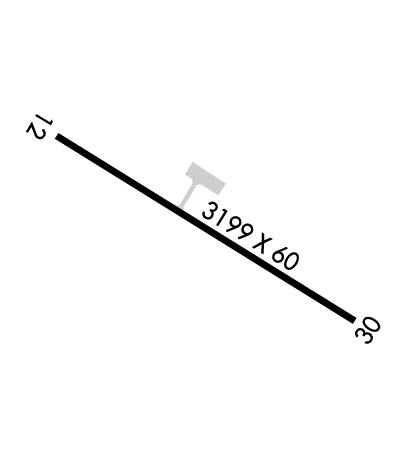
Runway Identifications
Runway Identification: 12/30
Length: 3200 ft
Width: 60 ft
Surface: ASPHALT-GOOD CONDITION
Edge lights: Medium Intensity

Treatment: NONE

 Runway: 12   Runway: 30
Mag heading: 120°Mag heading: 300°
Rwy Slope: -.49% DownRwy Slope: .49% Up
Approach: Approach:
Pattern: Left TrafficPattern: Left Traffic
Markings: BASICMarkings: BASIC
Marking Condition: FAIRMarking Condition: FAIR
Arresting Dev: Arresting Dev:
Lat & Long: N3247.5  W09300.5Lat. & Long.: N3247.2  W09300.0
Elev: 244.0 ft. MSLElev: 228.2 ft. MSL
TCH: TCH:
Visual Glide Path: Visual Glide Path:
Displaced Threshold: NoDisplaced Threshold: No
Touchdown Zone: YESTouchdown Zone: YES
Touchdown Elev.: 244.1 feetTouchdown Elev.: 243.3 feet
Visual Glide Slope: Visual Glide Slope:
RVR Equipment: RVR Equipment:
RVV Equipment: NORVV Equipment: NO
Approach Lights: Approach Lights:
REIL: YESREIL: YES
Centerline Lights: NOCenterline Lights: NO
Touchdown lights: NOTouchdown lights: NO
Runway Category: Runway with a Visual ApproachRunway Category: Runway with a Visual Approach
Declared Distances: Declared Distances:
Obstructions: TREESObstructions: TREES
Marked: NOT Marked/LightedMarked: NOT Marked/Lighted
Clearance slope: 2:1Clearance slope: 3:1
Obstruction height: 63 feet AGLObstruction height: 66 feet AGL
Dist. from runway: 356 feetDist. from runway: 461 feet
Centerline offset: 183 left of centerlineCenterline offset: 283 feet right of centerline
Comments: Comments:
C:/P: