Current Weather/Notams (Metars, TAFs, Notams, NWS Forecast, PIREPS, and nearby weather)
Customs Information Send updates to Support@FltPlan.com
Customs Not Available
Database effective 05/16/2024
Airport Diagram might not be current.
|
| Facility Name: | NORWALK-HURON COUNTY |
| City Name: | NORWALK |
| County: | HURON |
| State abbrev: | OH |
| State Name: | OHIO |
| | |
| Ownership: | PUBLICLY OWNED |
| Use: | OPEN TO THE PUBLIC |
| Owner's Name: | HURON CO COMMISSIONERS |
| Address: | 180 MILAN AVE STE 7 |
| | NORWALK, OH 44857-1195 |
| Owner's Phone: | 419-668-3092 |
| | |
| Manager's Name: | SCOTT SPARKS |
| Address: | PO BOX 406 |
| | NORWALK, OH 44857-0406 |
| Phone: | 419-706-2901 |
| | |
| FAA Region: | GREAT LAKES |
| FAA Field Office: | DET |
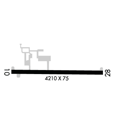
Runway Identifications
Runway Identification: 10/28Length: 4208 ft
Width: 75 ft
Surface: ASPHALT-FAIR CONDITION
Edge lights: Medium IntensityTreatment: NONE
| | Runway: 10 | | Runway: 28 |
| Mag heading: | 96° | Mag heading: | 276° |
| Rwy Slope: | .42% Up | Rwy Slope: | -.42% Down |
| Approach: | | Approach: | |
| Pattern: | Left Traffic | Pattern: | Left Traffic |
| Markings: | BASIC | Markings: | NONPRECISION INSTRUMENT |
| Marking Condition: | FAIR | Marking Condition: | FAIR |
| Arresting Dev: | | Arresting Dev: | |
| Lat & Long: | N4114.7 W08233.5 | Lat. & Long.: | N4114.7 W08232.6 |
| Elev: | 834.5 ft. MSL | Elev: | 852.1 ft. MSL |
| TCH: | | TCH: | |
| Visual Glide Path: | | Visual Glide Path: | |
| Displaced Threshold: | 239 feet | Displaced Threshold: | 667 feet |
| Touchdown Zone: | YES | Touchdown Zone: | YES |
| Touchdown Elev.: | 848.6 feet | Touchdown Elev.: | 851.0 feet |
| Visual Glide Slope: | | Visual Glide Slope: | |
| RVR Equipment: | | RVR Equipment: | |
| RVV Equipment: | NO | RVV Equipment: | NO |
| Approach Lights: | | Approach Lights: | |
| REIL: | NO | REIL: | NO |
| Centerline Lights: | NO | Centerline Lights: | NO |
| Touchdown lights: | NO | Touchdown lights: | NO |
| Runway Category: | Runway with a Visual Approach | Runway Category: | Runway with a Non-precision Approach |
| Declared Distances: | | Declared Distances: | |
| Obstructions: | TREES | Obstructions: | ROAD |
| Marked: | NOT Marked/Lighted | Marked: | NOT Marked/Lighted |
| Clearance slope: | APCH SLP 0:1 TO DTHR OVR 76 FT TREES, 0 FT DIST, 235 FT R. | Clearance slope: | OBSTN CLNC SLP 0:1 TO DTHR OVR 8 FT FENCE, 0 FT DIST, 245 FT L; 12:1 OVR 110 FT TREES, 1390 FT DIST, 225 FT R. |
| Obstruction height: | 85 feet AGL | Obstruction height: | 17 feet AGL |
| Dist. from runway: | 201 feet | Dist. from runway: | 201 feet |
| Centerline offset: | 234 right of centerline | Centerline offset: | 240 feet left of centerline |
| Comments: | 52 FT TREES, 0-200 FT DIST, 240 FT R; 16 FT BRUSH/TREES, 55-200 FT DIST, 115 FT L. | Comments: | 17 FT DRAG STRIP, 152 FT DIST, 242 FT L. |

