
| ||||||
| ||||||
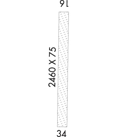
|
| Rwy | Rwy | |||||||
| 2460x75 | 2460' | 2460x75 | 2460' | |||||
| Runway ID | Single Wheel | Double Wheel | Double Tandem Wheel | Dual Double Wheel |
| 16/34 | N/A | N/A | N/A | N/A |
| These numbers are Advisory and are not limits. The Airport Manager should have more accurate Weight Limits | ||||
| FltPlan does not have IFR approach charts available for K55H. |
 Airport Diagram might not be current. | |
| Facility Name: | ATLANTA |
| City Name: | ATLANTA |
| County: | ELMORE |
| State abbrev: | ID |
| State Name: | IDAHO |
| Ownership: | PUBLICLY OWNED |
| Use: | OPEN TO THE PUBLIC |
| Owner's Name: | IDAHO STATE-ITD/DIV OF AERONAUTICS |
| Address: | BOX 7129 |
| BOISE, ID 83707-1129 | |
| Owner's Phone: | 208-334-8775 |
| Manager's Name: | IDAHO STATE-ITD/DIV OF AERONAUTICS |
| Address: | BOX 7129 |
| BOISE, ID 83707-1129 | |
| Phone: | 208-334-8775 |
| FAA Region: | NORTHWEST MOUNTAIN |
| FAA Field Office: | HLN |
| Date | Sunrise | Sunset |
|---|---|---|
| 04/18/24 Thursday | 6:51 | 20:29 |
| 04/19/24 Friday | 6:50 | 20:30 |
| 04/20/24 Saturday | 6:48 | 20:31 |
| 04/21/24 Sunday | 6:46 | 20:32 |
| 04/22/24 Monday | 6:45 | 20:34 |
| 04/23/24 Tuesday | 6:43 | 20:35 |
| 04/24/24 Wednesday | 6:42 | 20:36 |
| 04/25/24 Thursday | 6:40 | 20:37 |
| 04/26/24 Friday | 6:39 | 20:38 |
| 04/27/24 Saturday | 6:37 | 20:40 |
| 04/28/24 Sunday | 6:36 | 20:41 |
| 04/29/24 Monday | 6:34 | 20:42 |
| 04/30/24 Tuesday | 6:33 | 20:43 |
| 05/01/24 Wednesday | 6:31 | 20:44 |
| Airport Attendance Schedule | UNATTENDED |
| Airport Status | OPERATIONAL (This Status can change at any time - please check NOTAMS) |
| Airport Lighting Schedule | |
| Airport Storage Available | Tie Downs |
| Extra Services Available | NONE |
| Wind Indicator | YES - (unlit) |
| Control Tower | NO |
| CTAF Frequency | 122.900 |
| Unicom Frequency | |
| Rotating Beacon Color | |
| Segmented Circle | YES |
| Landing Fee | NO |
| Airport Inspected | STATE - performed by STATE AERONAUTICAL PERSONNEL |
| Inspection Date | 08/31/2023 |
| Type of Fuel Available | None |
| Airframe Repair Service | NONE |
| Power Plant Repair Service | NONE |
| Latitude | N4348.8 |
| Longitude | W11508.1 (ESTIMATED) |
| Arpt Elevation | 5500ft (SURVEYED) |
| Magnetic Variation | 17E |
| 1 miles NW | of ATLANTA |
| Traffic Pattern Altitude | |
| Sectional Chart | SALT LAKE CITY |
| Operations (Reported) | Yearly | Avg. Daily |
|---|---|---|
| General Aviation Transient | 400 | 1 |
| General Aviation Local | 0 | 0 |
| Air Taxi | 50 | 0 |
| Commerical | 0 | 0 |
| Commuter | 0 | 0 |
| Military | 0 | 0 |
| Aircraft based on Field | |
|---|---|
| General Aviation Singles | 0 |
| General Aviation Multi | 0 |
| Jet Aircraft | 0 |
| General Aviation Helicopters | 0 |
| Military Aircraft | 0 |
| Gliders | 0 |
| Ultralights | 0 |
| FSS on field | NO |
| FSS tie-in | BOISE |
| FSS Phone | 1-800-WX-BRIEF |
| Who issues Notams | BOI |
| Notam D service at airport | YES |
| ARTCC Name | SALT LAKE CITY |
| Airport Certification | |
| Aircraft Rescue & Firefighting Index | None |
| Airport of Entry | No |
| Custom Landing Rights | No |
| Joint Civil/Military | No |
| Military Landing rights | No |
| RCMDED FOR USE BY MT PROFICIENT PILOTS USING PROPER, HIGH PER ACFT. ARPT IS LCTD IN MTUS AREA; HIGH TIMBERED RIDGES ALL ARND ARPT. LTD MNVRG AREA. LAND RWY 34, DEP RWY 16. APCH ARPT FM THE SE (VALLEY/CITY) MAKING RIGHT BASE AND FINAL FOR RWY 16. BE AWARE OF NEARBY PVT LAZY H RANCH ARPT (.7 MI TO THE EAST) AND CK FOR TFC FOR INCRD SITUATIONAL AWARENESS. RCMD PILOTS REVIEW THE INFO PERTINENT TO THE OPRNS AT THE LAZY H ARPT. |
| DEPART WITH A RIGHT TURNOUT DOWN BOISE RIVER. ANNOUNCE INTENTIONS ON 122.9. NO GO-AROUND DUE TO RISING TERRAIN AND TREES. |
| NO WINTER MAINT. |
| GND VEHICLE TFC HAS ACES TO ARPT & RWY. |
| NO FONE AVBL AT ARPT. TOWN OF ATLANTA IS APRXLY 1 MI WALKING DIST FM ARPT; SOME SVCS AVBL IN TOWN. |
| FOR CD CTC SALT LAKE ARTCC AT 801-320-2568. |
| Runway: 16 | Runway: 34 | ||
| Mag heading: | N/A | Mag heading: | N/A |
| Approach: | Approach: | ||
| Pattern: | Left Traffic | Pattern: | Right Traffic |
| Markings: | Markings: | ||
| Marking Condition: | RWY 16/34 EDGES & BOTH RWY ENDS THR MKD WITH W ROCKS. | Marking Condition: | |
| Arresting Dev: | Arresting Dev: | ||
| Lat & Long: | Lat. & Long.: | ||
| Elev: | N/A | Elev: | N/A |
| TCH: | TCH: | ||
| Visual Glide Path: | Visual Glide Path: | ||
| Displaced Threshold: | No | Displaced Threshold: | No |
| Touchdown Zone: | NO | Touchdown Zone: | NO |
| Touchdown Elev.: | Touchdown Elev.: | ||
| Visual Glide Slope: | Visual Glide Slope: | ||
| RVR Equipment: | RVR Equipment: | ||
| RVV Equipment: | NO | RVV Equipment: | NO |
| Approach Lights: | Approach Lights: | ||
| REIL: | NO | REIL: | NO |
| Centerline Lights: | NO | Centerline Lights: | NO |
| Touchdown lights: | NO | Touchdown lights: | NO |
| Runway Category: | Runway with a Visual Approach | Runway Category: | Runway with a Visual Approach |
| Declared Distances: | Declared Distances: | ||
| Obstructions: | TREE; 75 FT - 100 FT TREES AT 130 FT ON CNTRLN; +500 FT TIMBERED MT 1000 FT ON CNTRLN; 50 FT - 75 FT TREES AT 0 FT 100 FT LEFT. | Obstructions: | TREES; +60 FT TREE 250 FT 125 FT LEFT; +1000 FT TIMBERED RIDGE AT 5000 FT ON CNTRLN. |
| Marked: | NOT Marked/Lighted | Marked: | NOT Marked/Lighted |
| Clearance slope: | RISING TRRN WITH 80 FT - 100 FT TALL TREES STARTING AT 50 FT PAST THE END OF RWY. | Clearance slope: | |
| Obstruction height: | 100 feet AGL | Obstruction height: | 80 feet AGL |
| Dist. from runway: | 45 feet | Dist. from runway: | 0 feet |
| Centerline offset: | 75 right of centerline | Centerline offset: | 120 feet right of centerline |
| Comments: | Comments: |
