Current Weather/Notams (Metars, TAFs, Notams, NWS Forecast, PIREPS, and nearby weather)
Customs Information Send updates to Support@FltPlan.com
Customs Not Available
Database effective 04/18/2024
Airport Diagram might not be current.
|
| Facility Name: | MADISON MUNI |
| City Name: | MADISON |
| County: | MORGAN |
| State abbrev: | GA |
| State Name: | GEORGIA |
| | |
| Ownership: | PUBLICLY OWNED |
| Use: | OPEN TO THE PUBLIC |
| Owner's Name: | CITY OF MADISON |
| Address: | 132 NORTH MAIN STREET |
| | MADISON, GA 30650 |
| Owner's Phone: | 706-342-1251 |
| | |
| Manager's Name: | JOHN KLIMM; CITY MGR |
| Address: | 132 NORTH MAIN STREET |
| | MADISON, GA 30650 |
| Phone: | 706-342-1251; ARPT PHONE 706-342-9857 |
| | |
| FAA Region: | SOUTHERN |
| FAA Field Office: | ATL |
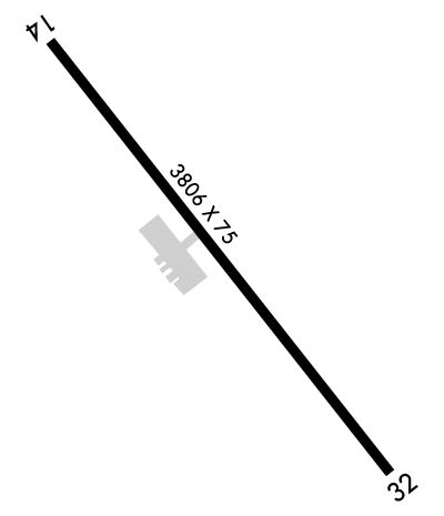
Runway Identifications
Runway Identification: 14/32Length: 3806 ft
Width: 75 ft
Surface: ASPHALT-FAIR CONDITION
Edge lights: Medium IntensityTreatment: NONE
| | Runway: 14 | | Runway: 32 |
| Mag heading: | 145° | Mag heading: | 325° |
| Rwy Slope: | 1.52% Up | Rwy Slope: | -1.52% Down |
| Approach: | | Approach: | |
| Pattern: | Left Traffic | Pattern: | Right Traffic |
| Markings: | NONPRECISION INSTRUMENT | Markings: | NONPRECISION INSTRUMENT |
| Marking Condition: | GOOD | Marking Condition: | GOOD |
| Arresting Dev: | | Arresting Dev: | |
| Lat & Long: | N3337.0 W08327.9 | Lat. & Long.: | N3336.5 W08327.4 |
| Elev: | 636.3 ft. MSL | Elev: | 694.0 ft. MSL |
| TCH: | 32 ft. AGL | TCH: | |
| Visual Glide Path: | 3.00 degrees | Visual Glide Path: | |
| Displaced Threshold: | No | Displaced Threshold: | 1131 feet |
| Touchdown Zone: | YES | Touchdown Zone: | YES |
| Touchdown Elev.: | 686.0 feet | Touchdown Elev.: | 694.0 feet |
| Visual Glide Slope: | 2-Light PAPI on LEFT side of Runway | Visual Glide Slope: | |
| RVR Equipment: | | RVR Equipment: | |
| RVV Equipment: | NO | RVV Equipment: | NO |
| Approach Lights: | | Approach Lights: | |
| REIL: | NO | REIL: | NO |
| Centerline Lights: | NO | Centerline Lights: | NO |
| Touchdown lights: | NO | Touchdown lights: | NO |
| Runway Category: | Runway with a Non-precision Approach | Runway Category: | Runway with a Visual Approach |
| Declared Distances: | TORA:3806' TODA:3806' ASDA:3740' LDA:3740' | Declared Distances: | TORA:3806' TODA:3806' ASDA:3806' LDA:2675' |
| Obstructions: | TREES | Obstructions: | ROAD |
| Marked: | NOT Marked/Lighted | Marked: | NOT Marked/Lighted |
| Clearance slope: | CONTROLLING OBSTRUCTION EXCEEDS A 45 DEGREE SLOPE | Clearance slope: | APCH RATIO 34:1 TO DSPLCD THR, 1530 FT FM DSPLCD THR, 200 FT RIGHT. |
| Obstruction height: | 33 feet AGL | Obstruction height: | 15 feet AGL |
| Dist. from runway: | 215 feet | Dist. from runway: | 201 feet |
| Centerline offset: | 248 left of centerline | Centerline offset: | |
| Comments: | | Comments: | 9 FT SECURITY FENCE CROSSES APPH 175 FT FM RY END, AND 15 FT ROAD CROSSES APCH 200 FT FROM RY END. |

