Current Weather/Notams (Metars, TAFs, Notams, NWS Forecast, PIREPS, and nearby weather)
Customs Information Send updates to Support@FltPlan.com
Customs Not Available
Database effective 05/16/2024
Airport Diagram might not be current.
|
| Facility Name: | LAKE CITY MUNI CJ EVANS FLD |
| City Name: | LAKE CITY |
| County: | FLORENCE |
| State abbrev: | SC |
| State Name: | SOUTH CAROLINA |
| | |
| Ownership: | PUBLICLY OWNED |
| Use: | OPEN TO THE PUBLIC |
| Owner's Name: | TOWN OF LAKE CITY; TOWN ADMIR IS STEPHANIE SNOWDEN. |
| Address: | PO BOX 1329 |
| | LAKE CITY, SC 29560 |
| Owner's Phone: | (843) 374-5421 |
| | |
| Manager's Name: | DUSAN FRIDL |
| Address: | PO BOX 1329 |
| | LAKE CITY, SC 29560 |
| Phone: | 843-687-6490 |
| | |
| FAA Region: | SOUTHERN |
| FAA Field Office: | ATL |
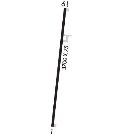
Runway Identifications
Runway Identification: 01/19Length: 3700 ft
Width: 75 ft
Surface: ASPHALT-GOOD CONDITION
Edge lights: Medium IntensityTreatment: NONE
| | Runway: 01 | | Runway: 19 |
| Mag heading: | 12° | Mag heading: | 192° |
| Rwy Slope: | .00% | Rwy Slope: | .00% |
| Approach: | | Approach: | |
| Pattern: | Left Traffic | Pattern: | Left Traffic |
| Markings: | NONPRECISION INSTRUMENT | Markings: | NONPRECISION INSTRUMENT |
| Marking Condition: | GOOD | Marking Condition: | GOOD |
| Arresting Dev: | | Arresting Dev: | |
| Lat & Long: | N3350.9 W07946.1 | Lat. & Long.: | N3351.5 W07946.0 |
| Elev: | 80.1 ft. MSL | Elev: | 80.1 ft. MSL |
| TCH: | 25 ft. AGL | TCH: | 25 ft. AGL |
| Visual Glide Path: | 3.00 degrees | Visual Glide Path: | 3.00 degrees |
| Displaced Threshold: | No | Displaced Threshold: | No |
| Touchdown Zone: | YES | Touchdown Zone: | YES |
| Touchdown Elev.: | 80.2 feet | Touchdown Elev.: | 80.2 feet |
| Visual Glide Slope: | 2-Box VASI on LEFT side of Runway | Visual Glide Slope: | 2-Box VASI on LEFT side of Runway |
| RVR Equipment: | | RVR Equipment: | |
| RVV Equipment: | NO | RVV Equipment: | NO |
| Approach Lights: | | Approach Lights: | |
| REIL: | NO | REIL: | NO |
| Centerline Lights: | NO | Centerline Lights: | NO |
| Touchdown lights: | NO | Touchdown lights: | NO |
| Runway Category: | Runway with a Non-precision Approach; CLOSE-IN TREELINE 169 FT L OF CNTRLN ON RWY 01 APCH. | Runway Category: | Runway with a Non-precision Approach |
| Declared Distances: | | Declared Distances: | |
| Obstructions: | TREE | Obstructions: | TREE |
| Marked: | NOT Marked/Lighted | Marked: | NOT Marked/Lighted |
| Clearance slope: | 12:1 | Clearance slope: | 12:1 |
| Obstruction height: | 71 feet AGL | Obstruction height: | 74 feet AGL |
| Dist. from runway: | 1096 feet | Dist. from runway: | 1160 feet |
| Centerline offset: | 232 right of centerline | Centerline offset: | 180 feet right of centerline |
| Comments: | | Comments: | |

